SPEEGLEVILLE PARK, TX Campground Reservation, Info, Images, Map, Directions

SPEEGLEVILLE PARK, Texas Campground Images, Info & Reservations

Listen

Directions

From I-35, take exit 330B Hwy 6 N toward Meridian for about 6 miles. After passing over the Lake on the Twin Bridges, take the first exit toward Lake Waco/Speegleville Park. Take a left on the access road. You will continue past the Twin Bridges Park about a quarter of a mile until you reach Overflow Road. Turn right on Overflow Road and drive for about 1.5 miles until you reach the entrance on the left.

Phone

254-756-5359

Activities

BOATING, CAMPING, FISHING

Keywords

SPGV,Speegleville Park

Related Link(s)

Rec Area Info & Images

Texas State Road Conditions

Texas State Tourism

Overview

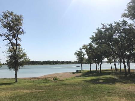
Speegleville Park is perched on the south end of a scenic cove of Waco Lake. The park provides outdoor recreation options like boating, jet skiing, fishing, swimming and bird watching.

Recreation

The main lake shoreline has a large amount of submerged timber, which typically holds fish year-round. Anglers will find plenty of catfish, crappie, large and smallmouth bass as well as sunfish. At least 51 species of fish inhabit the lake’s waters, and a record flathead catfish weighed in at a whopping 59.5 pounds.

A four-lane boat ramp helps visitors enjoy the lake.

Facilities

The park includes two screened shelters along with 30 campsites with water and electric hookups.

Natural Features

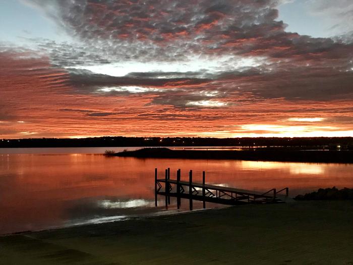
Waco Lake, located in central Texas within Waco city limits, boasts 79,000 acre-feet of water, providing irrigation and drinking water to residents of the Waco area. The lake is primarily fed by the Bosque River, which runs for 115 miles through central Texas.

Nearby Attractions

Horseback riding, hiking and biking can be done on the 20-mile Lacy Point Hiking and Biking Trail. The trail is accessible from the Lacy Point boat ramp, which is a short drive around the cove.

Reservation

More from CampingHiking.net:

MORAINE PARK CAMPGROUND, Colorado Campground Images, Info & Reservations

Listen Directions Take Highway 36 west from Estes Park, CO or Highway 34 east from Grand Lake, CO. Off the main park road, take the Bear Lake Road, which is near the Beaver Meadows Entrance Station, and follow the signs to the campground. Phone 970-586-1206 Activities CAMPING, FISHING, HIKING, HORSEBACK

Beaver Campground, Washington Campground Images, Info & Reservations

Listen Directions Take Highway 14 to Carson, WA and continue north on Wind River Highway for 13 miles to reach the campground. Phone 541-338-7869 Activities CAMPING, HIKING, FISH HATCHERY, KAYAKING, BIRDING, WATER ACCESS Keywords BGWR,CARSON,WA WIND RIVER,GIFFORD PINCHOT NF – FS Related Link(s) Rec Area Info & Images Washington State

Excelsior Group Camp, Washington Campground Images, Info & Reservations

Listen Directions From Seattle, Washington, go north on I-5 to Bellingham. Take exit 255 onto Sunset Drive/Mt. Baker Highway SR 542. Turn right (east) on SR 542 and continue past the town of Glacier near mile 33. Continue past Glacier approximately 7 miles to the campground. The sign for the

EASTSIDE, Idaho Campground Images, Info & Reservations

Listen Directions From Horseshoe Bend, Idaho, take Highway 52 for 9 miles west to the junction with the Sweet/Ola Highway. Turn north and travel 16 miles to Ola, Idaho. Travel north through Ola and follow 10 miles northeast on FS Rd 618, then make a right on FS Rd 626