LITTLE LASIER MEADOWS CAMPGROUND, CA Campground Reservation, Info, Images, Map, Directions

LITTLE LASIER MEADOWS CAMPGROUND, California Campground Images, Info & Reservations

Listen

Directions

From either east bound or west bound Interstate 80 take exit 188 to Highway 89 north to Sierraville. In 14.5 miles turn left onto Forest Road 07, at the Little Truckee Summit. Drive approximately 15 miles to Forest Road 70 and turn left. Cross the steel bridge and turn left, then go one mile to campground entrance on the left.

Phone

530-994-3401

Activities

BOATING, CAMPING, FISHING, HIKING, HORSEBACK RIDING, HUNTING, MOUNTAIN BIKING, NON-MOTORIZED BOATING

Keywords

Little Lasier Horse Camp,Lasier Meadows Horse Camp,Jackson Meadows Horse Camp

Related Link(s)

Rec Area Info & Images

California State Tourism

California State Road Conditions

Overview

Little Lasier Meadows Campground is a horse camp near scenic Jackson Meadow Reservoir, approximately 32 miles north of Truckee, in the Tahoe National Forest. The location provides a great base camp for a wide range of recreational activities, including boating, fishing, hiking, horseback riding and hunting. The Pacific Crest Trail passes just half a mile away from the campground.  This facility is operated and maintained by the Tahoe National Forest.

Recreation

Jackson Meadow Reservoir offers excellent opportunities for boating, canoeing, water skiing, swimming and fishing. Anglers will find rainbow and brown trout. A boat ramp is located at Pass Creek Campground. A designated swim beach is nearby. A portion of the Pacific Crest Trail meanders a half-mile near the campground. Hunting and biking are popular activities in the surrounding area.

Facilities

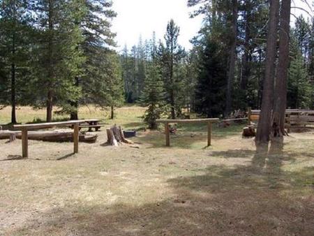
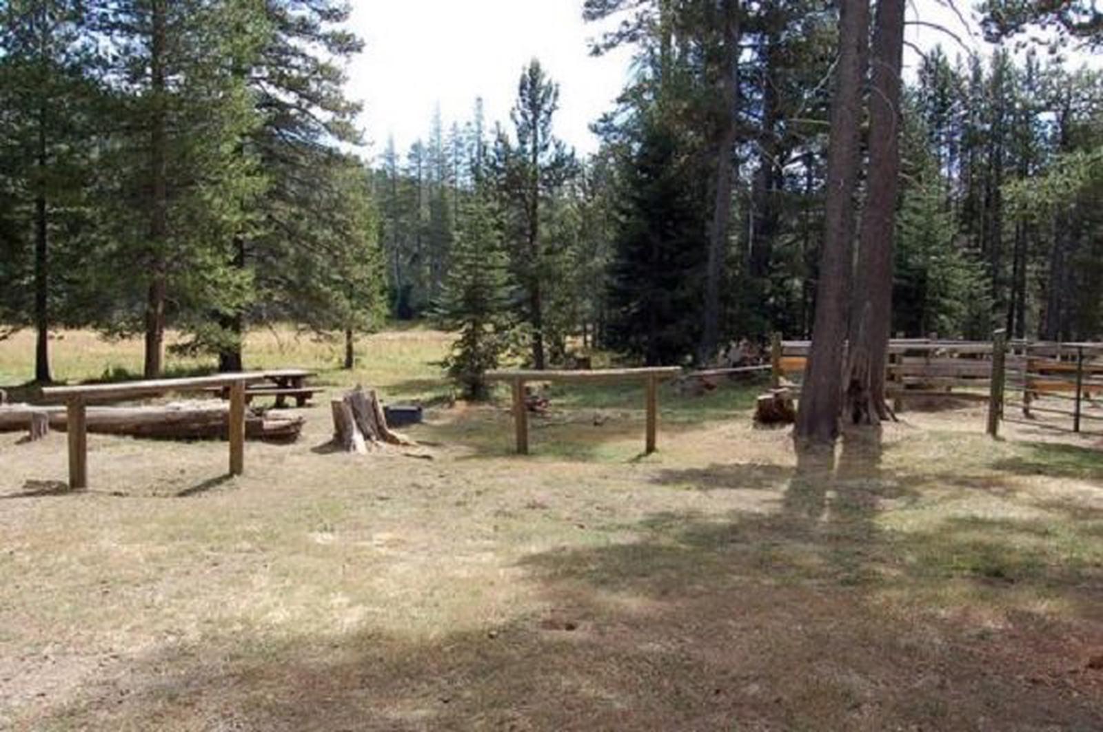
The campground offers equestrian sites for campers with horses. Sites are equipped with picnic tables, campfire rings and hitching racks. A shared horse corral is on-site. Vault toilets and drinking water are provided.

Natural Features

Nearby Jackson Meadow Reservoir is situated in a rolling forested valley, where visitors are awarded beautiful views of the Sierra Crest and English Mountain. The campground lies in a grassy meadow surrounded by lodgepole pine and fir trees, at an elevation of 6,511 feet.

Nearby Attractions

Jackson Meadows Reservoir and Recreation Area, numerous hiking, biking, and equestrian trails including the Pacific Crest Trail. A connector trail links the campground to the PCT only a half mile away. Milton and Bowman Reservoirs, and the Grouse Ridge Non-Motorized Area are also nearby.

Reservation

More from CampingHiking.net:

MOOSE LAKE CABIN, Montana Campground Images, Info & Reservations

Listen Directions From Philipsburg, travel south on Highway 1 for about 7 miles to the junction with Skalkaho Highway/Highway 38. Turn right onto Highway 38 and continue west for about 9 miles and turn left onto Moose Lake Road/Forest Road 5106. Travel another 9 miles to the cabin. Winter weather

COBB RIDGE, Missouri Campground Images, Info & Reservations

Listen Directions From Chadwick, Missouri, take Highway 125 south about 2 miles, then turn right onto Highway H and continue past Camp Ridge day-use area, turning right onto Lookout Road (the first portion of lookout road is paved – if you get to the gravel you have gone to far)

CANAL CREEK, Oregon Campground Images, Info & Reservations

Listen Directions From Waldport, Oregon, take State Route 34 east 7 miles to the campground sign at Canal Creek Rd../Forest Service Rd. 3462. Turn right onto Canal Creek Rd./FSR 3462 and go 4 miles to another campground sign and turn left into the campground. Phone 541-528-7725 Activities FISHING, HIKING, BERRY

OUTLET AREA, Arkansas Campground Images, Info & Reservations

Listen Directions From Booneville, Arkansas, follow State Highway 10 east for 17 miles to Waveland. Turn right on State Highway 309 and drive for one mile. Turn right again onto Waveland Park Road and continue another mile. Turn left on Outlet Park Road near the Blue Mountain Lake Field Office.

VAN HOOK GLADE, North Carolina Campground Images, Info & Reservations

Listen Directions From Highlands, North Carolina, follow Highway 64 west approximately 4.5 miles. The campground entrance is on the right. Phone 828-526-5918 Activities CAMPING, FISHING, HIKING, SWIMMING SITE Keywords VANH,HIGHLANDS,NFs IN NORTH CAROLINA – FS Related Link(s) Rec Area Info & Images Forest Service Concessionaire North Carolina State Tourism North

SOUTH OVERLOOK (IA), Iowa Campground Images, Info & Reservations

Listen Directions 1105 North HWY T15 Knoxville, Iowa 50138 From Pella, Iowa, follow county road T-15 southwest for 4 miles, then follow signs to South Overlook. Phone 641-828-7522 Activities BIKING, BOATING, CAMPING, HUNTING, WILDLIFE VIEWING Keywords Related Link(s) Rec Area Info & Images Iowa State Road Conditions Iowa State Tourism