SOUTH PIKE BAY, MN Campground Reservation, Info, Images, Map, Directions

SOUTH PIKE BAY, Minnesota Campground Images, Info & Reservations

Listen

Directions

From Cass Lake, Minn., travel 3 miles south on Highway 371. Turn east onto Forest Road 2137 and travel 2 miles to the campground.

Phone

218-547-1044

Activities

BIKING, BOATING, HISTORIC & CULTURAL SITE, CAMPING, FISHING, WATER SPORTS, SWIMMING SITE

Keywords

SPKB,Pike Bay

Related Link(s)

Rec Area Info & Images

Minnesota State Tourism

Minnesota State Road Conditions

Overview

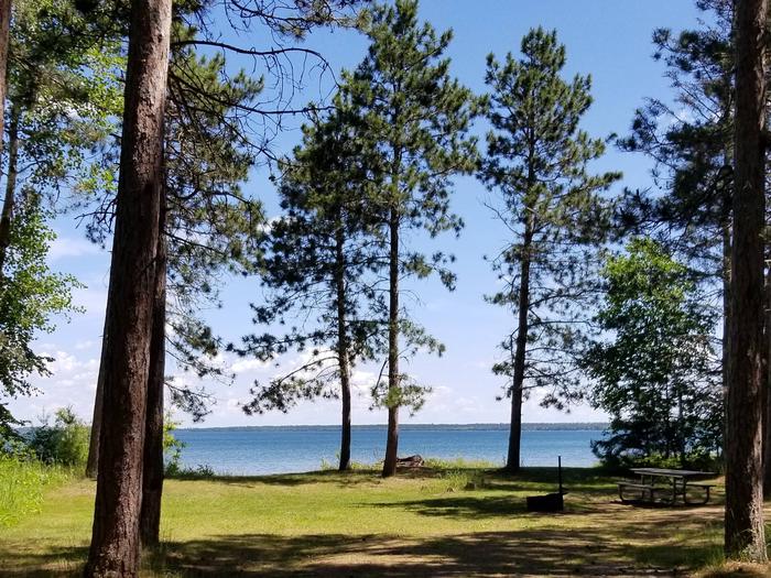
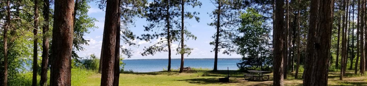
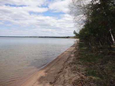
South Pike Bay Campground is located on the south shore of beautiful Pike Bay, on Cass Lake in north central Minnesota. Visitors enjoy the area for its excellent boating, canoeing and fishing opportunities.

Recreation

South Pike Bay offers offers many recreational activities, including boating, canoeing, water skiing and swimming. Anglers fish for walleye, northern pike, perch and trophy muskie. A boat ramp is located within the campground.

A trailhead for the Migizi Bike Trail is on-site. The paved trail stretches 14 miles along the lakeshore and is open to biking, walking and rollerblading.

The campground is a portage point for the 128-mile Chippewa Headwaters Loop Canoe Route. With six portages, the historic waterway is considered the most difficult in the forest, but is a beautiful trip through history.

Facilities

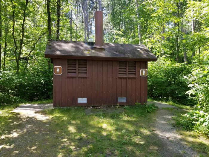
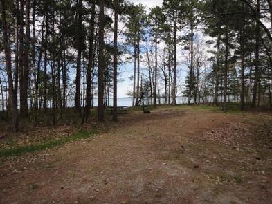
The campground offers 23 non-electric campsites, each equipped with a picnic table and campfire ring. Vault toilets, drinking water and trash collection are provided.

Natural Features

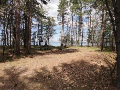
The campground is a long spur stretching along the shore of Pike Bay in a pleasant stand of mixed hardwoods and old growth pine. Some of the campsites are situated on the beautiful sand beach.

Nearby Attractions

The town of Cass Lake, Minn., is six miles northwest of the campground, offering restaurants, a bank, grocery and hardware stores, a movie theater and museum.

Reservation

More from CampingHiking.net:

LITTLE CRATER CAMPGROUND, Oregon Campground Images, Info & Reservations

Listen Directions From Bend, travel 23.5 miles south on Hwy 97, then 14.5 miles east on Road 21, and 0.5 miles north on Forest Road 2100 570. Phone 541-383-5300 Activities CAMPING Keywords Related Link(s) Rec Area Info & Images Oregon State Road Conditions Oregon State Tourism Overview Situated on the

GREEN VALLEY, California Campground Images, Info & Reservations

Listen Directions From Running Springs, travel east on Highway 18 about 3 miles to Green Valley Lake Road. Turn left and continue about 6 miles to the campground. Phone 909-866-8550 Activities BOATING, CAMPING, FISHING, HIKING, SWIMMING SITE Keywords GREV,GREEN VALLEY San Bernardino,SAN BERNARDINO NF – FS Related Link(s) Rec Area

MANISTIQUE – RAPID RIVER DISPERSED CAMPSITES, Michigan Campground Images, Info & Reservations

Listen Directions All driving directions are listed by lake. Please check campsite details. Phone 906-474-6442 Activities BIKING, BOATING, CAMPING, FISHING, HIKING, HORSEBACK RIDING, WATER SPORTS, WILDLIFE VIEWING, DAY USE AREA, SWIMMING SITE Keywords Dispersed campsites,Manistique,Rapid River,lyman lake,swan lake,bass lake,bear lake,camp cook,carr lake,chicago lake,clear lake,crooked lake,east lake,gooseneck lake,ironjaw lake,jackpine lake,lake nineteen,leg

THREE CREEKS MEADOW HORSE CAMP, Oregon Campground Images, Info & Reservations

Listen Directions From Sisters, OR: Travel 15.2 miles south on Forest Road 16 (Elm Street in Sisters). Phone 541-323-1746 Activities CAMPING Keywords THREE CREEKS MEADOW HORSE CAMP Related Link(s) Rec Area Info & Images Oregon State Road Conditions Oregon State Tourism Overview Three Creeks Meadow Horse Camp is one of

SANDY LAKE, Minnesota Campground Images, Info & Reservations

Listen Directions Take Highway 65 for 13 miles north of McGregor, Minnesota. Follow “South Entrance” signs to the campground office if assistance in finding your campsite is required. Phone 651-290-5850 Activities BOATING, HISTORIC & CULTURAL SITE, CAMPING, INTERPRETIVE PROGRAMS, FISHING, HIKING, VISITOR CENTER, WILDLIFE VIEWING, DAY USE AREA, SWIMMING SITE,

SANDBEACH, Oregon Campground Images, Info & Reservations

Listen Directions To Access from Pacific City, OR: From Highway 101 take Brooten Road into Pacific City. Turn left onto Pacific Ave at four way stop. Drive over the bridge and turn right onto Cape Kiwanda Dr (2.3 miles). Veer left when it changes to Sandlake Road and stay on