
Directions
From Interstate 5, take the exit for Willows/Oroville Hwy 162 and head west. After about 23 miles turn right at the junction at County Road 306. Travel approximately four miles, then turn left onto 162/Forest Highway 7. After approximately 30 miles turn right at the Masterson Group Campground sign and follow the road for a quarter-mile to the gated entrance.
Phone
530-963-3128
Activities
BIKING, CAMPING, FISHING, HIKING, HUNTING, PICNICKING, WILDLIFE VIEWING, DAY USE AREA, PADDLE BOATING, CANOEING, NON-MOTORIZED BOATING
Keywords
MGRC
Related Link(s)
California State Road Conditions
Overview
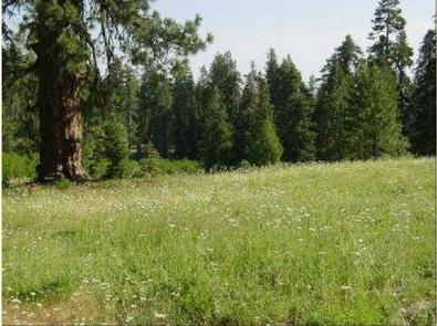
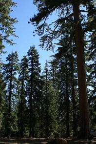
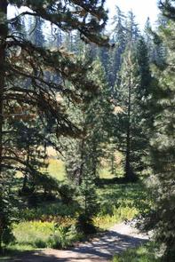
Tucked away in the towering pines of the Mendocino National Forest, the Masterson Campground is perfect for your next big get-together. The large grassy meadows of the campground are surrounded by a dense blanket of forest, offering visitors an outdoor experience of tranquility and solitude.
Recreation
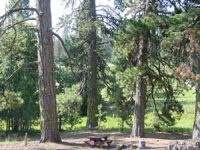
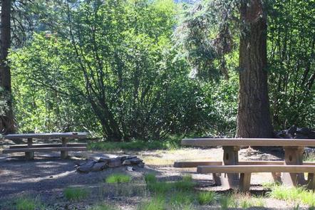
The campground’s open meadow areas allow for group games and activities, and a large fire ring provides the perfect place for a nighttime campfire circle and s’mores session. Plaskett Lake, a short one-mile walk from the campground, offers a variety of trout for the fishing enthusiast, as well as canoeing and other non-motorized boating activities. Mendocino National Forest’s 913,306 acres of mountains and canyons allow for a variety of recreational opportunities, including hiking, backpacking, boating, fishing, hunting, nature study and off-highway vehicle riding. Whether it’s deer, birds, rabbits, chipmunks or perhaps the occasional bear, wildlife viewing is always a popular activity for visitors. The area is also an extremely popular destination during hunting season.
Facilities
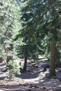
Masterson offers traditional primitive camping with the added convenience of toilets and running water. The site can hold up to 75 guests and 25 vehicles comfortably.
Natural Features
The Mendocino National Forest, California’s only national forest that is not crossed by a paved road, straddles the eastern spur of the Coastal Mountain Range in northwestern California, just a three-hour drive north of San Francisco and Sacramento. Sprinkled throughout the dense green forest are several lakes, offering visitors additional recreational opportunities against a stunning and secluded backdrop.
Nearby Attractions
The nearby Plaskett Lake Campground is a family campground that can handle additional visitors for larger parties. The day use site at Plaskett Lake is a great place to spend the day. Plaskett Lake is also planted with trout.