COUNCIL LAKE DISPERSED CAMPSITE, MI Campground Reservation, Info, Images, Map, Directions

COUNCIL LAKE DISPERSED CAMPSITE, Michigan Campground Images, Info & Reservations

Listen

Directions

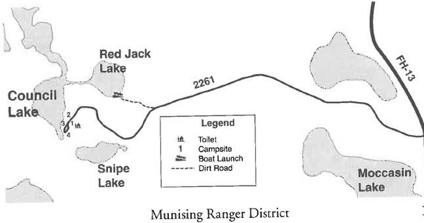
From Munising, Michigan, take Highway 28 east towards Shingleton. Turn south on Highway 13 at Wetmore. After 10 miles turn right onto Forest Service Road 2261. Continue until the road ends at Council Lake.

Phone

906-387-2512

Activities

BIKING, CAMPING, SWIMMING SITE

Keywords

CLDC,COUNCIL LAKE DISPERSED CAMPSITE (MI),Council Lake,Council Lake Dispersed Camp Site

Related Link(s)

Rec Area Info & Images

Michigan State Tourism

Michigan State Road Conditions

Overview

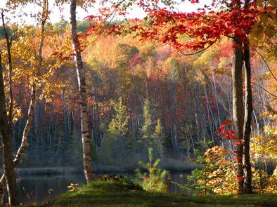
Council Lake Campsite sits on the shores of Council Lake in the center of the Hiawatha National Forest. Its location amid a series of forested lakes provides ample opportunity for visitors to enjoy nature in the scenic surroundings.

Recreation

Council Lake is a 14-acre lake with yellow perch, rock and largemouth bass, bluegill, black crappie, bullhead and northern pike. Licenses are required to fish in Michigan waters. Non-motorized boats can be used on the lake, however access at the campground is by land only. A boat ramp can be found at adjoining Red Jack Lake. Canoeing and kayaking are also popular among visitors to the tranquil campsite.

Facilities

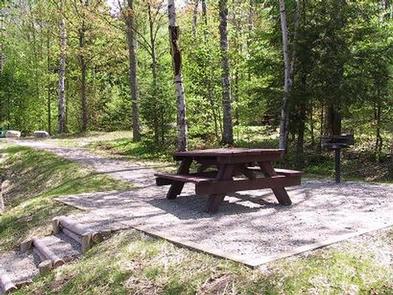
There are four primitive campsites at Council Lake for tent and small RV camping. Each campsite is equipped with a table and a campfire ring. A pit toilet is located near one of the sites, but toilet paper is not provided.

The day-use area is equipped with tables and a campfire ring with a grill. The area is near a beach that is perfect for lounging and swimming. No drinking water is provided at the campsite; water must be brought in and garbage must be carried out.

Natural Features

The small campground is nestled in a mixed stand of hardwood trees and pines. It is on the southern shores of Council Lake, close to adjoining Red Jack and Scout lakes.

Reservation

More from CampingHiking.net:

GOULDING LAKE CABIN, Alaska Campground Images, Info & Reservations

Listen Directions Accessible late May through October. Otter Lake, one of four lakes in the Goulding Lakes System, is located about 60 miles northwest of Sitka on the western edge of Chichagof Island. Access is by floatplane only, about a 50-minute flight from Sitka or Juneau. Refer to USGS topographic

PINE REST CAMPGROUND, Oregon Campground Images, Info & Reservations

Listen Directions From Sisters, OR: Travel 9.6 miles northwest on Highway 20, then 6.1 miles north on Forest Road 14, then 1.5 miles north on Forest Road 1419. Phone 541-323-1746 Activities CAMPING Keywords Related Link(s) Rec Area Info & Images Oregon State Road Conditions Oregon State Tourism Overview Pine Rest

LITTLE MAUD CAMPGROUND, Colorado Campground Images, Info & Reservations

Listen Directions Take I-70 west of Denver to Glenwood Springs Exit 116, Highway 82 to Basalt. At Basalt, take Frying Pan Road 15 miles to the Ruedi Complex Entrance. Phone (970) 927-0107 Activities BIKING, CAMPING, INTERPRETIVE PROGRAMS, FISHING, HIKING, WATER SPORTS, WILDLIFE VIEWING Keywords LITTLE MAUD CAMPGROUND,LITTLE MAUD,MAUD Related Link(s)

WHITE FLINT PARK, Texas Campground Images, Info & Reservations

Listen Directions From Interstate 35 in Temple, Texas take State Highway 36 west towards Gatesville. Just after crossing the Leon River bridge, turn right on White Flint Park Road and follow it to the park and campground entrance. Phone 254-986-3421 Activities BOATING, CAMPING, FISHING, WILDLIFE VIEWING, PADDLING, KAYAKING, CANOEING, BIRDING,