Directions
From Bend, travel 38.4 miles southwest on Cascade Lakes Hwy (46), then 0.7 miles east on Forest Road 4600 500, and then 0.4 miles east on Forest Road 4600 520.
Phone
541-323-1746
Activities
CAMPING, FISHING
Keywords
LILA,Lava Lake,Lava,Little Lava
Related Link(s)
Overview
Little Lava Lake Campground is located along the Cascade Lakes National Scenic Byway in the Central Oregon Cascades.
Recreation
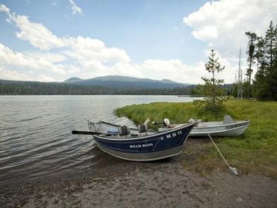
Little Lava Lake Campground provides recreation opportunities for fishing, paddling, swimming and hiking. For anglers, the 130-acre Little Lava Lake offers a quiet alternative to its larger neighbor to the north, Lava Lake. Reaching a maximum depth of 20 feet, the lake supports planted Rainbow trout, some Brook trout, and self-sustaining populations of Whitefish and Tui Chub. Bait, lures, flies, still fishing and trolling are all acceptable angling methods.
Facilities
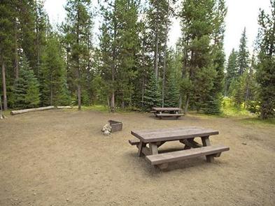
Little Lava Lake Campground’s campsites are predominately located under lodgepole pine canopy with some sites located along the lakeshore and the Deschutes River.
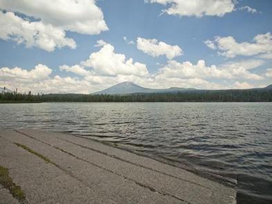
There is a boat ramp and a day use area that can be used at Little Lava Lake for a fee.
Natural Features
Little Lava Lake is located on the eastern slopes of the Cascade Mountain Range at an elevation of 4,740 feet. The small lake is surrounded by mature pine forests with bull rushes and lava outcroppings lining its shores.
Nearby Attractions
Visitors can explore wilderness areas, wild and scenic rivers, lakes and reservoirs and approximately 1,600 miles of trails within the Deschutes National Forest.
Lava Lands Visitor Center in nearby Bend, Oregon, and the unique geological landscape of Newberry National Volcanic Monument draw visitors to the region as well.
Visitors will also enjoy traveling the Cascade Lakes Scenic Byway which climbs into the Cascades over a 66-mile drive through snow-capped peaks and alongside alpine lakes.
A nearby resort on Lava Lake offers lodging and a limited selection of groceries.


