
Directions
Take Montana Highways 78 and 419 south of Columbus (on 1-90) 43 miles west of Billings, Montana.
Phone
406-587-9054
Activities
BIKING, CAMPING, FISHING, HIKING, WILDLIFE VIEWING
Keywords
None
Related Link(s)
Overview
Woodbine Campground is remotely located adjacent to the Absaroka-Beartooth Wilderness in southwestern Montana, about three hours from Yellowstone National Park via the scenic Beartooth Highway. Red Lodge, Montana is 57 miles east; Nye is 7 miles north. The administering organization is Gallatin Canyon Campgrounds; e-mail: gccampgrounds13@gmail.com
Recreation
The Stillwater River and nearby streams and lakes offer great fishing opportunities for rainbow, brown and cutthroat trout.
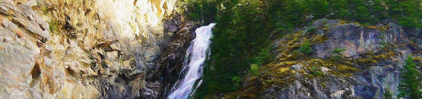
Hiking the Woodbine Falls Trail is a popular activity among campers. The 1.5-mile round-trip trail begins in the campground and follows Woodbine Creek before ending at an impressive cascade.
The Stillwater Trail provides access to the Absaroka-Beartooth Wilderness and is open to hiking and horseback riding. The trail reaches beautiful Sioux Charley Lake after 3 miles and continues on another 20+ miles into the wilderness.
Facilities
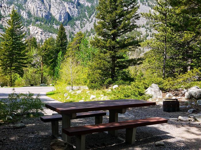
The campground offers single and group sites, some of which are accessible. Picnic tables and campfire rings with grills are provided, as are accessible vault toilets and drinking water.
Natural Features
Woodbine Campground is situated on the banks of the Stillwater River at an elevation of 5,300 feet. The campground is wooded and shady, with views of the surrounding snow-covered, 10,000 foot peaks.
A variety of wildlife, including deer, elk and bear, can be found in the surrounding area, creating prime opportunities for wildlife viewing.
Nearby Attractions
The Absarokee-Beartooth Wilderness Area is adjacent, boasting 700 miles of trails and hundreds of alpine lakes. The wilderness borders Yellowstone National Park and is a part of the 20-million-acre Greater Yellowstone Ecosystem.
The nearby town of Nye hosts Nye Goes Nuts annually in July. The popular event includes food, drinks, children’s games and the chicken chase, a crowd favorite.
The small community of Fishtail holds its annual Fishtail Family Fun Day at the end of June, with a pancake breakfast, vendor booths, a parade and live music.