
Directions
The street address for GPS use is 14764 Park Central Road, Thurmont, MD.
From Washington DC, take the George Washington Memorial Parkway north to I-495 onto I-270 north 27 miles to Frederick, MD. Take Route 15 for 17 miles north to Thurmont, MD. Take Route 77 West, the exit sign is marked Catoctin Mountain Park. Travel approximately 3 miles west on 77 and turn right onto Park Central Road. Pass the Visitor Center and continue 7/10 of a mile and turn left into Camp Misty Mount.
From Gettysburg, PA, take Route 15 South. In Thurmont, MD, exit onto Route 77 West (the exit sign says Catoctin Mountain Park). Travel approximately 3 miles west on 77 and turn right onto Park Central Road. Pass the Visitor Center and continue just under a mile and turn left into Camp Misty Mount.
Phone
301-271-3140
Activities
CLIMBING, HISTORIC & CULTURAL SITE, CAMPING, INTERPRETIVE PROGRAMS, VISITOR CENTER, DAY USE AREA
Keywords
Catoctin,Catoctin National Park,Catoctin Mountain,Camp Misty Mountain
Related Link(s)
Maryland State Road Conditions
Overview
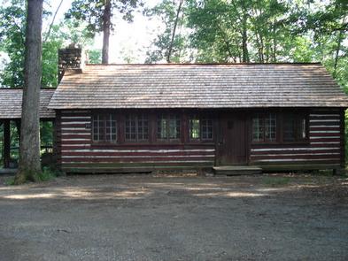
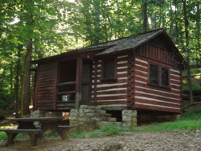
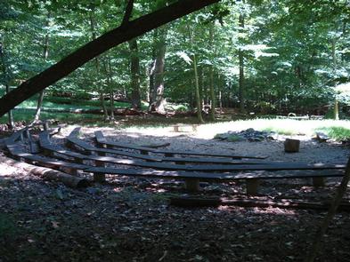
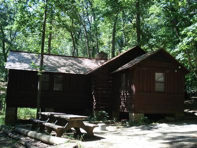
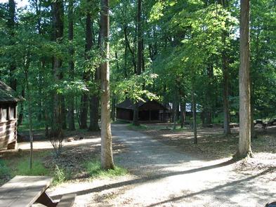
Camp Misty Mount brings together small groups, families and individuals for rustic mountain cabin camping in the Catoctin Mountains of Maryland. The historic stone and wood cabins were built in 1937 as part of a federal program during the Great Depression. The cabins provided outdoor recreational opporunties for nearby urban areas, and over 80 years later you can still enjoy the outdoor opportunities provided by Misty Mount!
Recreation
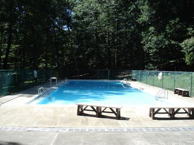
Misty Mount offers a number of nearby recreation opportunities. The trailhead for Wolf Rock is a short walk from the camp, pleasing both hikers and rock climbers. Wolf Rock is the only part of the park that allows both rock climbing and rappelling. From Wolf Rock you will also have access to many of the park’s trail systems. Kids love the camp’s swimming pool, open from late May through early September.
Facilities
Cabins are rustic, providing basic metal cots, mattresses, and overhead lighting. Cabin capacities range from three to eight people. No electric outlets are available; however, hot showers, flush toilets and drinking water are located inside each campsite loop. Cooking can be done outside on the grill attached to the campfire ring. A dining hall with commercial kitchen equipment is available to rent for indoor cooking. Camp Misty Mount can be reserved in its entirety (30 cabins). If you wish to reserve 10 or more cabins, you must call the Recreation.gov call center at (877)444-6777.
Natural Features
Camp Misty Mount is surrounded by hardwood forests on the slopes of Catoctin Mountain Park. The region is part of the Blue Ridge Province and offers access to scenic mountain views and clear streams.
Nearby Attractions
Interconnected hiking trails can be reached from Misty Mount on the Wolf Rock Trail, or by driving within a mile of the camp. Try the Hog Rock Trail or the Thurmont Vista Trail for phenomenal views of the valleys below. Visitors can hike to Cunningham Falls, the tallest waterfall in Maryland, from the Visitor Center.
Charges & Cancellations
Changes and Cancellations A $10.00 service fee will apply if you change or cancel your reservation. Late cancellations are subject to additional fees.