MOKINS BAY CAMPGROUND, ID Campground Reservation, Info, Images, Map, Directions

MOKINS BAY CAMPGROUND, Idaho Campground Images, Info & Reservations

Directions

From Coeur d’Alene, Idaho, take Route 95 north for 6.1 miles to Lancaster Road. Turn right and continue 6.3 miles to a ‘Y’ intersection. Bear right and continue to Mokins Road, turn left go 0.1 mile to campground entrance.

Phone

435-245-6521

Activities

BIKING, BOATING, CAMPING, FISHING, HIKING, WATER SPORTS, WILDLIFE VIEWING, SWIMMING SITE, MOUNTAIN BIKING, KAYAKING, CANOEING, JET SKIING

Keywords

Mokins Bay Campground,Mokins,Mokins Bay

Related Link(s)

Rec Area Info & Images

Idaho State Tourism

Forest Service Concessionaire

Idaho State Road Conditions

Overview

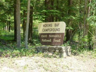
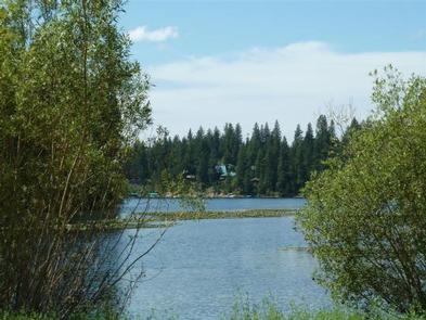
Mokins Bay Campground is located near the eastern shore of Hayden Lake in northwest Idaho. Its picturesque setting in the northwest portion of the Bitterroot Mountain range, known as the Coeur d’Alene mountains, creates solitude in a forested setting at this campground. The lake is a 10 minute walk from the campground.

Recreation

Fishing is popular in the surrounding lakes and streams, and cutthroat trout and large and small-mouth bass are the most common catches. Power boating and other water sports are also popular activities.
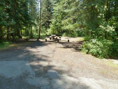
Facilities

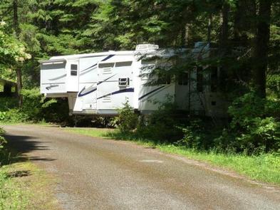
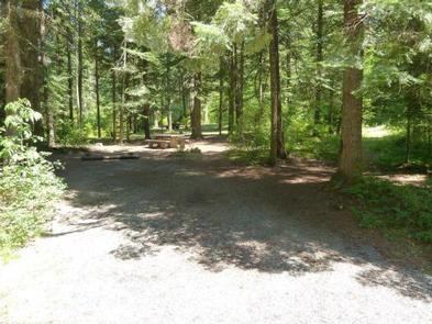
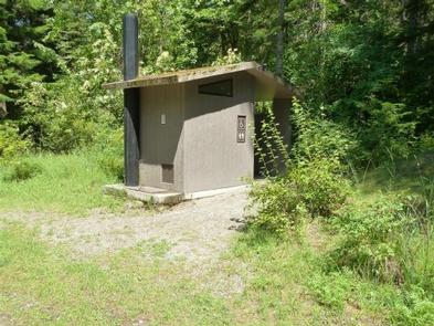
Drinking water, grills, paved parking spurs and vault toilets are among the amenities at Mokins. A horseshoe pit is also onsite. Access to campground is on a gravel road.

Natural Features

The small campground is surrounded by a heavy canopy of pines. Wildflowers like trillium and buttercups thrive in the springtime, creating a stunning backdrop for campers.

Hayden Lake boasts a 40-mile shoreline with a surface area of 3,800 acres. The lake was formed by the Missoula Floods that occurred nearly 15,000 years ago, at the end of the last ice age.

Nearby Attractions

The town of Coeur d’Alene, Idaho is 21 miles away, and offers several tourist attractions, as well as restaurants, gas and groceries.

Reservation

More from CampingHiking.net:

NORTH BEND PARK, Virginia Campground Images, Info & Reservations

Directions The physical address for North Bend Park: 1930 Mays Chapel Road, Boydton, VA 23917. It is located approximately 20 miles west of South Hill, VA. Phone 434-738-0059 Activities BIKING, CAMPING, FISHING, HIKING, HUNTING, WILDLIFE VIEWING, SWIMMING SITE, DISC GOLF Keywords NORB,BUGGS ISLAND,JOHN H KERR DAM Related Link(s) Rec Area

LOST CREEK CAMPGROUND, Utah Campground Images, Info & Reservations

Directions From Salt Lake City, Utah, take I-80 east for approximately 30 miles to Exit 146 for Highway 40 toward Park City/Heber City/Vernal. Take Exit 4 onto Highway 248 toward Kamas. Take left onto UT 32 then right onto Highway 150 (Mirror Lake Scenic Byway). Go 27 miles to campground.

RICHEY COVE, Kansas Campground Images, Info & Reservations

Directions From I-70, take Highway 177 south for 30 miles. Richey Cove entrance is located on the west side of the highway at the dam road. Phone 620-767-5195 Activities BOATING, CAMPING, FISHING, HIKING, HUNTING, SWIMMING SITE Keywords RICV,COUNCIL GROVE,COUNCIL GROVE LAKE Related Link(s) Rec Area Info & Images Kansas State

FLOUR LAKE CAMPGROUND, Minnesota Campground Images, Info & Reservations

Directions From Grand Marais, Minnesota, take Gunflint Trail (County Road 12) 27 miles north, turn right on County Road 22 (previously CR 66) and travel 3 miles to the campground road. Turn right and follow the campground road 1/2 mile to the campground. Phone (218)388-2203 Activities BIKING, BOATING, CAMPING, FISHING,

TALL CHIEF COVE, Oklahoma Campground Images, Info & Reservations

Directions From Tulsa, Oklahoma, take Highway 75 north to State Highway 20. Take the Skiatook exit, turn west on State Highway 20 and drive about 15 miles. Turn left on Lake Road and proceed about five miles to the campground. Phone 918-288-6820 Activities BOATING, CAMPING, FISHING, DAY USE AREA, SWIMMING

MERRISACH LAKE, Arkansas Campground Images, Info & Reservations

Directions From DeWitt, Arkansas, take US-165 south for 8.1 miles to State Route 44. Turn east for 5.3 miles and continue south onto Tichnor Blacktop Rd. After 10 miles, turn right onto Merrisach Lake Lane and continue into the park. Phone 870-548-2291 Activities BOATING, CAMPING, FISHING, HUNTING, WILDLIFE VIEWING, BIRDING