

Directions
Access to each individual cabins varies. Some can be reached by hiking-in, while others require a boat or plane to access . In winter, a snowmachine may be necessary. Please refer to each specific cabin for information on amenities and accessibility. Kenai National Wildlife Refuge: From Anchorage, take the Seward Highway south to the Sterling Highway; the eastern refuge boundary is at milepost 55 of the Sterling Highway. Another 5 miles from the boundary is the west entrance to the Skilak Wildlife Recreation Area. Continuing on to Soldotna will bring you to the refuge visitor center and headquarters, which is found by taking a left onto Funny River Road, then turning right (before the building supply store) onto Ski Hill Road.
Phone
(907) 262-7021
Activities
CAMPING
Keywords
Kenai National Wildlife Refuge,Big Indian Creek Cabin,Caribou Island Cabin,Dolly Varden Lake Cabin,Doroshin Bay Cabin,Engineer Lake Cabin,Kelly Lake Cabin,McLain Lake Cabin,Nurses Cabin,Pincher Creek Cabin,Pipe Creek Cabin,Snag Lake Cabin,Upper Ohmer Lake
Related Link(s)
Overview
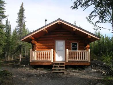
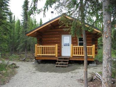
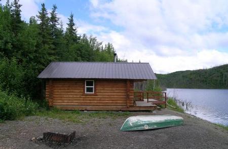
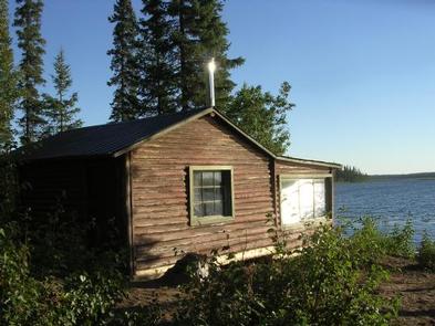
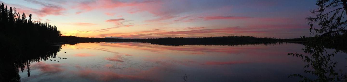
The Kenai National Wildlife Refuge guarantees breathtaking scenery and an unforgettable experience for visitors staying in one of the 14 rustic cabins located in Alaska’s Kenai Peninsula. Getting to the cabin can be a thrilling adventure in itself, as most of them require the use of boats, aircraft, hiking or skiing.
The grudging withdrawal of the Harding Ice Field has helped to make the lands of the Kenai National Wildlife Refuge a “miniature Alaska.” Today, the refuge includes examples of every major Alaska habitat type. The refuge is an Alaska in miniature in its diversity of wildlife, as well.
Recreation
Eager anglers can pursue chinook, sockeye, coho and pink salmon; as well as Dolly Varden char, rainbow trout, and arctic grayling. The refuge is also home to brown and black bears, caribou, Dall sheep, mountain goats, wolves, lynx, wolverines, eagles and thousands of shorebirds and waterfowl, not to mention the mighty Alaska-Yukon moose that the refuge was originally established (as the Kenai National Moose Range) to protect.
Facilities
Seven of Kenai Refuge’s 14 reservable public use cabins are historic log cabins built around the turn of the 20th century. The others are 16’x18′ trapper-style log cabins. Each cabin includes a table with benches, plywood bunks (without mattresses) a wood-heating stove, and an outhouse. Access to cabins varies. Some can be reached by hiking-in, while others require a boat or plane to access . In winter, a snowmachine may be necessary. For specific information on each cabin’s amenities and accessibility, click here.
Natural Features
Kenai National Wildlife Refuge spans 1.9 million acres along the western Kenai Peninsula in Alaska. The region includes the western slopes of the Kenai Mountains, forested lowlands along Cook Inlet, rivers, lakes and wetlands. To the east is Chugach National Forest and southeast is Kenai Fjords National Park.
Charges & Cancellations
A $10.00 service fee will apply if you change or cancel your reservation. The $10.00 service fee will be deducted from the refund amount.
Customers will be charged a $10.00 cancellation fee and forfeit the first night’s use fee if a cabin reservation is cancelled within 14 days of the scheduled arrival date. Cancellations for a single night’s use will not be assessed a service fee.