BEAVER DAM CAMPGROUND, LA Campground Reservation, Info, Images, Map, Directions

BEAVER DAM CAMPGROUND, Louisiana Campground Images, Info & Reservations

Listen

Directions

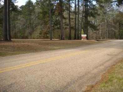
From Minden, take Louisiana 159 north to Caney Lake Road (Webster Parish Road 111) . Turn left on Caney lake Road, continue 2 miles to recreation area entrance.

Phone

318-927-2061

Activities

BIKING, CAMPING, FISHING, HIKING

Keywords

CANEY LAKES RECREATION AREA,KISATCHIE NATIONAL FOREST,Beaver Dam,Caney Lakes

Related Link(s)

Rec Area Info & Images

Louisiana State Tourism

Louisiana State Road Conditions

Overview

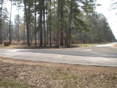
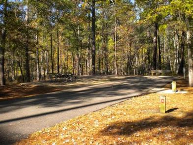
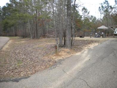
Beaver Dam Campground is situated on the shores of Upper Caney Lake in the Caney Lakes Recreation Complex. The campground is located in a beautiful setting among woods, lakes and hills. Swimming, boating, fishing and water skiing are the top activities.

Sugar Cane National Recreation Trail passes right next to the campground and offers varied terrain for hikers and bikers. The Sugar Cane trail was named for the crop that was once cultivated here, in addition to cotton.

Recreation

Bass, crappie, catfish, bluegill and sandbass can be caught in the lakes. The Sugar Cane Trail spans 5.7 miles and the Lost Man Loop spans 2 miles. Both are open to hiking and mountain biking.

Facilities

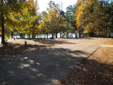
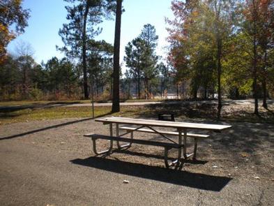
Campsites come with electric and water hookups. The group picnic area accommodates up to 200 guests while each campsite fits up to eight campers. A sanitary dump station, drinking water and flush toilets are provided.

Natural Features

Beaver Dam sits at an elevation of 160 feet along the north shores of the 125-acre Upper Caney Lake. The group picnic area is near Lower Caney Lake, spanning 250 acres.

Kisatchie National Forest, the only national forest in Louisiana, spans 604,000 acres and mostly consists of bayous with bald cypress groves and old growth pine.

Nearby Attractions

The city of Minden has restaurants, shopping and golfing.

Reservation

More from CampingHiking.net:

TAYLOR FERRY, Oklahoma Campground Images, Info & Reservations

Listen Directions Address for GPS: Taylor Ferry South Campground, 33814 E. 746 Rd., Wagoner, OK 74467 From Wagoner, Oklahoma, travel 5 miles east on Highway 51. Turn left on South 330 Road and travel south for approximatly 1/4 mile. Turn left on East 746 Road and travel less than 1

REYNOLDS CREEK, Texas Campground Images, Info & Reservations

Listen Directions From I-35, take exit 330B Hwy 6 N toward Meridian for about 7 miles. After passing over the Lake on the Twin Bridges, take the Speegleville Road exit (second exit after the bridges). Turn right on Speegleville Road. After 1 mile you will reach a 4-way stop. Continue

BIG GAME CAMPGROUND, Wyoming Campground Images, Info & Reservations

Listen Directions From Cody, Wyo., follow Sheridan Avenue west through Cody until the road leaves town, and becomes Buffalo Bill Scenic Byway (U.S. Highway 14/16/20). The campground is 29 miles west of Cody, on the north side of the highway and next to the river. It is between Wapiti Campground

Adirondack Shelters, Maryland Campground Images, Info & Reservations

Listen Directions GPS information is provided as verification of Shelter # 1, which is near Shelter #2. Users are asked to help protect park resources by using the trail system when accessing the shelters or other park features. Trail maps can be obtained at the park Visitor Center or downloaded

LEIGH CREEK CAMPGROUND, Wyoming Campground Images, Info & Reservations

Listen Directions From Ten Sleep, WY, drive 7.5 miles on Hwy 16 to FSR 018 (WY Hwy 436). Bear right and travel nearly 1 more mile to the campground. Phone 406-587-9054 Activities BIKING, BOATING, CLIMBING, FISHING, HIKING, WILDLIFE VIEWING, HOTEL/LODGE/RESORT PRIVATELY OWNED, OFF ROAD VEHICLE TRAILS, KAYAKING, STAR GAZING, BIRDING,