MARY SMITH CAMPGROUND, CA Campground Reservation, Info, Images, Map, Directions

MARY SMITH CAMPGROUND, California Campground Images, Info & Reservations

Directions

From Weaverville: Take Highway 3 north for 7 miles. Turn right on Rush Creek Road for 9 miles. Turn left on Trinity Dam Blvd for 3/4 mile. Turn right on Lewiston Vista/Mary Smith exit. Campground is 1/4 mile from exit on County Road 105, 2 miles north of Lewiston.

Phone

530-275-8113

Activities

BOATING, CAMPING, FISHING, HIKING, WILDLIFE VIEWING

Keywords

Lewiston Lake

Related Link(s)

Rec Area Info & Images

California State Road Conditions

California State Tourism

Forest Service Concessionaire

Overview

Mary Smith Campground is located off County Road 105, two miles north of the town of Lewiston, CA. This campground offers excellent fishing and tent camping.

This campground was picked as one of California’s prettiest lake campgrounds in Sunset Magazine. Many of the sites have shore access to Lewiston Lake.

Recreation

The area offers excellent opportunities for fishing, kayaking, hiking and wildlife viewing. Pine Cove boat ramp is within four miles, and Fairview launching area on Trinity Lake is nine miles north. Motorized boats are limited to ten miles per hour.

Rainbow trout are abundant, and brown and brook trout are common. This is a good lake for a float tube and excellent fly fishing. The area offers wonderful wildlife viewing opportunities.

Facilities

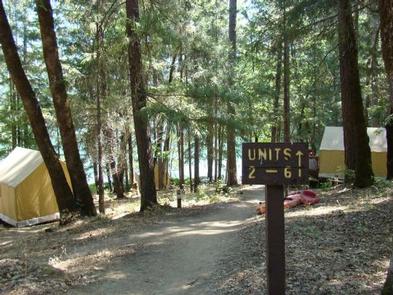
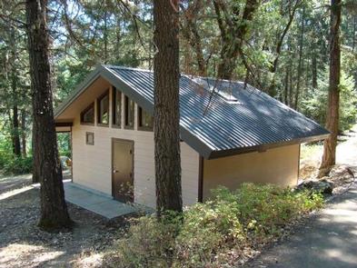
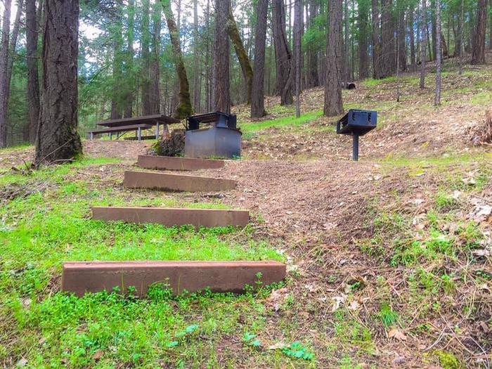
There are six Glamping unit sites all with on-site fire pits and picnic tables. The sites offer fair to outstanding privacy. There are both flush and vault toilets, and drinking water is provided.

With the exception of the large cluster of sites at the campground entrance (Glamping camping site #’s 2, 3, 4, 5a, 5b, and 9 ADA compliant), the remaining sites are arranged in small groups. No trailers are allowed and there are no parking spurs.

Glamping Camping Unit & Site Amenities:

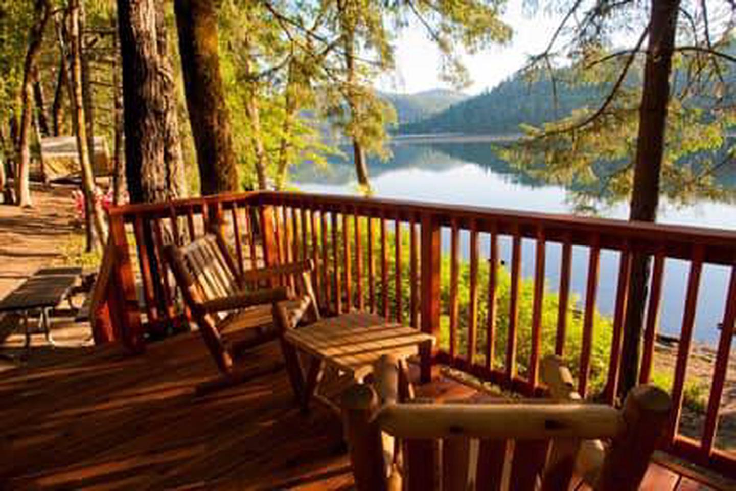
Inside: over-sized queen beds with feather down comforters and pillows (linen service provided), two bed-side nightstands, over-sized rugs and a boot bench.
Outside: front deck equipped with two armchairs and coffee table, fire pit and picnic table.

Natural Features

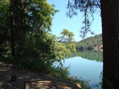
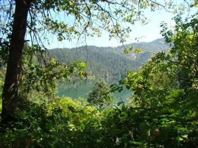
The campsites are tucked into a mixed forest of conifer and deciduous trees, surrounded by abundant wildflowers. Every site offers a view of Lewiston Lake and the surrounding Trinity Alps.

Lewiston Lake is about five miles long, about 70 feet deep, and sits at an elevation of 1,902 feet. It is a favorite among anglers and paddlers.

Reservation

More from CampingHiking.net:

TANEUM CABIN, Washington Campground Images, Info & Reservations

Directions From Seattle: Take I-90 to Exit 93. Turn left on Elk Heights Road and travel 1/4 mile north to Thorp Prairie Road. Turn right and go about 3.5 miles to East Taneum Road. Turn right, cross over I-90 and turn right on West Taneum Road, which becomes Forest Service

SAILOR LAKE, Wisconsin Campground Images, Info & Reservations

Directions From Fifield, follow State Highway 70 east for about 7 miles and turn right (south) on Forest Road 139 and continue for 3 miles. Phone 715-762-2461 Activities BOATING, CAMPING, FISHING, HIKING, HUNTING, WILDLIFE VIEWING, CANOEING, HISTORIC SITES Keywords SAIL,CHEQUAMEGON-NICOLET NF – FS Related Link(s) Rec Area Info & Images

NAVAJO LAKE CAMPGROUND, Utah Campground Images, Info & Reservations

Directions Go east from Cedar City on Scenic Byway SR 14, 25 miles to the Navajo Lake road turnoff to the south. Follow the Navajo Lake road 5 miles to Navajo Lake campground. Phone 801-226-3564 Activities BIKING, BOATING, CAMPING, FISHING, WILDLIFE VIEWING, SWIMMING SITE, PHOTOGRAPHY, KAYAKING, CANOEING, WATER ACCESS Keywords

GATES GROUP, California Campground Images, Info & Reservations

Directions From Auburn, Calif., take Highway 80 to the Foresthill Road and travel 20 miles east to Foresthill. Turn right onto Mosquito Ridge Road and travel 42 miles east to French Meadow Reservoir. Follow the signs to the campground. Phone 530-367-2224 Activities BIKING, BOATING, CAMPING, FISHING, HIKING, PICNICKING, SWIMMING SITE

KENNEL CREEK CABIN (AK), Alaska Campground Images, Info & Reservations

Directions Kennel Creek Cabin is located approximately 19 air miles southeast of the City of Hoonah, Alaska on the south shore of Freshwater Bay. Access is by vehicle, float plane, or boat. Total distance by gravel road is approximately 27 miles. By road travel south from Hoonah past the airport.

PARADISE GUARD STATION, Utah Campground Images, Info & Reservations

Directions Follow the mileage indications below and look for signs on the ground when traveling to Paradise Guard Station. Leave with plenty of time to arrive at the guard station before dark. From Vernal, travel west on Highway 121/Maeser-Lapoint Highway, toward Lapoint. After passing the landfill and descending the hill