

Directions
From Washington, D.C., and points north, take I-95 south to exit 150-B toward VA Route 619/Joplin Road. The park entrance is the second right. It is an additional 15-20 minute drive from the park entrance to Oak Ridge Campground.
From Fredericksburg, Virginia, and points south, take I-95 north to exit 150 toward VA Route 619/Joplin Road. Turn left at the bottom of the exit ramp and continue on VA Route 619 West approximately 1/4 mile to the park entrance.
Washington Dulles International Airport and Ronald Reagan Washington National Airport are approximately 45 minutes drive-time from Prince William Forest Park. Baltimore/Washington International Airport and Richmond International Airport are 90 minutes away.
There is no bus service near the park. Local commuter buses may be available near the park via the PRTC system. Amtrak and Virginia Railway Express services are available in nearby Quantico, Virginia, approximately 5 miles from the park entrance. There is no public transportation directly to the park.
Phone
703-221-7181
Activities
BIKING, HISTORIC & CULTURAL SITE, CAMPING, INTERPRETIVE PROGRAMS, FISHING, HIKING, VISITOR CENTER, WILDLIFE VIEWING, DAY USE AREA, PHOTOGRAPHY, BIRDING, SCENIC DRIVE, BACKPACKING
Keywords
Prince William Forest,Oak Ridge
Related Link(s)
Virginia State Road Conditions
Overview
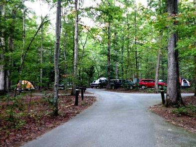
Oak Ridge Campground is a 100-site, wooded campground located in Prince William Forest Park, 35 miles southwest of Washington, DC. The park’s land was set aside during the Great Depression, and in 1935 the Civilian Conservation Corps (CCC) began restoring the previously over-farmed acreage, converting it to recreational lands for public use. The CCC built trails, dams and cabins, making the park a wonderful place for recreation and relaxation.
Large group camping is not permitted at Oak Ridge Campground. Please read the need to know section for additional information.
Recreation
The park offers many recreational activities, including hiking, biking, orienteering and fishing. Hikers enjoy exploring the park’s 37 miles of foot trails. The South Valley, Oak Ridge and Farms to Forest Trails all begin at the campground entrance.
Bicyclists will find 21 miles of paved roads within the park, including the 12-mile Scenic Drive. Little traffic and a 25 m.p.h. speed limit make this a popular biking spot. A 3-mile, family-friendly paved bike lane leads to the campground. Mountain biking is also available on 10 miles of gravel fire roads.
The park boasts 30 orienteering courses with picturesque settings. Orienteering is a 19th century Scandinavian sport primarily used as military training. The courses were developed in 1972 and continue to provide hours of entertainment and exploration for park visitors.
Approximately 18 miles of streams and two small lakes are open to the public for fishing. The water quality of Quantico Creek supports numerous fish species and other aquatic life. The most common fish species are bluegill, pumpkinseed, largemouth bass and channel catfish.
Facilities
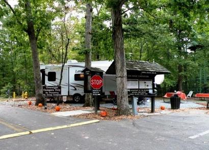
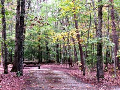
The campground is open March through November and accommodates tents, RVs and trailers. “Recreational vehicles are limited to 32 feet in length and 12 feet in height. Trailers and fifth wheels are limited to 26 feet in length and 12 feet in height. Each site has a picnic table, grill, lantern post and parking spur. Each loop has restrooms with sinks and flush toilets. Loop B also has showers. A and C unit comfort stations close down at the first part of November for winterizing. Loop B comfort station is open till the camp closure the first of December.
Natural Features
Prince William Forest Park preserves approximately 15,000 acres of Piedmont forest covering a major portion of the Quantico Creek watershed. The park represents one of the largest parcels of undeveloped land in the area and is the third largest unit of the National Park System in Virginia. The area is the largest example of a Piedmont forest ecosystem in the National Park Service, makeing it a significant natural resource.
Various geological outcroppings, winding creeks, gently rolling slopes and man-made lakes make wonderful destinations for any adventurous visitor.
The park is home to 46 species of mammals, 22 species of amphibians, 25 species of reptiles, more than 129 species of birds, 26 species of fish and an unknown number of invertebrates.
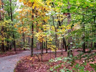
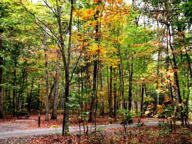
More than 900 plant species exist in Prince William Forest Park. From the smallest wildflower to the tallest tree, each species has a special role to play in this forest ecosystem. From tree bark in winter, wildflowers in spring, canopy cover in summer and autumn colors in fall, Prince William Forest Park offers beautiful scenery year-round.
Nearby Attractions
Prince William Forest Park is centrally located, with easy access to all of the attractions the Northern Virginia and Washington, D.C., area have to offer. From the park entrance, the National Museum of the Marine Corps and the main gate of the United States Marine Corps Base Quantico are just a mile away.
The park is located directly between historic Fredericksburg and Spotsylvania National Military Park and Manassas National Battlefield Park.