
Directions
From south of Fresno: Take State Route 99 to SR 41 north to SR 145. Turn left on 145 and go 8.4 miles to Road 33. Turn right on Road 33, and go 1 mile to Road 400. Turn right on 400, and go 9.7 miles to the Buck Ridge Recreation Area. Follow the signs to the campground and various areas within the park.
From south of Madera: Take SR 99 north to exit 153B. Bear right onto Madera Ave. and go .3 miles to Gateway. Turn left and drive .2 miles to the traffic light at Yosemite Ave. (SR 145). Turn right and go 7.2 miles to Road 33. Turn left on Road 33, and go 1 mile to Road 400. Turn right on 400, and go 9.7 miles to the Buck Ridge Recreation Area. Follow the signs to the campground and various areas within the park.
From north of Madera: Take SR 99 south to exit 153B. Exit onto Olive Ave. Turn left onto Madera Ave. and go .3 miles to Gateway. Turn left and drive .2 miles to the traffic light at Yosemite Ave. (SR 145). Turn right and go 7.2 miles to Road 33. Turn left on Road 33, and go 1 mile to Road 400. Turn right on 400, and go 9.7 miles to the Buck Ridge Recreation Area. Follow the signs to the campground and various areas within the park.
Phone
559-673-5151
Activities
FISHING, HIKING, HORSEBACK RIDING, HUNTING, PICNICKING, DAY USE AREA, SWIMMING SITE, MOUNTAIN BIKING
Keywords
BURI,HENSLEY LAKE,FRESNO SIDE,EAST SIDE,HIDDEN DAM,HENSLEY LAKE
Related Link(s)
California State Road Conditions
Overview
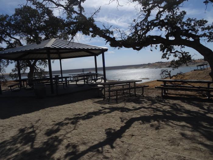
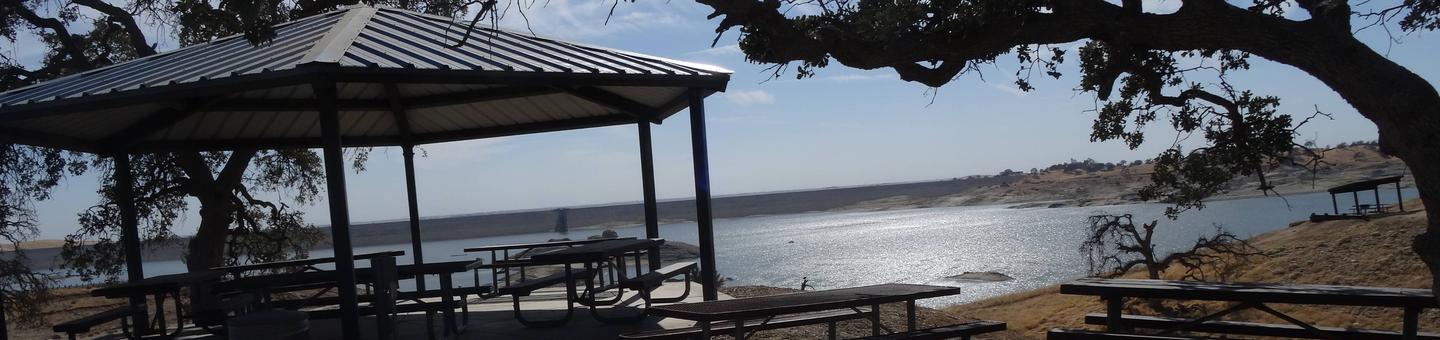
Buck Ridge Park is a group day-use area located at Hensley Lake in the foothills of central California, 50 miles north of Fresno.
The lake area offers many recreational opportunities, such as swimming, water skiing, fishing and hiking, and attracts a growing number of visitors per year. It is within a short drive to Yosemite, Kings Canyon and Sequoia National Parks, as well as Sierra National Forest.
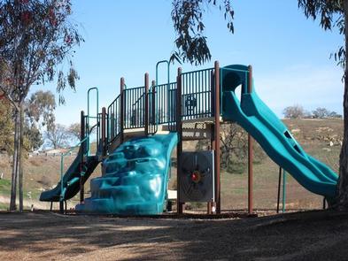
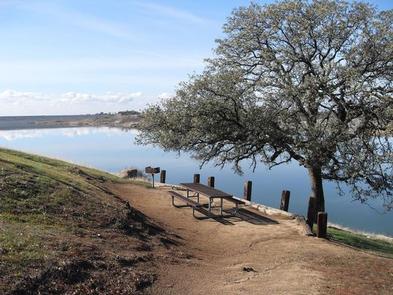
The 1,500-acre lake was created by the construction of Hidden Dam on the Fresno River. With over 20 miles of shoreline, it is a popular vacation spot for families because of its playground, swimming areas and water activities.
Recreation
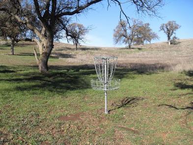
The area is packed with opportunities for outdoor fun. The lake area has a swim beach, a disc golf course and a hiking, mountain biking and equestrian trail. On the water, visitors can ski, swim and fish.
Facilities
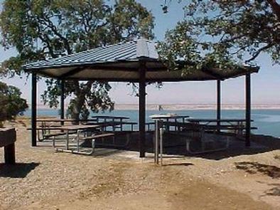
This facility has boat ramps, picnic areas, a group picnic shelter and a playground. Drinking water is provided, and there is a grocery store within a short driving distance.
Natural Features
Buck Ridge is located directly on the shore of Hensley Lake and surrounded by the oak woodlands of the Sierra Nevada foothills, offering a mixture of sun and shade.
Nearby Attractions
Yosemite National Park is about one hour north, and Sequoia and Kings Canyon National Parks are about 1.5 hours southeast of the facility.
Sequoia and Kings Canyon National Parks