RAY BEHRENS, MO Campground Reservation, Info, Images, Map, Directions

RAY BEHRENS, Missouri Campground Images, Info & Reservations

Directions

From Hannibal MO, travel west on Highway 36 for 17 miles, turn south onto Route J and go 12 miles to the campground.


Phone

573-735-4097

Activities

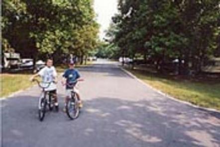
BIKING, BOATING, CAMPING, DAY USE AREA

Keywords

RABE,BEHRENS CAMPGROUND,MARK TWAIN LAKE,MARK TWAIN LAKE

Related Link(s)

Rec Area Info & Images

Missouri State Tourism

Missouri State Road Conditions

Overview

Ray Behrens is a scenic campground and recreation area, conveniently located on the southeastern shores of Mark Twain Lake. Here, visitors can enjoy the perks of the campground, go boating on the lake or explore the area’s historic attractions.

Twain, the legendary author, was born in a village beside the lake and grew up in a town about 20 miles down the road.

Recreation

Mark Twain Lake provides countless opportunities for outdoor recreation – boating, swimming, fishing, picnicking, camping, hiking and hunting to name a few.

Facilities

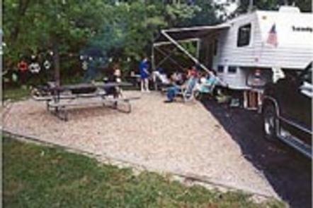
Ray Behrens Campground has three loops: Deer Run, Little Bluestem and Cedar Ridge. All campsites come with electric hookups. Showers and accessible flush toilets are in close proximity of every site. The park also features a marina and playgrounds.

Natural Features

The Salt River flows through rolling hills of north-central Missouri, where it is dammed to form the 18,000-acre Mark Twain Lake. A variety of recreation areas surround the lake, including the Mark Twain State Park.

Nearby Attractions

Beside the lake is the village of Florida, where Mark Twain was born. Twenty-five miles east is the town of Hannibal, where visitors can tour the author’s boyhood home.

Reservation

More from CampingHiking.net:

Lodgepole Campground (MT), Montana Campground Images, Info & Reservations

Directions From Philipsburg travel 10.75 miles south on State Highway 1. The campground is directly across the highway from Georgetown Lake and Red Bridge Boat Launch. Phone 406-210-8199 Activities BIKING, BOATING, CAMPING, FISHING, HIKING, HUNTING, WATER SPORTS, WILDLIFE VIEWING, SWIMMING SITE Keywords LODB,BEAVERHEAD-DEERLODGE NF -FS Related Link(s) Rec Area Info

OLD KUTTAWA, Kentucky Campground Images, Info & Reservations

Directions From Nashville, take I-24 West to Exit 40. Turn left on 62 and then right on Highway 295. Follow Highway 295 to recreation area entrance. Phone LAKE BARKLEY RESOURCE MANAGERS OFFICE: 270-362-4236 Activities BOATING, FISHING, DAY USE AREA, SWIMMING SITE Keywords OLDK,LAKE BARKLEY,KUTTAWA,OLD KUTTAWA,BARKLEY LOCK & DAM Related Link(s)

BRIDGEVIEW (RATHBUN LAKE), Iowa Campground Images, Info & Reservations

Directions From Moravia, IA, travel 10 miles west on Highway J18 and follow signs into the campground. Phone FOR CAMPGROUND INQUIRIES DURING MAY-SEPTEMBER PLEASE CALL 641-724-3062. DURING CLOSED SEASON PLEASE CALL 641-647-2464 Activities BIKING, BOATING, CAMPING, FISHING, HIKING, PICNICKING, WILDLIFE VIEWING, DAY USE AREA, INFORMATION SITE, SWIMMING, KAYAKING, CANOEING, WATER

LAKE IRWIN, Colorado Campground Images, Info & Reservations

Directions From Gunnison, take Colorado Highway 135 north 28 miles to Crested Butte. Turn left on Gunnison County Road 12. Proceed 7 miles. Turn right on Forest Road 826 and follow signs to the campground. Phone 970-349-6348 Activities BIKING, BOATING, CAMPING, FISHING, HIKING Keywords LAKI,GUNNISON,GM,UNCOMP NF – FS Related Link(s)

PIPER ISLAND CABIN, Alaska Campground Images, Info & Reservations

Directions Accessible year round by floatplane or boat, weather permitting. Located 30 miles north of Sitka within Schulze Cove, on the north side of Fish Bay, the northwest coast of Baranof Island. From Sitka, boat access is 90 minutes, air access is 20 minutes. For geographic features surrounding the cabin,