WEST ROLLING HILLS, KS Campground Reservation, Info, Images, Map, Directions

WEST ROLLING HILLS, Kansas Campground Images, Info & Reservations

Listen

Directions

Take I-70 to exit 290, then 5 miles to 244, then east 1/2 mile to park entrance.

Phone

785-784-4447

Activities

BOATING, CAMPING, SWIMMING SITE

Keywords

ROLH,MILFORD LAKE,MILFORD LAKE

Related Link(s)

Rec Area Info & Images

Kansas State Tourism

Kansas State Road Conditions

Overview

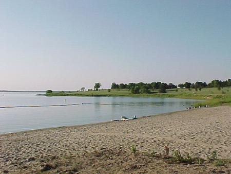
West Rolling Hills is a comfortable campground with a site layout that maximizes views of the sparkling Milford Lake.

An expanse of 33,000 acres surrounding the lake is public, protected land that’s home to an array of wildlife. It’s also an ideal setting for outdoor recreation like hiking, swimming, hunting and driving off-road vehicles.

Click here for the Milford Lake Virtual Tour.

Recreation

Activities include boating, swimming, fishing, hunting, hiking, wildlife viewing and biking.

Nearly 70% of the land resources are available for public hunting and the park has a fish cleaning station for anglers returning from a successful trip.

Facilities

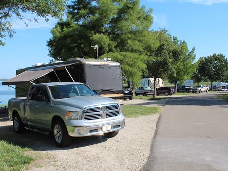
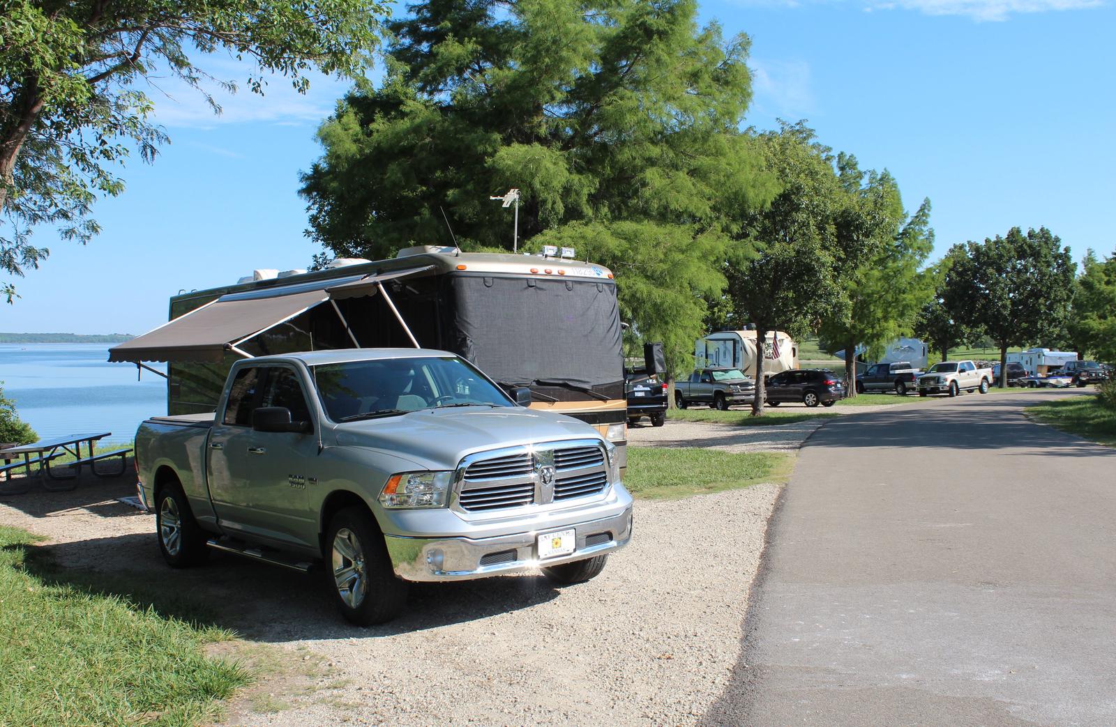
The loop A campground has modern conveniences like showers and flush toilets. Most of these sites have electric and water hookups, as well.

The Thunderbird Marina is a easy starting point for a day on the lake, while an on-site playground provides fun for families.

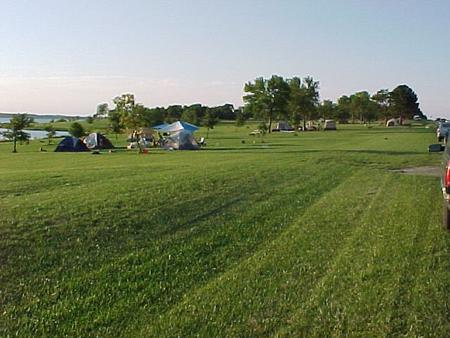
Free camping opportunities are available for visitors looking for basic camping with vault toilets.

Natural Features

Milford Lake is fed by the Republican River and stands as the largest man-made lake in Kansas, with a surface area of 15,700 acres and 163 miles of shoreline.

Nearby Attractions

The Milford Nature Center and Fish Hatchery is nearby, below the dam and a golf course is adjacent to the nature center.

Reservation

More from CampingHiking.net:

CHAPMAN CAMPGROUND AND GROUP, Colorado Campground Images, Info & Reservations

Listen Directions Take I-70 west of Denver to Glenwood Springs, Colorado. Take exit 116 (Highway 82) south to Basalt. At Basalt, take Frying Pan Road. Go 29 miles to Chapman Campground. Phone 970-927-0107 Activities BIKING, CAMPING, FISHING, HIKING, WILDLIFE VIEWING Keywords CHAP,CHAPMAN LAKE,WHITE RIVER NF -FS Related Link(s) Rec Area

BLACKHAWK PARK, Wisconsin Campground Images, Info & Reservations

Listen Directions From DeSoto, WI, travel 3 miles north on HWY 35 and turn left on County Road BI. From LaCrosse, WI, travel 25 miles south on HWY 35 and turn right on County Road BI. Phone 608-648-3314 Activities BOATING, CAMPING, INTERPRETIVE PROGRAMS, FISHING, DAY USE AREA, SWIMMING, KAYAKING, CANOEING

SPRINGY POINT, Idaho Campground Images, Info & Reservations

Listen Directions From Sandpoint, Idaho, take US 95 south across the Long Bridge, then turn west onto Lakeshore Drive. After three miles turn right into the campground. Phone 208-437-3133 Activities BOATING, CAMPING, FISHING, PICNICKING, DAY USE AREA, SWIMMING Keywords SPRP,ALBENI FALLS DAM Related Link(s) Rec Area Info & Images Idaho

WHITE CLOUD, California Campground Images, Info & Reservations

Listen Directions From Nevada City, travel east on Highway 20 for 10 miles. Turn right at the White Cloud Campground sign and then the first right into the campground. From Interstate 80 take exit 161, Highway 20 to Nevada City and drive 26 miles west toward Nevada City. Turn left

SARGE CREEK, Oklahoma Campground Images, Info & Reservations

Listen Directions From Kaw City, Oklahoma, travel nearly 3 miles east on Highway 11, then follow signs to the campground. Phone 580-762-5611 Activities BOATING, CAMPING, FISHING, HIKING, WILDLIFE VIEWING, DAY USE AREA Keywords SARG,KAW LAKE,KAW LAKE Related Link(s) Rec Area Info & Images Oklahoma State Tourism Oklahoma State Road Conditions