SHADY CREEK, IA Campground Reservation, Info, Images, Map, Directions

SHADY CREEK, Iowa Campground Images, Info & Reservations

Directions

From Davenport, Iowa, drive west on Highway 22 about 17 miles and turn at the Shady Creek sign.

Phone

563-419-0857

Activities

BOATING, CAMPING, FISHING, HIKING, DAY USE AREA

Keywords

SHAD,MISSISSIPPI RV. RI

Related Link(s)

Rec Area Info & Images

Iowa State Tourism

Iowa State Road Conditions

Overview

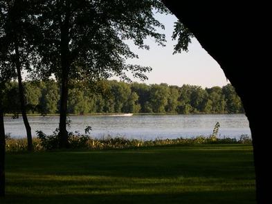
Shady Creek Campground is a 22-acre park where campers enjoy getaways on the banks of the Mississippi River. A nature trail, shore fishing and fantastic bird watching are offered at Shady Creek.

Recreation

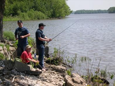
The Mississippi River draws many anglers annually. The most popular fish species is the channel catfish; bluegill, walleye and northern pike are also found in the river.

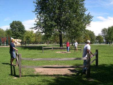
Picnicking and playing horseshoes is a popular activity in the park.

Facilities

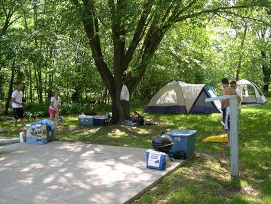
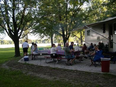
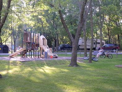
The park’s campsites contain 50-amp electric hookups, campfire rings and picnic tables. Flush toilets and showers are provided. A boat ramp and playground are on-site.

Natural Features

The park has spectacular views of the Mississippi River. Many trees throughout the campground provide great places to lounge in the shade.

The Upper Mississippi River begins at the headwaters of Lake Itasca, Minnesota and flows 1,250 miles to Cairo, Illinois where it joins the Ohio River.

Nearby Attractions

Wildcat Den State Park is just north of Shady Creek, offering hiking trails and the historic Pine Creek Grist Mill built in 1848.

The Mark Twain National Wildlife Refuge is a 40-minute drive downstream. Trails and observation decks are open to the public. Hunting and fishing are allowed in many area of the refuge.

Reservation

More from CampingHiking.net:

WARNER LAKE, Utah Campground Images, Info & Reservations

Directions From Moab, the fastest access (about 1 hour) to Warner Lake Campground is by driving south on Highway 191. Drive 6 miles south of Moab and turn east (left) onto Old Airport Road (sign has arrow to La Sal Loop Road, National Forest Access). Turn south (right) at the

PICKETT BUTTE LOOKOUT, Oregon Campground Images, Info & Reservations

Directions Important note regarding GPS use: please be advised that GPS units can, and have sent guests down the wrong roads to access the lookout. Please consider following the directions below rather than your GPS unit. Directions: From Canyonville take West 1st Street and turn onto SE 3rd St/OR-227. Continue

LAVONIA, Texas Campground Images, Info & Reservations

Directions From Wylie, Texas take State Highway 78 North to Lake Road (County Road 486) located in the city of Lavon. Take a left on Lake Road. Follow signs into the campground by taking a left over the railroad tracks bridge. Phone 972-442-3141 Activities BOATING, CAMPING, FISHING, SWIMMING SITE Keywords

UNION GROVE, Texas Campground Images, Info & Reservations

Directions From Interstate 35 in Salado, Texas take the Farm-to-Market Road 2484 exit. Travel west on 2484 about five miles to Union Grove Park Road, and turn right into the facility. Phone 254-947-0072 Activities CAMPING, SWIMMING SITE Keywords UNIO,STILLHOUSE HOLLOW RESERVOIR,STILLHOUSE LAKE,LAKE STILLHOUSE,STILLHOUSE HOLLOW LAKE,LAKE STILLHOUSE HOLLOW,UNION GROVE WEST,STILLHOUSE HOLLOW