SUPPLY PARK, OK Campground Reservation, Info, Images, Map, Directions

SUPPLY PARK, Oklahoma Campground Images, Info & Reservations

Directions

From Woodward, Oklahoma, travel 9 miles northwest on Highway 3/270 to Fort Supply Lake sign. Turn west and follow for 3 miles, crossing Fort Supply Dam. Continue 3/4 mile to the four-way stop; turn left and follow access road into the campground.

Phone

580-766-2001

Activities

BOATING, CAMPING, HUNTING, SWIMMING SITE

Keywords

SUPP,COTTONWOOD PARK,FORT SUPPLY LAKE

Related Link(s)

Rec Area Info & Images

Oklahoma State Road Conditions

Oklahoma State Tourism

Overview

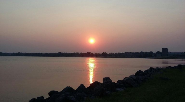
Supply Park sits along the pristine shores of Fort Supply Lake, where fishing, swimming and boating are popular pastimes.

Recreation

Fishing opportunities abound with catches like crappie, walleye, white bass, hybrid bass, channel catfish and flathead catfish. Hunters enjoy the 6,000 acres of land populated by bobwhite quail, deer, pheasants and rabbits.

The campground provides a sandy beach, boat ramp and fishing pier for visitors to enjoy the lake.

Facilities

Supply Park offers 110 campsites, most with electric hookups, that range from $17-$24 per night, one large group camping shelter with eight associated campsites for $176 per night, and one reservable group day use pavilion for $36 per day. Other amenities include a boat launch, dump stations, accessible fishing piers, hot showers, group camping and picnic areas and two playgrounds.

Natural Features

Supply Park is set along the western shores of the lake in northwest Oklahoma. Sand dunes line the east side of the lake, and the vast, 1,800-acre lake has an average depth of eight feet.

Nearby Attractions

Stop by the Fort Supply Historic Site, the Pioneer Museum and Art Center in Woodward, and Boiling Springs State Park.

Reservation

More from CampingHiking.net:

BIG CREEK CABIN, Montana Campground Images, Info & Reservations

Directions From Livingston, drive south on Highway 89 for approximately 34 miles to Big Creek Road and a sign for Mountain Sky Guest Ranch. Turn right at the sign and follow Big Creek Road for about 5 miles to the cabin. High-clearance, four-wheel drive vehicles are strongly recommended. In winter,

OLD KUTTAWA, Kentucky Campground Images, Info & Reservations

Directions From Nashville, take I-24 West to Exit 40. Turn left on 62 and then right on Highway 295. Follow Highway 295 to recreation area entrance. Phone LAKE BARKLEY RESOURCE MANAGERS OFFICE: 270-362-4236 Activities BOATING, FISHING, DAY USE AREA, SWIMMING SITE Keywords OLDK,LAKE BARKLEY,KUTTAWA,OLD KUTTAWA,BARKLEY LOCK & DAM Related Link(s)

LAKE EVA CABIN, Alaska Campground Images, Info & Reservations

Directions The lake is typically frozen from December through early May (floatplanes cannot land on the lake). Located 27 air miles northeast of Sitka, near northeast coast of Baranof Island. Travel by floatplane is 25 minutes one-way from Sitka. For geographic features surrounding cabin, refer to USGS topographic map Sitka

CURTIS CREEK, Kansas Campground Images, Info & Reservations

Directions Take I-70 to the 290 exit and proceed north 5 miles to 837. Continue west on 837 for 6 miles to reach the park entrance. Phone 785-238-5714 Activities CAMPING Keywords CURC,MILFORD LAKE,MILFORD LAKE Related Link(s) Rec Area Info & Images Kansas State Tourism Kansas State Road Conditions Overview Curtis

LUNA WHITE DEER CAMPGROUND, Wisconsin Campground Images, Info & Reservations

Directions From Eagle River, travel 13.4 miles on STH 70 to FR2176 (Divide Road). Turn right (south) and continue 5.6 miles to FR2188. Turn right and travel 0.7 miles to the campground. Phone (715) 479-2827 Activities BIKING, BOATING, CAMPING, FISHING, WILDLIFE VIEWING, SWIMMING SITE Keywords Related Link(s) Rec Area Info