CURTIS CREEK, KS Campground Reservation, Info, Images, Map, Directions

CURTIS CREEK, Kansas Campground Images, Info & Reservations

Listen

Directions

Take I-70 to the 290 exit and proceed north 5 miles to 837. Continue west on 837 for 6 miles to reach the park entrance.

Phone

785-238-5714

Activities

CAMPING

Keywords

CURC,MILFORD LAKE,MILFORD LAKE

Related Link(s)

Rec Area Info & Images

Kansas State Tourism

Kansas State Road Conditions

Overview

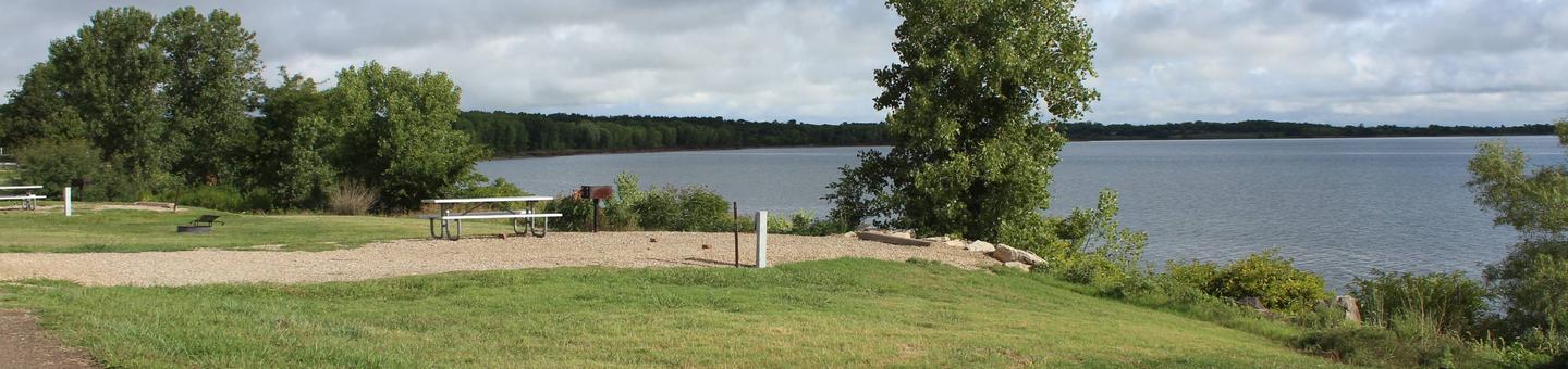
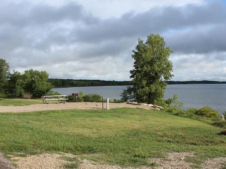
Curtis Creek Park is a classic camping destination with a wealth of options for boating, hiking, hunting and fishing.

The park area provides excellent views of Milford Lake and Milford Dam. In total, the Milford Lake region is home to 33,0000 acres of public land protected for recreation, wildlife and cultural resources.

Click here for the Milford Lake Virtual Tour.

Recreation

Whether it’s boating, birding, fishing or biking, Curtis Creek provides opportunities for all types of visitors.

Water skiing is popular sport on the lake, while an accessible floating fishing dock provides an ideal location for catching trout closer to shore.

Facilities

The majority of sites have electric and water hookups and modern amenities such as flush toilets and hot showers, provide a comfortable camping experience.

A boat ramp and playground are both provided for entertainment and convenience.

Natural Features

The campground is on a peninsula on the banks of Milford Lake, the largest man-made lake in Kansas. Fed by the waters of the Republican River, Milford Lake spans a surface area of 15,700 acres and an impressive 163 miles of shoreline.

Nearby Attractions

Hiking trails include the Waterfall Trail and the Crystal Trail. The wildlife Viewing Tower and Trail is a hot spot for excellent wildlife viewing.

The Milford Education Center and Fish Hatchery are located below the dam.

Reservation

More from CampingHiking.net:

KAH SHEETS BAY CABIN, Alaska Campground Images, Info & Reservations

Listen Directions Accessible by boat or float plane, 24 miles from Petersburg. The cabin may also be reached by hiking the 2.75-mile trail from Kah Sheets Lake, which is accessible by float plane only. Due to changes in Kah Sheets Creek near the cabin, visitors will need at least a

JUNIPER LAKE GROUP, California Campground Images, Info & Reservations

Listen Directions From the Red Bluff (I.5), drive east on state HWY 36 approximately 70 miles to Chester. Turn left at fire station immediately after crossing Feather River Bridge (watch for National Park Service sign on right) continue approximately 13 miles follow signs to Juniper Lake Campground and Group Campsite

CLEAR LAKE GROUP SITE, Washington Campground Images, Info & Reservations

Listen Directions From Naches, Washington, follow Highway 12 west for approximately 34 miles to County Road 1200/Tieton Reservoir Road at the west end of Rimrock Lake. Turn south/left on County Road 1200 and follow for about .3 miles to Road 740. Continue for a half-mile, and the reservation site is

HUNTER COVE, Nebraska Campground Images, Info & Reservations

Listen Directions From Highway 80, take Highway 183 south to Alma, Nebraska. Turn left onto Highway 136. then turn right on Berrigan Road and travel 1.25 miles to the intersection of Road B. Turn right and travel one mile; the park entrance is on south side of the road. Phone