
Directions
Address for GPS: Taylor Ferry South Campground, 33814 E. 746 Rd., Wagoner, OK 74467 From Wagoner, Oklahoma, travel 5 miles east on Highway 51. Turn left on South 330 Road and travel south for approximatly 1/4 mile. Turn left on East 746 Road and travel less than 1 mile to the entrance gate and check in station.
Phone
918-485-4792 OR 918-682-4314
Activities
BOATING, CAMPING, FISHING, HUNTING, SWIMMING SITE
Keywords
TAFE,FORT GIBSON LAKE,TAYLOR FERRY SOUTH,SOUTH TAYLOR FERRY,FORT GIBSON LAKE
Related Link(s)
Oklahoma State Road Conditions
Overview
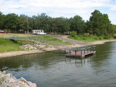
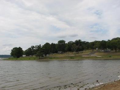
Taylor Ferry South is a heavily wooded campground that provides an abundance of shade for rest and relaxation. Conveniently located off Highway 51, users can easily access the main body of the lake for a variety of water activities. As an added bonus, there are several stores and marinas nearby for supplies and equipment rentals. Boat and RV storage locations are within a mile of the campground.
Recreation
The nearly 20,000-acre lake offers excellent boating and swimming opportunities.
Anglers enjoy fishing for black bass, white bass, crappie and several varieties of catfish and panfish.
The lake’s 225 miles of shoreline are home to thousands of acres of public hunting lands, where white-tailed deer, bobwhite quail, mourning dove, duck, geese, cottontail rabbit and squirrel roam.
Facilities
This year-round campground offers 95 sites, 89 of which have electric hookups.
Amenities include flush and pit toilets, drinking water, showers, a dump station and boat ramp.
Natural Features
The area around Taylor Ferry South is primarly an oak-hickory forest; however, the entrance road is lines with pines. Most of the rocky shoreline within the campground has a gradual slope to the water’s edge for easy access. A man made sandy swim beach with playground equipment is located across the highway from the campground.
Nearby Attractions
Historic Fort Gibson, established in 1824, served as an important military post on the western frontier for close to 70 years. Now a National Historical Landmark, the site is open to the public year round.
Volunteers reenact the lifestyle of the late 1800s during various events held throughout the year. A reconstructed log stockade, and original barracks, hospital, bakehouse and other structures still stand today.