CASTLE ROCK GROUP CAMPGROUND, OR Campground Reservation, Info, Images, Map, Directions

CASTLE ROCK GROUP CAMPGROUND, Oregon Campground Images, Info & Reservations

Directions

From Hebo, Oregon travel south on Highway 22, 4.2 miles. Location is on the right.

Phone

503-392-5100

Activities

HIKING, SWIMMING

Keywords

Related Link(s)

Rec Area Info & Images

Oregon State Tourism

Oregon State Road Conditions

Overview

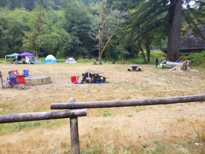
Located on Three Rivers, this group campground is ideal for family gatherings and group arrangements. Conveniently located off Hwy. 22 and surrounded by forest, it provides a picturesque setting to enjoy a fun filled, group camping experience.

Recreation

Campground offers an open space style group camping experience. The river provides opportunities for fishing or summer swimming, and hiking trails are within a few miles from the site.

Facilities

The group site includes eight picnic tables, group fire ring, individual rock fire pits, one vault toilet, garbage dumpster and a parking area.

Natural Features

Open grassy meadow surrounded by forests, rivers, and coastal mountains, this campground offers a picturesque setting to gather, camp, fish, and play.

Reservation

More from CampingHiking.net:

LUCERNE CAMPGROUND, Utah Campground Images, Info & Reservations

Directions From Manila, Utah: Follow Highway 43 for 2.6 miles to the state line, where Highway 43 becomes Wyoming Highway 530. Follow Wyoming 530 for 1.3 miles to Lucerne Valley Road/Forest Road 146. Continue on this road approximately 4 miles to the campground. Phone 801-226-3564 Activities BOATING, CAMPING, FISHING, WATER

COON CREEK GROUP CAMPGROUND, California Campground Images, Info & Reservations

Directions From San Bernardino, take I-10 to the Alabama exit in Redlands, California. Turn onto Lugonio Avenue (Highway 38). Head northeast on Highway 38 for approximately 31 miles to Forest Route IN02. Continue for approximately 6 miles to the campground. Phone 909-866-8550 Activities CAMPING, FISHING, HIKING, WILDLIFE VIEWING Keywords COON,SAN

Dundo Group Campground, Virginia Campground Images, Info & Reservations

Directions From Washington, D.C., metro area, travel west on Interstate 66 to exit 43A. Take US Highway 29 south approximately 55 miles to Ruckersville, Virginia, then take US Highway 33 west to Shenandoah National Park and Skyline Drive Swift Run Entrance. Follow Skyline Drive south approximately 18 miles and turn

CANYON VIEW GROUP SITES, California Campground Images, Info & Reservations

Directions From Fresno, CA follow California State Highway 180 East, to its end. Canyon View Campground is on the left (north) side of the road. Phone 559-565-3341 Activities BIKING, CAMPING, HIKING, HORSEBACK RIDING, VISITOR CENTER Keywords Related Link(s) Rec Area Info & Images California State Tourism National Park Services Concessionaire

RAINBOW POINT CAMPGROUND, Montana Campground Images, Info & Reservations

Directions From West Yellowstone, travel 5 miles north on Highway 191. Turn west (left) onto Rainbow Point Road (Forest Road 6954) and travel 3 miles, then 2 miles north (right) on Rainbow Point Road, after the intersection. Phone 406-646-1012 Activities BIKING, BOATING, CAMPING, FISHING, HIKING, WILDLIFE VIEWING, DAY USE AREA,

BAD BEAR CAMPGROUND, Idaho Campground Images, Info & Reservations

Directions Hayfork Group Cg (ID) HIGHWAY 21 Idaho City ID 83706 Phone 208-392-6681 Activities CAMPING, FISHING, VISITOR CENTER, WILDLIFE VIEWING Keywords None Related Link(s) Rec Area Info & Images Idaho State Tourism Idaho State Road Conditions Overview Bad Bear Campground is located 48 miles northeast of Boise, Idaho, in a