

Directions
From the north, take I-95 to Bangor, then I-395 to Brewer, then take Rte. 15 south to Stonington. From the south, take I-95 or I-295 to Augusta, then Rte. 3 to Belfast, then Rte. 15 to Stonington.
Phone
207-335-5551
Activities
CAMPING
Keywords
None
Related Link(s)
Overview
Campsite reservations can be made beginning on April 1st each year at 10:00am (EST). The first night to book a campsite is May 15th.
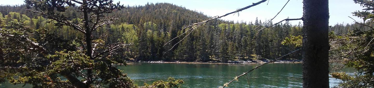
Duck Harbor Campground is located on Isle au Haut, a rugged island off the coast of Stonington, Maine. Remote and inaccessible to automobiles, Isle au Haut is linked to the mainland by mailboat.
Recreation
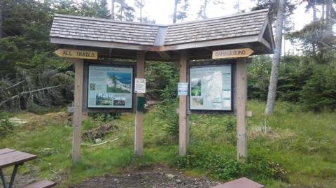
Isle au Haut offers excellent hiking. The remoteness of the island provides a quiet experience along primitive trails with many great views of rocky cliffs and coastal scenery. Bicycling is allowed but is very rigorous, on loose rock, and unpaved road. No trail biking. You must bring your own mountain bike. Bicycles can only be unloaded at the Town Dock. No bicycles may be loaded or unloaded at Duck Harbor Landing.
Facilities
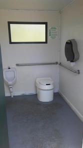
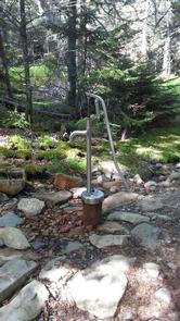
This small campground contains five campsites. Each campsite has a fire ring, picnic table, and a lean-to shelter which is three-sided with roof and floor. Dimensions are 8′ tall, 8′ deep, and 12.5′ wide. Use of tents is limited to what can fit inside the shelters. There are three composting toilets at the campground and a hand pump for water located 0.3 miles from campground.
There is a ranger station 4 miles from the campground but only 0.3 miles from the Isle au Haut Town Landing. The ranger station is open mid-April to mid-October, when there are rangers on Isle au Haut for the season. While the rangers are typically out in the field and not at the ranger station during most of the day, the lobby remains open, allowing visitors access to maps, reading material, water, and the only public restroom in town. Boat service to Duck Harbor is limited at the beginning and end of the season. Please review the Need to Know section.
Natural Features
Isle au Haut provides opportunities to explore rocky shorelines, wooded uplands, marshes, bogs, and a mile-long freshwater lake. A section of Acadia National Park covers about half of Isle au Haut. The campground is situated on the western side of Isle au Haut. It is just south of the Duck Harbor Boat Landing. The island is approximately six miles long by two miles wide.
Nearby Attractions
There is a small, traditional village near the Isle au Haut Town Landing where one can find a general store, seasonal gift shop, a seasonal food shack, and post office.
Charges & Cancellations
No Shows
- If a camper does not arrive at his/her campsite by 11:00am check-out time the day after the scheduled arrival date, their reservation will be cancelled, the camper will incur a $20.00 service fee, and forfeit the first night’s camping fee.
Making Changes to Your Reservation
- A $10.00 service fee will apply if you make any changes to your reservation.
Cancelling Your Reservation
- If you cancel your reservation the day before or on the day of your scheduled arrival date, you will incur a $10 service fee and forfeit your first night’s camping fee. If you cancel your reservation 2 or more days before your scheduled arrival date, you will only incur a $10 service fee.
Please review Rules & Reservation Policies below for more information.