MOOSE LAKE, WI Campground Reservation, Info, Images, Map, Directions

MOOSE LAKE, Wisconsin Campground Images, Info & Reservations

Directions

From Hayward, Wisconsin, drive east on State Highway 77 about 28 miles. Turn right onto Forest Service Road 174 and continue about a mile, then turn right onto Forest Service Road 176. After about 5 miles turn right again and drive less than 2 miles to the campground.

Phone

(715) 634-4821 OR (715) 264-2511

Activities

CAMPING

Keywords

MOOL,CHEQUAMEGON-NICOLET NF – FS

Related Link(s)

Rec Area Info & Images

Overview

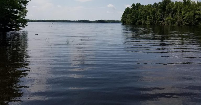
Moose Lake Campground sits along its namesake lake in the Chequamegon National Forest of northern Wisconsin. The serene lake and surrounding forest offer a spectacular location for families to enjoy nature.

Recreation

The location provides access to a variety of activities, including miles of off-road vehicle, hiking and mountain biking trails.

Anglers will find an abundance of musky, walleye, bass and pan fish in the lake, and the clear water is ideal for kayaking, canoeing and swimming. A sandy beach and a boat ramp provide convenient lake access.

Facilities

This small and semi-secluded campground offers about 15 single-family campsites for tent and RV camping.

Each site is equipped with tables and campfire rings with grills. Accessible vault toilets, drinking water and trash collection are provided. Roads into the campground are not paved and the parking aprons are grass and gravel.

Natural Features

Chequamegon National Forest offers 845,000 acres dotted with countless lakes, rivers and streams. Pine, spruce, maple, aspen, and balsam forests, as well as extensive jack pine plantations, make up the lush landscape.

Moose Lake is a 1,670-acre body of water that is popular for fishing, boating and swimming. Elk, eagles, loons and other wildlife are often viewed in and near the campground.

Reservation

More from CampingHiking.net:

BLUFF CREEK, Alabama Campground Images, Info & Reservations

Directions From Eufaula, Alabama, follow US 431 north. Turn right on State Route 165 and continue for 18 miles, then follow signs into the campground. Phone 334-855-2746 Activities BOATING, CAMPING, FISHING, HUNTING, WILDLIFE VIEWING Keywords LAKE EUFAULA (ALABAMA),WALTER F GEORGE LAKE Related Link(s) Rec Area Info & Images Alabama State

CEDAR BREAKS PARK, Texas Campground Images, Info & Reservations

Directions From I-35, take Farm to Market Road 2338 west for 3.5 miles to D.B. Wood Road. Turn left and continue for 2.5 miles. Turn right onto Cedar Breaks Road and follow signs to the park. Phone 512-930-5253 Activities BOATING, CAMPING, FISHING, HIKING, HUNTING, PICNICKING, PADDLING, MOUNTAIN BIKING Keywords CEDA,LAKE

PEAVY CABIN, Oregon Campground Images, Info & Reservations

Directions North of Baker City, take U.S. Hwy 30 (Elkhorn Drive Scenic Byway) to Haines. At Haines, turn west on County Rd 1146, staying with the Scenic Byway to Anthony Lakes. Continue on the Scenic Byway (now Forest Service Road 73) past the Elkhorn Summit for approximately 8 miles. Turn

SUNGLOW CAMPGROUND, Utah Campground Images, Info & Reservations

Directions Travel a half-mile south of Bicknell, Utah, on Highway 24, then turn east on Forest Road 143 and travel 1.5 miles to the campground. Phone 435-836-2811 Activities CAMPING, HIKING Keywords SUNG,FISHLAKE NF – FS Related Link(s) Rec Area Info & Images Utah State Road Conditions Utah State Tourism Overview