PICNIC POINT (WI), WI Campground Reservation, Info, Images, Map, Directions

PICNIC POINT (WI), Wisconsin Campground Images, Info & Reservations

Listen

Directions

From Medford, take State Highway 13 north 4 miles. Turn left (west) onto County Highway M for about 7 miles. Turn right (north) onto County Highway E and continue for about 8 miles. Turn right (east) onto Forest Road 1563 and continue for 1 mile, then turn right (south) onto Forest Road 106 for 2 miles.

Phone

715-748-4875

Activities

BOATING, CAMPING, FISHING, HIKING, SWIMMING SITE

Keywords

PCPT,CHEQUAMEGON-NICOLET NF – FS

Related Link(s)

Rec Area Info & Images

Wisconsin State Tourism

Wisconsin State Road Conditions

Overview

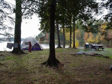
Picnic Point Campground is a quaint campground, where a large group can enjoy a peaceful escape in northern Wisconsin. The rustic nature of the campground draws campers in for a respite from the hustle and bustle of nearby cities and towns.

Recreation

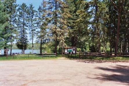
A boat ramp into the 411-acre Mondeaux Flowage is available not far from the campground. The lake, although rather shallow, is popular for swimming and fishing. Anglers fish for musky, pan fish, largemouth bass and pike, among other varieties.

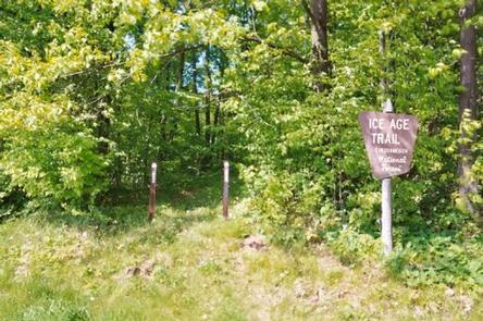
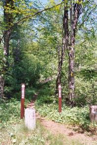
A system of hiking trails is available in the area, including the 1,200-mile Ice Age National Scenic Trail, which traces the edge of a historic glacier that once covered the state of Wisconsin and much of North America.
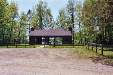
Facilities

The campground offers one large group campsite for tent camping only. The site can accommodate up to 35 people.

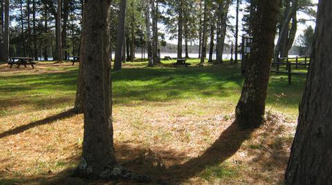
The site is equipped with multiple tables and campfire rings with grills. Vault toilets and drinking water are provided. The campground does not provide trash collection and visitors are required to pack out all garbage.

Natural Features

The campground’s shaded group campsite is nestled under towering pine trees along the western shore of Mondeaux Flowage. Sites sit right on the edge of the scenic lake, where boats can also be anchored.

Nearby Attractions

The city of Medford is located about 18 miles from the campground. A variety of services can be found there.

Reservation

More from CampingHiking.net:

MACKS CREEK PARK, Idaho Campground Images, Info & Reservations

Listen Directions From Gowen Road (Exit 57) off I-84, head east toward South Federal Way. Continue to follow Highway 21 for 12.5 miles. Turn right on Arrow Rock Road immediately after the High Bridge crossing over the lake. Continue 4.5 miles on Arrow Rock Road to Macks Creek Park. Phone

GRIZZLY, California Campground Images, Info & Reservations

Listen Directions From Reno, travel north on Highway 395 to Highway 70 and turn west to Portola. From Portola, take County Road 126 north for 7 miles, then County Road 112 to the east side of Lake Davis. Continue approximately 1 mile to the campground, which is on the left.

LOST CREEK, Oregon Campground Images, Info & Reservations

Listen Directions From Portland, follow Highway 26 for 18 miles past the town of Sandy to the community of Zigzag. Turn north (left) onto Lolo Pass Road (Forest Road 18). Travel just over 4 miles and turn right onto Forest Road 1825. Continue for less than a mile and then

CONGO GULCH, Oregon Campground Images, Info & Reservations

Listen Directions From Pendleton, Oregon: Travel south on Highway 395 for 50 miles to the Ukiah exit. Turn left on Highway 244 to Ukiah. Turn right (south) just before the city park; this road becomes Forest Service Road (FSR) 52 at the Forest boundary. Travel 50 miles to the small

Beaver Creek Group Camp, Washington Campground Images, Info & Reservations

Listen Directions From Seattle, Washington, take I-5 north to exit 194 in Everett. Take Highway 2 north at Highway 204 toward Lake Stevens. Turn north on Highway 9, then east on Highway 92 to Granite Falls. Continue about 23 miles on Highway 7 Scenic Byway. Phone 360-804-1103 Activities CAMPING Keywords

SMITH AND MOREHOUSE, Utah Campground Images, Info & Reservations

Listen Directions From Salt Lake City, Utah, take Highway 80 east for 36 miles to the Kamas exit. Travel south for 12 miles to Oakley, turn left on Highway 213 and travel 12 miles to end of pavement. Turn right and go 2 miles to the campground entrance. Phone KAMAS