ALBENI COVE, ID Campground Reservation, Info, Images, Map, Directions

ALBENI COVE, Idaho Campground Images, Info & Reservations

Directions

From Highway 2 in Newport, Washington, turn south onto Highway 41. Follow for .5 miles and turn east on Fourth Street into Oldtown, Idaho. Follow for approximately 3 miles to the campground.

Phone

208-437-3133

Activities

BOATING, CAMPING, FISHING, PICNICKING, WATER SPORTS, WILDLIFE VIEWING, DAY USE AREA, SWIMMING

Keywords

ALBE,ALBENI FALLS DAM

Related Link(s)

Rec Area Info & Images

Idaho State Tourism

Idaho State Road Conditions

Overview

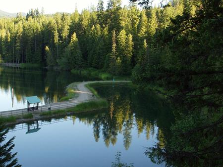
Albeni Cove is a small campground located just upstream from Albeni Falls Dam on the Pend Oreille.

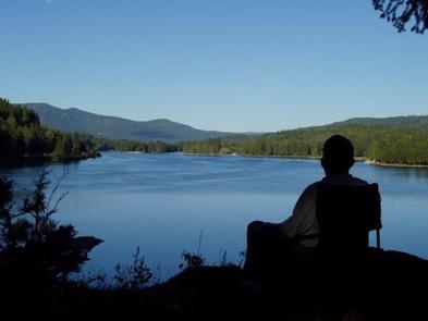
Situated amongst firs, cedars and pines, Albeni Cove provides a rustic, but incredibly beautiful location for camping and recreation on the river.

Recreation

Water sports are the most common activity at Albeni Cove, including swimming, fishing and boating. Campers are likely to spot wildlife in the area, including bald eagles, osprey, a wide variety of birds, and most commonly, deer.

Facilities

Albeni Cove Campground offers 14 campsites, all with picnic tables and grills. An on-site dock, boat ramp and swimming beach provide easy access to the water.

Natural Features

Albeni Falls Dam on the Pend Oreille River, provides flood control, power production and countless recreational activities for visitors year-round.

Behind the dam, the Pend Oreille River stretches 65 miles through a glacial-carved valley that separates three mountain ranges.

Lake Pend Oreille is surrounded by scenic mountains and is one of the largest and deepest natural lakes in the western United States, plunging to depths of more than 1,200 ft. in some areas.

Nearby Attractions

The Albeni Falls Visitor Center features exhibits on the history of the dam and the natural features of the area. Tours of the dam are given daily during the summer.

Charges & Cancellations

A $10.00 service fee will apply if you change or cancel your reservation. Late cancellations are subject to additional fees. For full details see NRRS Reservation Policy.

Reservation

More from CampingHiking.net:

OAK PARK DAY USE, Texas Campground Images, Info & Reservations

Directions From Waco or Corsicana, Texas, take State Highway 31 to the intersection with FM 667. Turn north on FM 667 and travel about 1.5 miles to the park entrance on the left side of the road. Phone 254-578-1431 Activities SWIMMING Keywords Oak park Related Link(s) Rec Area Info &

LAVONIA, Texas Campground Images, Info & Reservations

Directions From Wylie, Texas take State Highway 78 North to Lake Road (County Road 486) located in the city of Lavon. Take a left on Lake Road. Follow signs into the campground by taking a left over the railroad tracks bridge. Phone 972-442-3141 Activities BOATING, CAMPING, FISHING, SWIMMING SITE Keywords

MINERAL LAKE, Wisconsin Campground Images, Info & Reservations

Directions From Mellen, Wisconsin, take County Highway GG west for about 9 miles to the campground sign. Turn right and drive less than a mile to the campground. From Clam Lake, Wisconsin, take County Highway GG north for about 9 miles to the campground sign and turn left. Phone 715-264-2511

CHERRY VALLEY, California Campground Images, Info & Reservations

Directions Campground can be reached from Hwy 120 using Cherry Lake Road also known as Forest Road (FR) 1N07 or from Cottonwood Road also known as FR 1N04.  -Traveling from Hwy 120, go East from Groveland 13.8 miles turn left on Cherry Lake Road/1N07 for 23.5 miles where it becomes

BROOKEN COVE, Oklahoma Campground Images, Info & Reservations

Directions From Enterprise, Oklahoma, take Highway 71 north for 5 miles and follow signs to the campground. Phone 918-799-5843 Activities BOATING, CAMPING, FISHING, HIKING, SWIMMING SITE Keywords BRCO,EUFAULA LAKE,EUFAULA LAKE Related Link(s) Rec Area Info & Images Oklahoma State Tourism Oklahoma State Road Conditions Overview Brooken Cove Campground sits along

HUNTERS GROUP SITE, Washington Campground Images, Info & Reservations

Directions Take State Highway 2 west of Spokane for 32 miles to the town of Davenport. Turn north on State Highway 25 and travel 37 miles. Follow signs for the campground. Turn left (west) on Campground Road in the town of Hunters. Phone 509-754-7889 Activities BOATING, HISTORIC & CULTURAL SITE,