
Directions
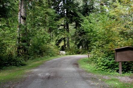
From Darrington, Washington, travel 16 miles southeast on the graveled single lane section of the Mt. Loop Scenic Byway. The campground is located on the west side of the road at mile post 37, just beyond the junction of Mt. Loop and Forest Road 49.
Phone
360-804-1103
Activities
CAMPING, FISHING, HIKING
Keywords
BEDA,BEDAL,MT. BAKER-SNOQU NF – FS
Related Link(s)
Washington State Road Conditions
Overview
Bedal Campground is located just off the Mountain Loop Highway in the stunning Mt. Baker-Snoqualmie National Forest.
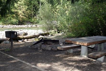
Nestled in canopy of forest along the rushing water of the Sauk River, this campground offers visitors a primitive camping experience and access to a wide range of recreational activities.
Mt. Baker-Snoqualmie National Forest sits on the west side of the Cascades in Washington, showcasing glacier-covered peaks, wide mountain meadows and old-growth forests, rich in history and outdoor opportunities.
Recreation
The Mt. Baker-Snoqualmie National Forest boasts 1,500 miles of trails. From smooth paths meandering through deep quiet forests to challenging ascents up a boulder-studded mountain, opportunities abound for every skill level. Access to biking, rafting and fishing is also readily available.
Within five miles of Bedal Campground are the spectacular North Fork Sauk Falls. A short hike descending 200 feet rewards visitors with views of cascading 45-foot waterfalls that flow into a deep pool surrounded by low-lying ferns and towering forest.
For those interested in higher elevations, the popular Sauk Mountain Trail begins and ends in high mountain meadows, offering wildflowers and spectacular vistas the entire length. On a clear day, Mt. Rainier can be seen to the south, Puget Sound and the San Juan Islands to the west and the rugged Cascade peaks stretching to the east.
Facilities
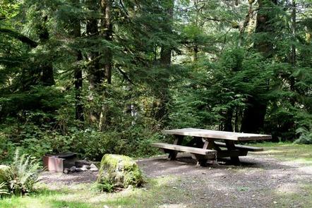
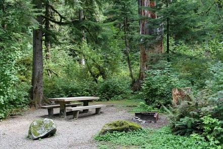
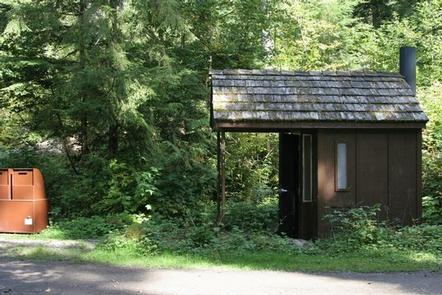
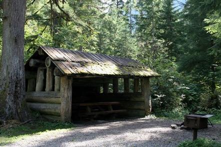
Bedal Campground offers 21 standard sites. Picnic tables, tent pads, campfire rings and vault toilets are provided.
A large Adirondack shelter built out of of old-growth timber is also available to visitors.
Visitors can access the Sauk River from the campground and a boat ramp is provided for non-motorized watercraft.
Natural Features
On a clear day visitors can spot Mt. Baker, the most prominent feature of the Mt. Baker Wilderness Area. Rising to an elevation of 10,781 feet, this active volcano is perpetually snow-capped and mantled with an extensive network of creeping glaciers. Mt. Baker’s summit, Grant Peak, is actually a 1,300-foot-deep mound of ice, which hides a massive volcanic crater.
Along the banks of the Sauk River an outstanding show of wildflowers in July and August includes paintbrush, phlox, tiger lilies, aster, columbine and lupine.
The surrounding undeveloped wilderness, clean streams and diverse forests support an abundance of wildlife. In addition to being home for a multitude of mammals, birds, amphibians and reptiles, the area sustains more rare species such as lynx, moose, wolves and wolverine.
Nearby Attractions
Visitors enjoy the North Cascades and Mt. Rainer National Parks, where interpretive programs and exhibits offer education about the diverse landscape and history of the area.