

Directions
From Porterville, California, take Highway 190 east. Continue through Springville for approximately 28 miles to the Quaking Aspen Campground.
From Bakersfield, California, take Highway 65 North to Highway 190 east. Continue for approximately 28 miles to the campground.
Phone
559-539-5230
Activities
BIKING, CAMPING, FISHING, HIKING, HORSEBACK RIDING, HUNTING, WILDLIFE VIEWING
Keywords
QUAC,SEQUOIA NF – FS
Related Link(s)
California State Road Conditions
Overview
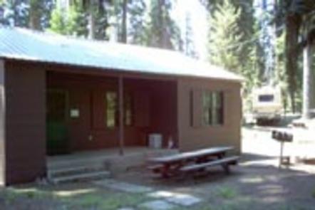
Quaking Aspen Cabin is situated in the Sequoia National Forest, about an hour from Springville, California.
The cabin was originally built in the 1930s by the Civilian Conservation Corps and was used by the Forest Service to house fire patrol, recreation workers and other personnel. Located just inside Quaking Aspen Campground, the cabin is available to rent from mid-May through mid-October.
Recreation
Nearby activities include horseback riding, mountain biking, hiking, rock climbing, hunting and fishing.
Visitors enjoy exploring surrounding sequoia groves. Bear Creek Grove has a trail that winds through the Belknap Complex along Bear Creek and the Tule River. The nearby Freeman Creek Grove is a 1,425-acres unlogged grove featuring several large sequoias, including the President George Bush Tree.
There is fishing in area streams and the Tule River. The Summit Trailhead, about 10 miles north of the campground, offers access to excellent hiking.
The Trail of 100 Giants is 10 miles away. Possible day trips include Dome Rock and the Needles rock formation. There is also an amphitheater near the cabin where interpretive programs hosted by the Forest Service are held periodically during the summer.
Facilities
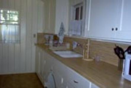
The one-bedroom, one-story cabin has electricity, hot and cold running water and a furnace for cool days and nights.
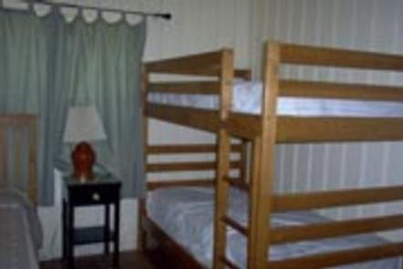
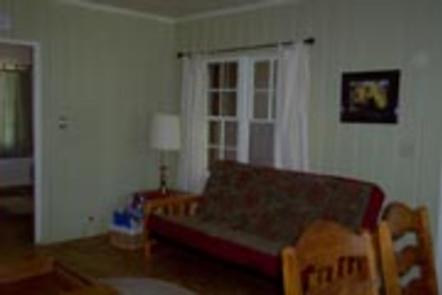
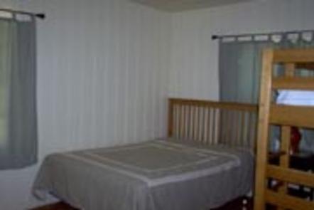
The bedroom contains a queen-size bed and a bunk bed. The living room has a futon that sleeps two, as well as a couch and a dining table with six chairs. The fully-equipped kitchen includes a stove, refrigerator, microwave, toaster, coffee maker, pots and pans, dishes and utensils and a small table. The cabin also has a bathroom with a flush toilet and a tub-shower.
A picnic table and campfire ring are available outside.
Guests should plan to bring linens, pillows, blankets, towels, toiletries, food and trash bags. Suggested additional items include toilet paper, paper towels, camp chairs, insect repellent and dish towels.
Natural Features
The cabin is located in the Giant Sequoia National Monument, just a few miles from several groves of Giant Sequoias. Other nearby points of interest include the Needles Lookout, Dome Rock and Trail of 100 Giants.
Because the cabin is located at a 7,000 foot elevation, visitors need to be prepared for a wide variety of weather, including warm afternoons, chilly nights and afternoon thunderstorms. It is also not unusual to have an early fall dusting of snow before the cabin closes for the season.