LONGSHOAL, MO Campground Reservation, Info, Images, Map, Directions

LONGSHOAL, Missouri Campground Images, Info & Reservations

Listen

Directions

From Warsaw, Missouri, take Highway 7 for about 8 miles northwest. Follow signs into the campground.

Phone

660-438-2342

Activities

BOATING, CAMPING, FISHING, HIKING

Keywords

LOSH,TRUMAN LAKE,HARRY S TRUMAN

Related Link(s)

Rec Area Info & Images

Missouri State Tourism

Missouri State Road Conditions

Overview

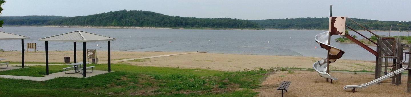
Longshoal Park sits on the shores of Harry S. Truman Lake in the hills of western Missouri.

Visitors enjoy fishing, hunting, swimming and boating.

Click here for the Harry S. Truman Lake virtual tour.

Recreation

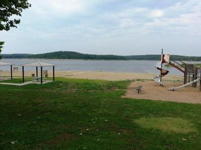
Longshoal is an excellent fishing location. Anglers find crappie, largemouth bass and blue and flathead catfish. Truman Lake is also a popular destination for tournament fishermen. Longshoal Marina is located within the park, offering convenient boat services for guests. A sandy beach makes the area perfect for families.

Facilities

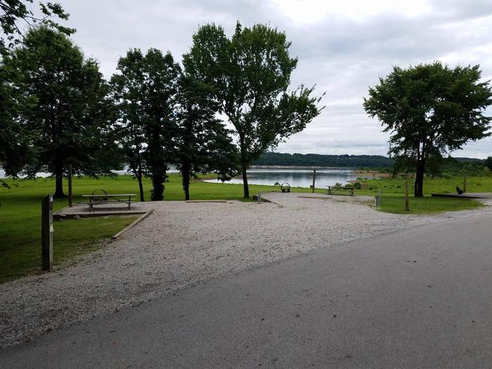
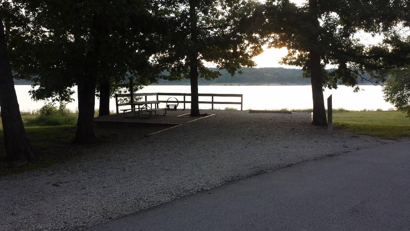
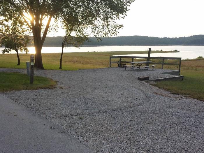
This campground offers 77 sites with electric hookups, along with 12 primitive sites without hookups. A day-use group shelter is available as well.

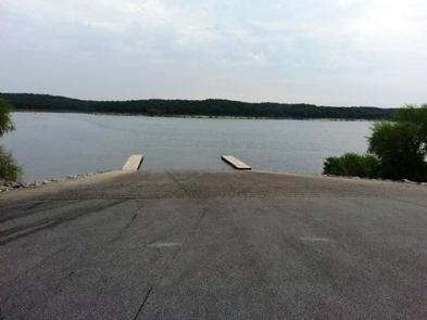
Amenities include flush and pit toilets, showers, drinking water, laundry facilities, a dump station, marina and boat ramp.

Natural Features

Truman Lake lies among rolling hills and rocky bluffs. Dense hardwood forests studded with mature pine trees cover the area.

Wildlife is abundant in and around the park. Whitetail deer, turkey, hummingbirds, hawks and ospreys are commonly seen. Bald eagles can be viewed during the winter months.

Nearby Attractions

The 950 miles of shoreline around Truman Lake provide plentiful opportunities for fun in the outdoors. Many parks surround the lake, including Harry S. Truman State Park.

The Harry S. Truman Visitor Center sits atop Kaysinger Bluff and provides a spectacular view of the dam and reservoir. Exhibits provide information about the rich history of the Osage River Valley from pre-civilization to modern day. Waterfowl, bald eagles and turkey vultures are commonly seen from the observation deck.

Longshoal Marina 

Reservation

More from CampingHiking.net:

DOUBLE LAKE RECREATION AREA, Texas Campground Images, Info & Reservations

Listen Directions From New Waverly, Texas, go 22 miles east on Highway 150 to FM 2025. Turn and drive south 0.25 miles to the campground. Phone 936-653-3448 Activities BIKING, BOATING, CAMPING, INTERPRETIVE PROGRAMS, FISHING, HIKING, SWIMMING SITE, OTHER RECREATION CONCESSION SITE Keywords DOUL,NFs IN TEXAS -FS Related Link(s) Rec Area

JESS JUDY, West Virginia Campground Images, Info & Reservations

Listen Directions Follow 28/55 from Petersburg, WV, for 8 miles. Turn left onto Smoke Hole Road, Route 28/11, and travel for 13 miles to County Route 2. Turn left onto Smoke Hole Road, County Route 2, and follow for approximately 2 miles. Jess Judy Campground will be on the right.

HOODVIEW, Oregon Campground Images, Info & Reservations

Listen Directions From Sandy, Oregon, travel east on Highway 26 for approximately 40 miles to Skyline Road/Road 42. Turn right on Skyline Road and continue south for about 9 miles. Turn right on Forest Service Road 57 and travel west for 2 miles, then turn right again at the Hoodview

STONE CELLAR GUARD STATION, Colorado Campground Images, Info & Reservations

Listen Directions From Saguache, take Colorado Hwy 114, 34 miles northwest from Saguache, over North Pass. Take FR#804 south 4 miles to junction, east 1 mile to FR #787, then 21 miles south to the cabin. Phone 719-655-2547 Activities CAMPING, INTERPRETIVE PROGRAMS, FISHING, HIKING, HORSEBACK RIDING, HUNTING, WINTER SPORTS, WILDLIFE

LOWER FIR GROUP AREA, New Mexico Campground Images, Info & Reservations

Listen Directions From Alamogordo take US 82 east, go 17 miles, just past Cloudcroft. Turn left (northwest) onto NM 244. Go approximately 1 mile. Turn right onto Forest Road 422. Go approximately 1/4 mile. Campground is on the left. Phone 575-682-7570 Activities CAMPING Keywords FIRL,LINCOLN NF – FS Related Link(s)

BOULDER BASIN, California Campground Images, Info & Reservations

Listen Directions From Idyllwild, travel north for about 8 miles on State Route 243. Turn right onto Black Mountain Road/Forest Route 4S01 and continue about 5 miles to the campground. Black Mountain Road is an unpaved forest road, not recommended for low clearance vehicles or trailers. Phone 909-382-2922 Activities BIKING,