ALTURAS LAKE INLET, ID Campground Reservation, Info, Images, Map, Directions

ALTURAS LAKE INLET, Idaho Campground Images, Info & Reservations

Directions

From Highway 75, turn onto Forest Road 205/Alturas Lake Road. Travel approximately 3 miles to the campground.

Phone

928-537-8888

Activities

BIKING, BOATING, CAMPING, FISHING, HIKING, WATER SPORTS, SWIMMING SITE

Keywords

ALTL,ALTURAS INLET,SAWTOOTH NF – FS

Related Link(s)

Rec Area Info & Images

Idaho State Tourism

Idaho State Road Conditions

Forest Service Concessionaire

Overview

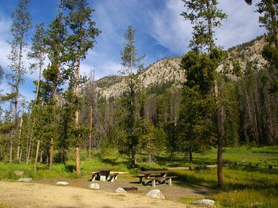
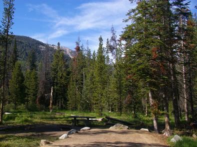
Alturas Lake Inlet Campground is located on the shores of scenic Alturas Lake at the foot of the Sawtooth Mountain Range.

Recreation

This site is part of the Sawtooth National Recreation Area, where outdoor activities abound. Alturas Lake offers excellent boating, water skiing, canoeing, kayaking and fishing for bull trout and Kokanee salmon.

The 10-mile round trip Alpine Meadows Trail begins nearby, with spectacular canyon, meadow and alpine lake views. The trail is also a popular area for bird watching.

Facilities

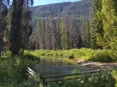
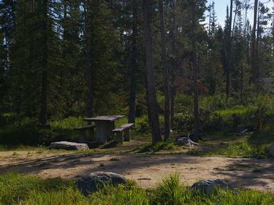
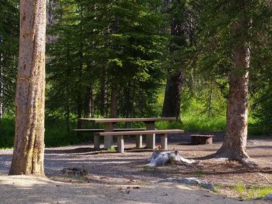
This campground contains several family campsites, some of which have lake or creek views. Vault toilets and drinking water are provided. Roads and parking spurs are gravel.

A day-use site is adjacent to the campground with a designated swim beach. Smokey Bear Boat Ramp is less than 1/4-mile away.

Natural Features

Alturas Creek runs through the campground, where summer wildflowers are plentiful and a mixed-growth conifer forest provides partial shade. Temperatures are cool, with an average summer high of 78 degrees and a low of 40 degrees.

Nearby Attractions

The Sawtooth National Recreation Area offers a myriad of excellent hiking and biking opportunities, and an estimated 750 miles of trails crisscross the valley and surrounding mountains.

Perkins Lake is less than 2 miles away, with excellent fishing and canoeing. Pettit and Yellowbelly Lakes are nearby, with more fishing, canoeing and hiking. The Salmon River offers fishing for rainbow trout, Westslope cutthroat trout and occasional hybrid cutbows and bull trout.

Popular area events include an Arts and Crafts Fair in July, and Wagon Days, Salmon Festival, Quilt Fair and Fireman’s Ball in September.

Reservation

More from CampingHiking.net:

INDIAN TREES CAMPGROUND, Montana Campground Images, Info & Reservations

Directions From Sula, travel 6 miles south on Highway 93, then 1 mile southwest on Forest Road 729. Road to campground is gravel, but the campground and parking spurs are paved. Phone 406-821-3913 Activities BIKING, HISTORIC & CULTURAL SITE, CAMPING, FISHING, HIKING, HUNTING, SWIMMING SITE Keywords INDT,BITTERROOT NF -FS Related

MORGANTON POINT, Georgia Campground Images, Info & Reservations

Directions Take U.S. Highway 515 north from Blue Ridge for 4 miles to Georgia Highway 60. Turn right (southwest) and continue 3 miles to the town of Morganton. In Morganton, turn right on County Road 616 (Lake Drive) and proceed for 1 mile. To enter the campground, take the first

BEAR LAKE CAMPGROUND (CO), Colorado Campground Images, Info & Reservations

Directions From Colorado Highway 12 south of the Town of Cuchara, take FSR 422 5 miles west to the campground. Phone FOR RESERVATIONS CALL (877) 444-6777 FOR OTHER, NON REAL TIME INFORMATION, CALL 719-269-8500 Activities BIKING, CAMPING, FISHING Keywords Related Link(s) Rec Area Info & Images Colorado State Tourism Colorado

HIDEOUT CANYON BOAT-IN CAMPGROUND, Utah Campground Images, Info & Reservations

Directions From Manila, Utah: Take State Route 44 southeast for 7 miles. Turn northeast onto Forest Road 092, and continue to Sheep Creek Bay Boat Ramp. Once on the water, travel 2 miles southeast to reach the campground. Phone 801-226-3564 Activities BIKING, BOATING, CAMPING, FISHING, HIKING, SWIMMING SITE Keywords HIDE,HIDE

New Fork Lake Group Campground, Wyoming Campground Images, Info & Reservations

Directions From Pinedale, take U.S. Highway 191 northwest 6 miles. Turn north onto State Highway 352 and travel just over 14 miles. Turn east onto New Fork Lake Road, which is gravel, and travel almost 4 miles to the campground. Phone 307-367-4326 Activities BIKING, BOATING, CAMPING, FISHING, HIKING, WILDLIFE VIEWING,

BICENTENNIAL CAMPGROUND, California Campground Images, Info & Reservations

Directions Upon entering the Marin Headlands follow the signs to the Visitor Center. The campground is less than 1/2 mile drive from the Visitor Center. Phone 415-331-1540 Activities BIKING, HISTORIC & CULTURAL SITE, CAMPING, INTERPRETIVE PROGRAMS, VISITOR CENTER, MOUNTAIN BIKING, BERRY PICKING Keywords Related Link(s) Rec Area Info & Images