

Directions
Starrigavan Recreation Area is located 7 miles northeast of Sitka at the end of Halibut Point Road and 3/4 mile from the local Alaska Marine Highway Ferry Terminal. There are no roads to Sitka. Access is via the Alaska Marine Highway or Alaska Airlines.
Upon exiting the Ferry Terminal parking lot, turn left. Estuary and Backpackers Loop are the last right hand turn before the end of the highway. Bayside Loop is the last left hand turn before the end of the highway.
From the airport, go across Japonski Bridge to downtown Sitka. Take Halibut Point Road north 7 miles to Starrigavan Recreation Area.
Phone
907-747-6671
Activities
BIKING, BOATING, HISTORIC & CULTURAL SITE, CAMPING, INTERPRETIVE PROGRAMS, FISHING
Keywords
STAG,TONGASS NF – FS
Related Link(s)
Overview
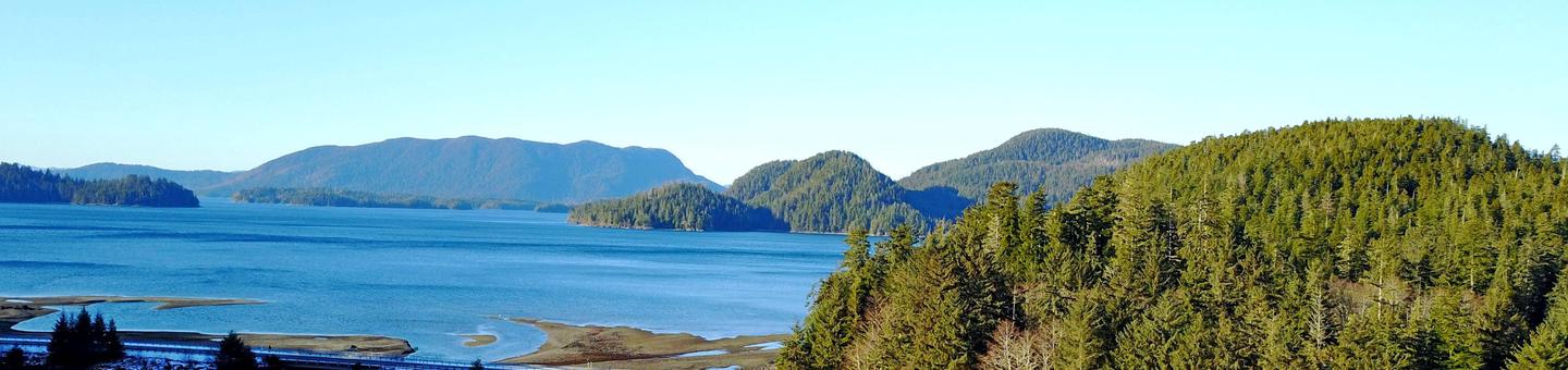
Starrigavan Campsites lie within Starrigavan Recreation Area about seven miles north of Sitka. Visitors enjoy hiking, photography, wildlife viewing, picnicking, fishing and kayaking. Learn more about the campsites here.
Access to Sitka is by boat or airplane. The campsites are a two-minute drive from the Alaska Marine Highway Sitka Ferry Terminal or a seven-mile drive from downtown Sitka or the airport.
Recreation
Hiking, picnicking and wildlife viewing are popular pursuits at Starrigavan. Visitors also enjoy fishing in saltwater and freshwater areas. Many bird and wildlife viewing opportunities exist. Hiking options include the Estuary Life Boardwalk Trail, Forest and Muskeg Trail, the Mosquito Cove Trail and numerous intertwining path and roadways of the recreation area.
For information about fishing permits and seasons, visit the Alaska Department of Fish and Game .
Facilities
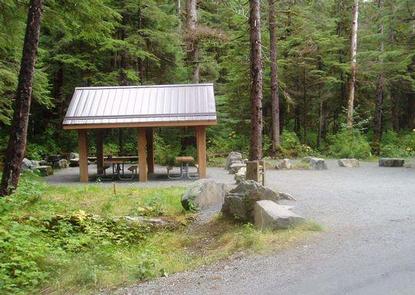
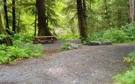
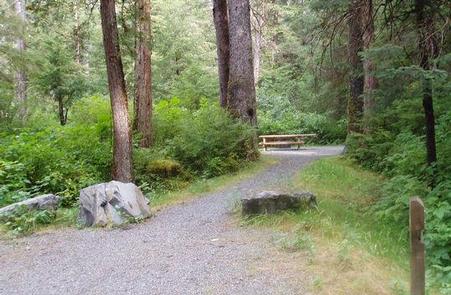
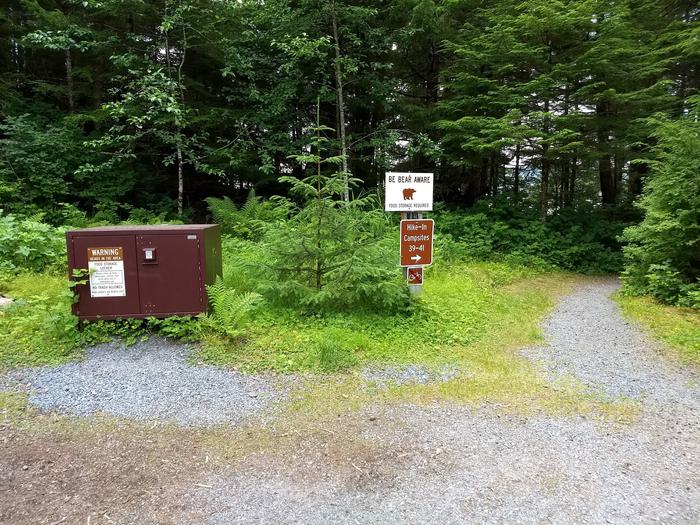
This primitive camping area is fully accessible and offers a variety of accommodations, including group tent sites, individual campsites (both drive in, one is pull through, and hike-in) and Starrigavan Creek Cabin. Several sites overlook Starrigavan Bay; others are close to Starrigavan Creek. Maximum RV length accommodated is 38 feet.
Two small group tent sites accommodate up to 20 people, offering twice the amount of tent space and vehicle parking as individual campsites. They also have covered cooking shelters with two picnic tables, a large grill and a fire ring with two log benches.
Picnic tables, campfire rings, gravel tent pads and gravel parking spurs are furnished at the individual sites. Vault toilets, drinking water, bear-proof food lockers and seasonal trash collection are provided. Firewood is provided for a small fee. A dump station is located in Sitka, seven miles away.
Natural Features
The campsites are situated within a typical temperate rainforest of hemlock and spruce trees with salmonberry bushes, low shrubs and mosses covering the forest floor.
The Starrigavan Recreation Area is home to a diverse range of forest, estuary and marine habitats. Depending on the season, visitors might spot brown bear, spawning coho (silver) and pink (humpy) salmon, common merganser, bufflehead, bald eagle, great blue heron, kingfisher, river otter or Sitka black-tailed deer.
Nearby Attractions
The State of Alaska’s Old Sitka State Historic Site is nearby. Visitors can take half or full-day kayak trips to Katlian Bay and Siginaka Islands.