BLACK ROCK, ID Campground Reservation, Info, Images, Map, Directions

BLACK ROCK, Idaho Campground Images, Info & Reservations

Directions

From Idaho City, travel north on State Highway 21 for about two miles, to the Granite Creek/Rabbit Creek Road No. 327. Turn right and travel east for 18 miles on Road No. 327, to the campground.

Phone

208-392-6681

Activities

BIKING, CAMPING, FISHING, HIKING, WILDLIFE VIEWING, SWIMMING SITE

Keywords

BLRK,BLACK ROCK CAMPGROUND,BOISE NF – FS

Related Link(s)

Rec Area Info & Images

Idaho State Road Conditions

Idaho State Tourism

Overview

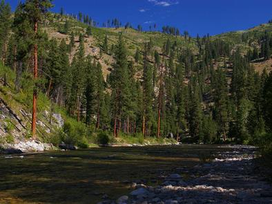
Black Rock Campground is located 20 miles from Idaho City, on the North Fork Boise River, at an elevation of 4,300 feet. Visitors enjoy fishing, swimming and exploring local trails.

Recreation

The North Fork Boise River offers rainbow trout fishing in a beautiful natural setting. Many swimming holes can be found within a short distance of the campground.

Numerous trail opportunities for hiking, mountain biking, horseback riding and dirt biking can be found in the vicinity.

Facilities

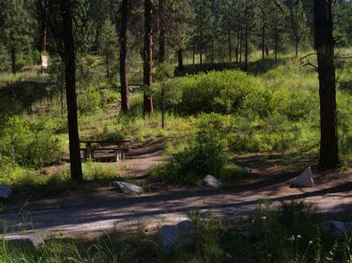
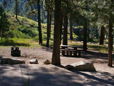
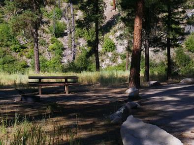
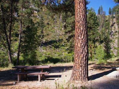
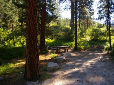
The campground contains several single-family campsites, each equipped with a picnic table and campfire ring. Some sites also have grills. Vault toilets, drinking water and trash collection are provided within the campground. Roads and parking spurs are dirt.

Natural Features

The campground sits on the banks of the North Fork Boise River, where ponderosa pines tower over the area. Most campsites have partial shade, but little privacy from other campers. A variety of wildlife makes its home around the campground.

Reservation

More from CampingHiking.net:

HOSPITAL FLAT, California Campground Images, Info & Reservations

Directions From Kernville, go 6.5 miles north on Sierra Way (Mountain 99) to the campground. Phone 760-376-1815 Activities BOATING, CAMPING, FISHING, SWIMMING SITE Keywords HOSP,KERN RIVER,UPPER KERN CANYON,SEQUOIA NF – FS Related Link(s) Rec Area Info & Images California State Tourism Forest Service Concessionaire California State Road Conditions Overview Hospital

ROSE CANYON, Arizona Campground Images, Info & Reservations

Directions From Tucson, Arizona, take Catalina Highway/Arizona Route 39 northeast. The campground is located between mile markers 17 and 18 on the Catalina Highway. Phone 520-576-1477 Activities CAMPING, FISHING, DAY USE AREA Keywords ROSE,ROSE CANYON REC AREA,ROSE CANYON LAKE,ROSE PARK,ROSE CANYON PARK,CORONADO NF – FS Related Link(s) Rec Area Info

BIG SPRINGS WARMING HUT, Idaho Campground Images, Info & Reservations

Directions From West Yellowstone, Montana, travel 22 miles south on Highway 20 to Mack’s Inn. Turn east on Big Springs Loop Road and travel 2 miles to the warming hut access road. Turn south into the warming hut parking area. Phone 208-558-7658 OR 208-270-0094 Activities CAMPING Keywords BISP,CARIBOU-TARGHEE NF –

LOGANVILLE, California Campground Images, Info & Reservations

Directions From Downieville, take Highway 49 north about 17 miles. The campground is on the right side of the highway across from the Logaville RV Dump Station. Phone (530)478-6253 Activities BIKING, CAMPING, FISHING, HIKING, HUNTING, MOUNTAIN BIKING, WATER ACTIVITIES, SCENIC DRIVE Keywords LOVI,TAHOE NF – FS Related Link(s) Rec Area

DALE HOLLOW LAKE – PRIMITIVE CAMPING, Tennessee Campground Images, Info & Reservations

Directions Camping locations are dispersed throughout Dale Hollow Lake. Reference primitive camping map or site details for information on how to get to the specific site. Mailing and contact information is for the Resource Manager’s Office. Phone DALE HOLLOW LAKE RESOURCE MANAGERS OFFICE-931-243-3136. SHERIFF’S DEPARTMENT EMERGENCY CONTACTS: CLAY COUNTY 931-243-3266