EAST ELK CREEK GROUP CAMPSITE, CO Campground Reservation, Info, Images, Map, Directions

EAST ELK CREEK GROUP CAMPSITE, Colorado Campground Images, Info & Reservations

Listen

Directions

East Elk Creek Group campground is located off of US Hwy 50 between Gunnison and Montrose, on the north side of the highway approximately 1/2 miles west of Elk Creek.

Phone

970-641-2337

Activities

BOATING, CAMPING, FISHING, HIKING, HUNTING, WILDLIFE VIEWING

Keywords

EEGS,CURECANTI NATIONAL RECREATION,CURECANTI,ELK LAKE,ELK

Related Link(s)

Rec Area Info & Images

Colorado State Tourism

Colorado State Road Conditions

Overview

Invite family and friends to East Elk for an active group camping experience surrounded by rugged and stark mountains. The campground is perched on the tranquil East Elk Creek, which allows for water activities without the commotion of the reservoir. Enjoy time picnicking, kayaking, fishing or exploring wildlife.

Recreation

The campground is set just off of the windsurfing area in the Cebolla Basin. It’s an ideal location for avid windsurfers. It’s also great for canoeing and hiking.

Try the Dillon Pinnacles Trail for the nearest hiking trail.
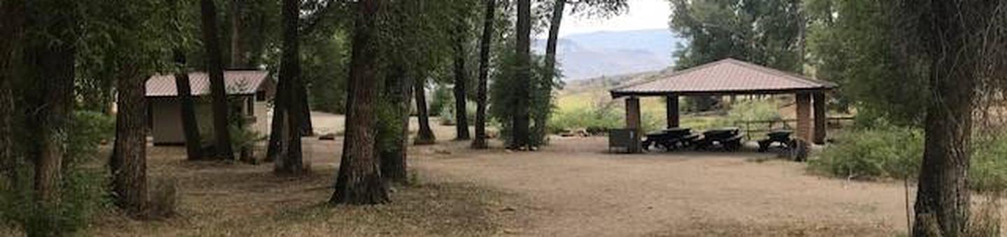
Facilities

This is a group campsite accommodating a minimum of 9 people up to a maiximum 50 people. Showers and a marina are less than a mile away at Elk Creek.
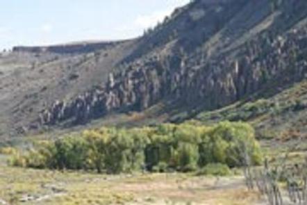
Natural Features

East Elk Creek sits at an altitude of 7,800 feet, just off the Blue Mesa Reservoir in Curecanti National Recreation Area.

The reservoir is surrounded by scenic mountains and is home to the largest population of Kokanee land locked salmon in the state of Colorado.

The other two reservoirs in the recreation area, Crystal Reservoir and Morrow Point Reservoir, are surrounded by high rising cliffs.

Nearby Attractions

Spend an hour and a half on a pontoon that floats down the Morrow Point Reservoir. The tour is ranger-guided and highlights the history of the Black Canyon. Find more tour information here.

Reservation

More from CampingHiking.net:

HEBER SPRINGS, Arkansas Campground Images, Info & Reservations

Listen Directions From Heber Springs, AR, travel 2 miles west on SR-110, then .5 miles north on the paved access road. Follow signs to campground. Phone 501-250-0485 Activities BOATING, CAMPING, SWIMMING SITE Keywords HEBE,GREERS FERRY LAKE,GREERS FERRY LAKE Related Link(s) Rec Area Info & Images Arkansas State Tourism Arkansas State

DAM SITE RIVER (BEAVER LAKE), Arkansas Campground Images, Info & Reservations

Listen Directions From Eureka Springs, Arkansas, take Highway 62 West and travel just over 4 miles. Turn left on Highway 187 and continue for about 6 miles. Take the first right after crossing the dam and follow signs to the campground. Phone 479-253-9865 Activities BOATING, CAMPING, FISHING, HIKING, WATER SPORTS,

CUB RIVER GUARD STATION, Idaho Campground Images, Info & Reservations

Listen Directions From Preston, Idaho, head approximately 3 miles south on U.S. Highway 91. Turn east on Cub River Road/Forest Road 406. Proceed about 10 miles to the guard station. This road is heavily traveled throughout the summer with other recreationists, so please travel slowly and use caution. Phone 208-847-0375

FOX CREEK GROUP CAMP, Oregon Campground Images, Info & Reservations

Listen Directions From Detroit, Oregon, drive east on State Highway 22. After crossing the bridge, take a left onto Forest Service Road (FSR) 46/Breitenbush. Follow FSR 46 for about 6.5 miles to Fox Creek Group Camp. Phone 503-854-3366 Activities CAMPING, FISHING, SWIMMING SITE Keywords Fox Creek,Fox Creek Group,Fox Creek Camp,FCGC,Fox