
Directions
From Roseburg, OR take OR-138 E/NE Diamond Lake Blvd. Travel east on Highway 138 for 39 miles to Forest Service Road (FSR) 4712/Mott Bridge. Turn right FSR 4712, cross the river, then turn left on FSR 4712-009 to the site. The reservation area is at the end of the road.
Phone
(541)496-3532
Activities
WILDLIFE VIEWING, BIRDING
Keywords
SBAL,STEAMBOAT BALLFIELD,STEAMBOAT BALL FIELD GROUP S,UMPQUA NF – FS
Related Link(s)
Overview
Steamboat Ball Field Group Site sits near the banks of the North Umpqua River under a canopy of forest. With access to a multitude of recreational opportunities, including a ball field, river access and a handful of trailheads within the area, this campsite offers an ideal setting for group camping and recreation excursions.
Recreation
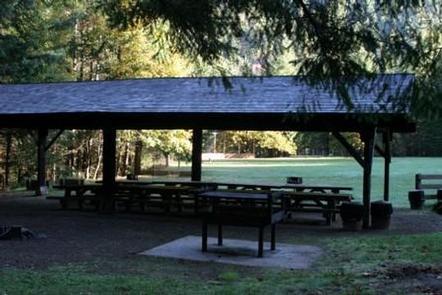
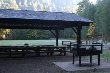
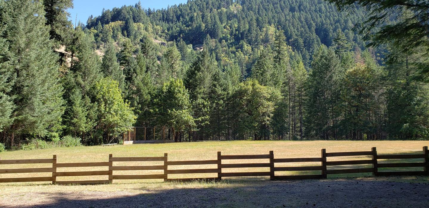
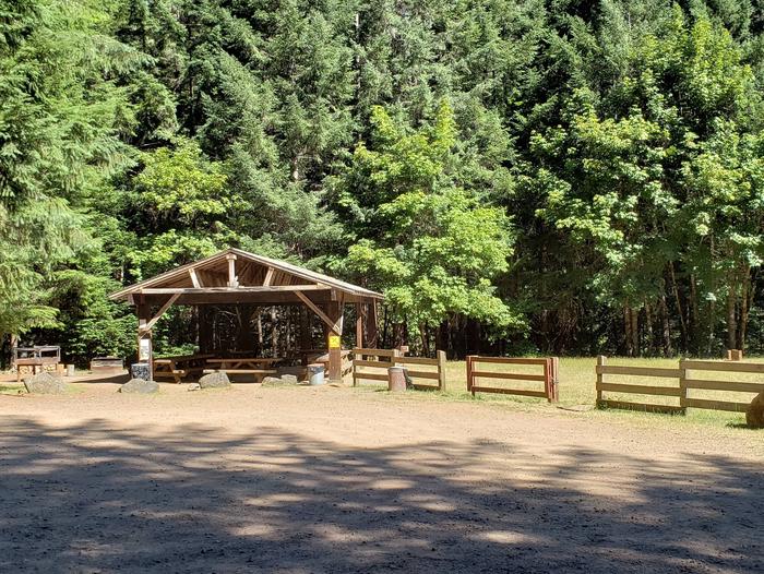
Fishing, hiking and swimming top the list of activities at this site. With wide open spaces, along with a ball field and horseshoe pits, this campground offers visitors plenty of recreational opportunities. A forested bank and mountainous backdrop to the North Umpqua River is a perfect setting for both swimmers braving its cold, refreshing waters, and for anglers fishing for rainbow, steelhead and cutthroat trout. A picnic shelter and large grill provide the perfect setting for gathering after a day of activity or relaxation.
Facilities
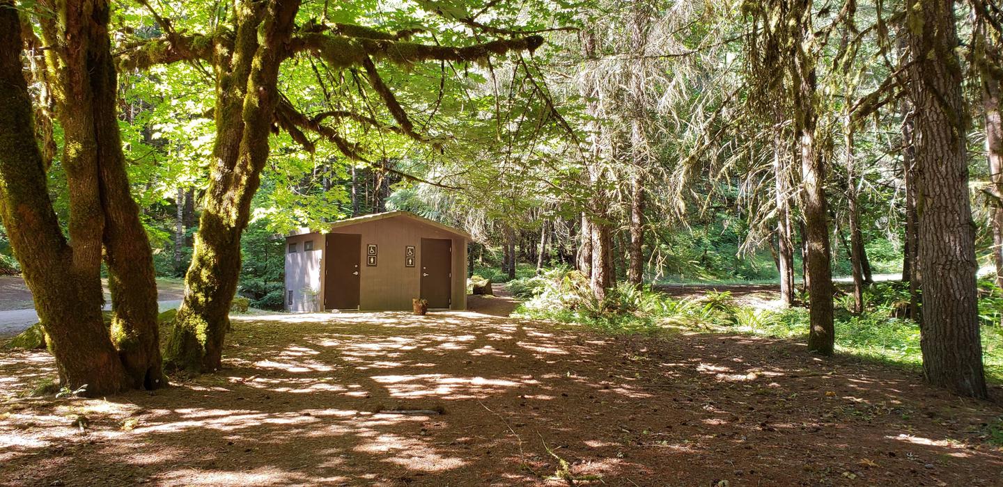
This campground has one large reservation only group site able to accommodate up to 100 people and a maximum of 20 vehicles. The site is equipped with picnic tables, campfire rings, grills and accessible vault toilets. A baseball field, horseshoe pits and picnic shelter are available for use.
Natural Features
Visitors to Umpqua National Forest are often taken aback by the unique landscapes of southwestern Oregon. Explosive geologic events have shaped the distinctive landscape on the nearly 1 million-acre forest, and provide spectacular scenery as well as an abundance of natural and cultural resources. Flowing adjacent to this campground is the North Umpqua River, a tributary of the Umpqua River, and a designated National Wild and Scenic River. Possessing remarkable values related to fisheries, culture, recreation and scenery, the North Umpqua River is renowned for its emerald green waters and fly fishing. Several designated wilderness areas provide undisturbed solitude for visitors. Encompassing 19,100 acres, Boulder Creek Wilderness offers dense old-growth forests and steep terrain that tower above Boulder Creek, which runs through the heart of the wilderness. Diverse ecosystems support a wide range of habitat for wildlife common to the area. From eagles and owls, to salamanders and salmon, these species, along with many others, depend on surrounding undeveloped wilderness, clean streams, and diverse forests to live.
Nearby Attractions
Hikers will enjoy the 79-mile North Umpqua Trail which begins in the Mount Thielsen Wilderness at Maidu Lake and follows the river to the confluence with Rock Creek. Sections of this trail are also open to mountain bikes and stock. There are opportunities for fishing within 1 mile of the campground, and within 10 miles a non-motorized boat ramp, and places for swimming and berry picking.