
Directions
To reach the cabin from Porterville, take Highway 190 East to Springville. Turn left onto the Balch Park Road at the east end of Springville. You can either stay on this road all the way to the Cabin, or you can also take the Bear Creek Road, approximately 4 miles from the Highway 190 turn off. When the Bear Creek Road intersects with the Balch Park Road, turn left. Driving time from Springville on either route will take approximately an hour.
Phone
559-539-5230
Activities
BIKING, CAMPING, FISHING, HIKING, HUNTING
Keywords
MTHM,SEQUOIA NF – FS
Related Link(s)
California State Road Conditions
Overview
The Mountain Home Guard Station not available for reservations.
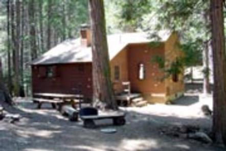
The Mountain Home Guard Station sits in a cluster of firs, pines and Giant Sequoia in the Sequoia National Monument in the Sequoia National Forest at an elevation of 6,000 feet. The cabin is a two-hour drive from Bakersfield, California.
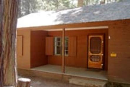
The Guard Station was built in the early 1930’s by the Civilian Conservation Corps (CCCs) as a residence for Forest Service fire patrolmen stationed in the area.The exterior is constructed of redwood board over diagonal sheeting nailed to a standard wooden frame. The cabin still has many original features, including kitchen cabinets and wood floors.
The cabin offers many amenities, including water and propane-powered appliances, but it does not have electricity; guests must bring their own flashlights and lamps.
The nearest store is one hour away, in Springsville, so guests must plan accordingly for their stay.
Recreation
There are numerous recreational options, including horseback riding from the nearby Balch Park Pack Station, hunting, mountain biking and hiking.
For fishing enthusiasts, there are several nearby ponds and and the Tule River.
Facilities
The one-story, one-bedroom cabin measures 900 square feet. It does not have electricity but has propane-powered heat, water heater and appliances. The cabin sleeps six, but there is room outside the cabin for tents, bringing the maximum occupancy to 10. The bedroom has a queen bed, a twin bed and a roll-away bed. There are two twin beds in the living room that also serve as couches.
The kitchen is equipped with a propane stove and refrigerator, pots and pans, dishes and utensils and a small table. The living room has a picnic-style table and benches for dining, while the bathroom includes a flush toilet, sink and a tub-shower.
A picnic table and a campfire ring sit outside. There are also two corrals that may be used to keep horses and mules overnight. These are for guests who bring their own stock for riding on nearby roads and trails.
Natural Features
The cabin is situated in the Sequoia National Monument, home to the world’s largest tree, the Giant Sequoia.
The cabin is on the edges of the Golden Trout Wilderness and close to the Tule River.