


Directions
From Soda Springs, take Highway 34 north approximately 12 miles to the China Hat turnoff (Blackfoot River Narrows). This road will follow Blackfoot River for another 11 miles to a junction; there is a Forest Service sign at this point. Take the right fork (Caribou National Forest Road 102) southeast for another 10 miles to the guard station. The road will turn into Diamond Creek Road. Maps are available upon request at the district office.
Phone
208-847-0375
Activities
BIKING, CAMPING, FISHING, HIKING, HUNTING, WINTER SPORTS
Keywords
JOHG,CARIBOU-TARGHEE NF – FS
Related Link(s)
Overview
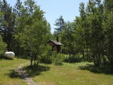
Johnson Guard Station is located 30 miles east of Soda Springs, Idaho, on a site that was established in 1910. The current building was constructed in 1934, and is named after James J. Johnson, who served as ranger of the Georgetown Ranger District from 1907-1913. It’s been used for various purposes over the years, from serving as summer headquarters to housing work crews.
The cabin is accessible by car in warmer months and by snowmobile in winter. The cabin provides a few conveniences, so guests should be prepared to bring the supplies and equipment they need to make their stay more comfortable.
Recreation
The Bear Canyon OHV Trail is about 1 mile north of the guard station (Idaho OHV safety message). Hikers and mountain bikers will also find trails nearby. The area surrounding the cabin is a playground for snowmobilers and skiers in the winter months.
Anglers can fish in nearby Diamond Creek. The surrounding area also attracts game and game bird hunters.
Facilities
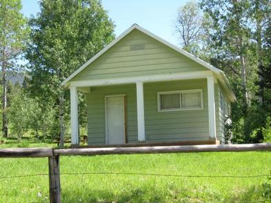
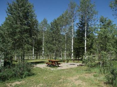
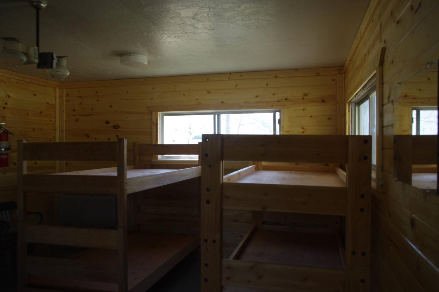
The guard station has a maximum capacity of 15 people. One sleeping room is available with four single beds.. Guests need to provide bedding and sleeping pads. The kitchen has a gas stove for cooking and a dining table with chairs. A gas furnace heats the cabin. Propane is provided for the lights, cook stove and heater. A vault toilet and picnic table are located outside.
No water or electricity is available at the cabin. Guests will need to supply their own water for drinking, washing and cooking. Bedding/sleeping pads, cookware, kitchen utensils and emergency supplies are not provided.
Guests are required to bring garbage bags to pack out their trash. The cabin should be cleaned before leaving, so guests should bring some cleaning supplies.
Natural Features
The cabin sits in a meadow at an elevation of 6,500 feet surrounded by the peaks of Dry Ridge and the Webster subrange in southeastern Idaho. Stands of aspen and lodgepole pine dot the landscape.
Wildlife in the Caribou-Targhee National Forest includes black bears, wolves, elk, moose, mule deer, bison, grizzly bears, mountain lions and pronghorn (bear safety tips).