

Directions
- From Noxon: Travel the Pilgrim Creek Road 149 for approximately 13 miles to Road 2205. Follow Road 2205 for approximately 2 miles to the lookout.
- From Trout Creek: Travel road 2229 for 11.5 miles. Turn left after the Marten Creek Bridge and follow road 151 for approximately 11 miles to the junction with road 2213. Continue for 5.5 miles to the junction with road 2205. Turn right and follow road 2205 for 2 miles to the lookout.
Phone
406-827-3533
Activities
CAMPING, HIKING, HUNTING, FIRE LOOKOUTS/CABINS OVERNIGHT
Keywords
GPLR,KOOTENAI NF – FS
Related Link(s)
Overview
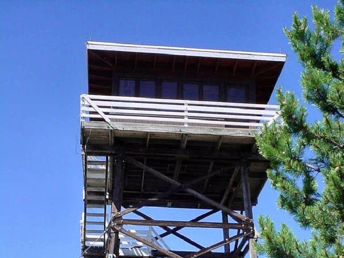
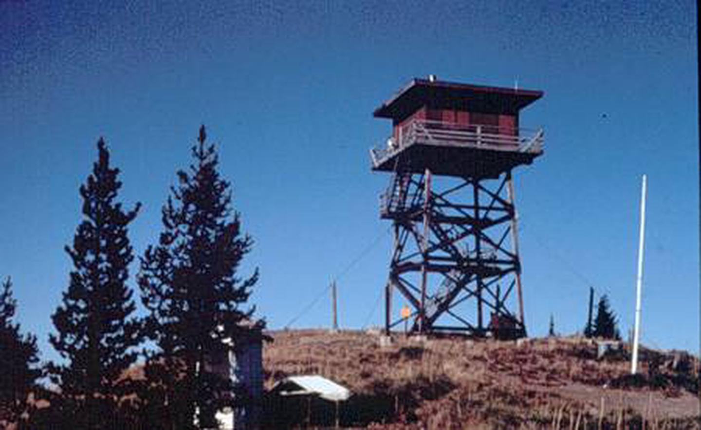
The gem peak lookout is located in the Cabinet Ranger District, situated above the Clark Fork River Area at the southern end of the Cabinet Mountain Wilderness. The original Gem Peak Lookout was activated in 1921 as a "rag outfit"–a pole platform tent near a 15 foot open-platform tower.
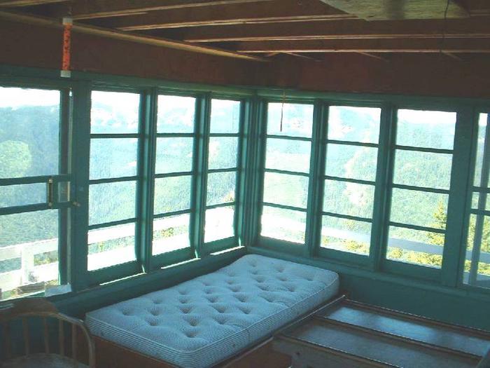
Today, the renovated structure includes a 225 square foot cabin atop a 30-foot tower with amenities such as a wood heating stove, single beds and of course, the incredible view of the Clark Fork River and the Noxon area.
Full vehicle access depends on weather conditions, but typically visitors can drive straight to the lookout.
Recreation
The Cabinet Ranger District features almost half a million acres of National Forest lands offering a full range of year-round recreational opportunities. Approximately 400 miles of trail are available to the hiker, hunter, and stock user to access various lakes and scenic viewpoints. 150 miles of these trails are open to motorized use. The District maintains almost 400 miles of open road, and many miles of gated roads offer additional opportunities to mountain bikers, berry pickers, and hunters.
There is a trailhead located near the lookout with access for both hiking and OHV riding. For more information on designated OHV-riding areas, Click here. Visitors may also enjoy seasonal Huckleberry picking in the land surrounding the lookout.
Facilities
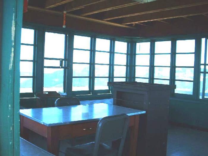
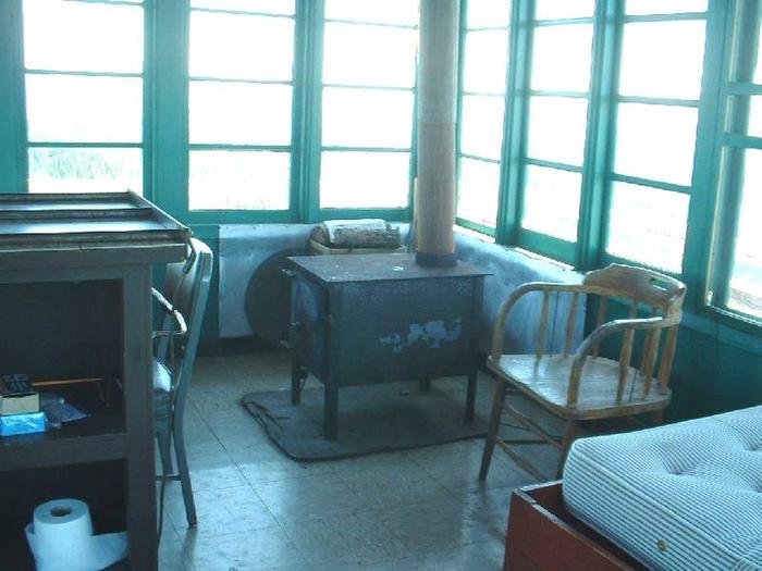
The lookout can accommodate up to 4 people with two single beds plus mattresses, a table and chairs, a bench and a wood heating stove. The lookout is not wired for electricity, but it does come with firewood stored at the base of the tower. Guests will need to bring their own light source and cooking equipment.
There is a vault toilet located outside. Potable water is not available at the tower; Visitors will need to bring enough drinking water for the extent of their stay.
Cleaning equipment is provided and guests are expected to leave the tower in good condition upon departure. This is a "pack it in, pack it out" facility; trash collection is not provided.
In addition to the above amenities, guests will need to bring a few of their own supplies to ensure a comfortable stay. Linens, pillows, cooking utensils, toilet paper, trash bags and food are not provided.
Natural Features
The Clark Fork River Area is bordered by the Idaho line on the west and the Cabinet Mountains Wilderness on the east. The Clark Fork River flows north and west through the District, and the Bull and Vermilion Rivers join it from the north. Rugged peaks ranging in elevation from 6,000-8,700 feet overlook the valley bottom.
The Kootenai National Forest is dominated by a mixed conifer forest, but there is also an impressive ancient cedar grove set aside as a scenic area. In the spring and throughout the summer, a succession of wildflowers add color to hillsides and meadows and in the fall, stands of western larch and aspen mix yellows with the reds of huckleberry bushes, mountain maples and mountain ash.