

Directions
From Albuquerque drive east on I-40 to Exit 175, proceed north toward Cedar Crest, on State Highway 14 approximately 6 miles to Scenic Byway 536. Go just over a mile west on Scenic Byway 536 to the picnic site and look for signage on your left. Group sites are in the two covered areas adjacent to the road.
Phone
505-281-3304
Activities
CLIMBING, HIKING, WILDLIFE VIEWING, BIRDING
Keywords
DOCL,CIBOLA NF – FS
Related Link(s)
New Mexico State Road Conditions
Overview
Doc Long Picnic Sites is named for Dr. William Henry Long. He was one of three forest pathologists in the USA who conducted pioneering research of tree diseases.
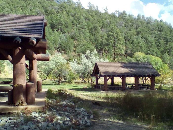
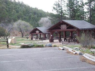
Doc Long, worked in New Mexico from 1910 through the 1930s. Doc lived in a cabin on the site where the “furthest set”, rustic log pavilion is now. The original pavilion and picnic ground were constructed in 1935 by the Civilian Conservation Corps, also known as the CCC. Their base camp was located a short distance down State Road 536 and is now owned by the Boy Scouts of America. Pavilions A and B were added later and are adjacent to the road next to the small playing field.
The Civilian Conservation Corps has a rich history and lasting presence throughout the Sandia Mountains. In their honor, we ask that you take extra care to “leave no trace” when you visit. Please note that there is no overnight camping at Doc Long.
Recreation
There is access to hiking, mountain biking and horseback riding trails from Doc Long. Bill Spring Trail, Oso Corridor Trail, Faulty Trail and a short pathway leading to Sulphur and Cienega picnic sites are connected to Doc Long for easy access.
The site’s playing field can accommodate outdoor activities that will make your picnic a memorable one for everyone. Help your kids explore the ecosystem, and its related plants and animals through our Junior Ranger program. For more information about the Junior Ranger program, call the Sandia Ranger Station at (505) 281-3304.
The surrounding forest and the majestic mountains provide a beautiful location for sightseeing, hiking, and outdoor recreation. Bring your camera.
Facilities
Water and electricity, firewood/charcoal are not available at the site. Accessible vault toilets and bear proof trash receptacles are provided. For details, please read the “Know Before You Go” below.
Doc Long offers two large, accessible group picnic shelters, which are replicas of the 1930s Civilian Conservation Corps design. Each can accommodate up to 30 people and are equipped with multiple picnic tables and grills. The site features a playfield area adjacent to the group shelters, interpretive displays, and a visitor information “hut” staffed by friendly volunteers. The “hut” is typically open on weekends, May 15 through October 14, to welcome visitors and provide information and assistance.
PARKING: Each reservation comes with ten (10) day use parking passes which should be picked up before hand at the Sandia Ranger Station, Monday through Friday between 8:00 a.m. and 4:30 p.m., (505) 281-3304.
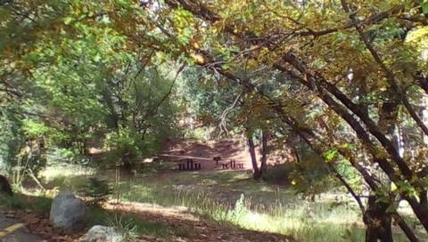
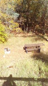
*Additional dispersed picnic areas, which do not require a reservation, are available on a first-come, first-served basis. Each area can accommodate a small family group and have no covering. Tables and grills are provided.
Help to prevent bug kill. Obtain firewood near your destination and burn it on-site: Don’t Move Fire Wood.
Learn more about the recreation opportunities in theCibola National Forest & Grasslands , including the Sandia Mountain Trails and the history of the Civilian Conservation Corp .
Natural Features
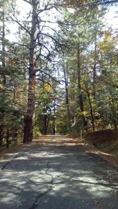
The picnic area is at an altitude of 7,360 feet. It is nestled in a dense forest of towering ponderosa pines and is surrounded by mountainous terrain.
The Sandia’s are home to mule deer, black bear and many other species of wildlife and birds, including the red-tailed hawk, predator of the playful Abert’s squirrel, who is a year-round resident of the Doc Long site.
Nearby Attractions
There are privately owned businesses and restaurants all along NM State Road 14 and a museum on your way up the 536 Scenic Byway which extends 13.6 miles from the base of the Sandia’s to the Sandia Crest.
At the Sandia Crest there is parking, a gift store, snack bar and a lookout deck. There you can see panoramic views from any direction you look. Sunsets are spectacular. It was voted Best Place to “Pop the Question” in 2010. It is a popular path for motorcyclists and auto touring, with its winding road to the peak.
The Peak area provides two launch pads for hang gliding, which is a popular sport during summer months.