White Earth Campground, MT Campground Reservation, Info, Images, Map, Directions

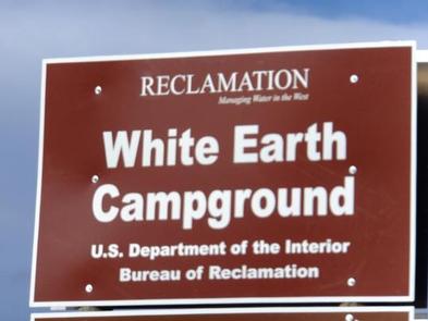
White Earth Campground, Montana Campground Images, Info & Reservations

Directions

Heading north along MT highway 12/287 from Townsend. Drive north to the town of Winston, MT, and turn right onto Beaver Creek Road and follow the road 5.5 miles to the campground.

Phone

406-475-3921

Activities

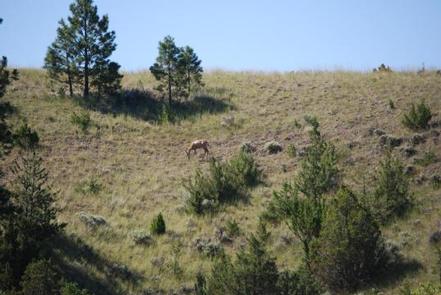
BOATING, CAMPING, FISHING, WATER SPORTS, WILDLIFE VIEWING, MOTOR BOAT, KAYAKING

Keywords

White Earth Shelter,WHITE EARTH GROUP USE SHELTER,Canyon Ferry Reservoir

Related Link(s)

Rec Area Info & Images

Montana State Road Conditions

Montana State Tourism

Overview

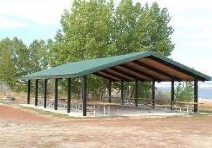
White Earth Group Use Shelter is located at White Earth Campground, just east of the town of Winston, Montana, on Canyon Ferry Reservoir. In 1805, the Lewis and Clark expedition passed through this region. On July 22, 1805, Sacagawea recognizes the country and assures the men that the three forks of the Missouri were of no great distance. This news gave the expedition hope in the anticipation of soon reaching the headwaters of the Missouri River.

Recreation

Canyon Ferry Reservoir offers a wide range of year-round recreational opportunities. Water related activities include everything from swimming and fishing to sailing and motor-boating. Canoeists and kayakers explore the many quiet backwater bays. Jet skiers, windsurfers and water skiers skim the summer waves, while winter draws ice fishermen and ice skaters.

Facilities

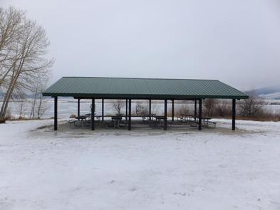
White Earth Group Use Shelter is 30′ X 44′ shelter with electrical power. The shelter has 8 picnic tables, 5 campsites and an accessible vault toilet. White Earth Campground has 36 designated campsites, a boat ramp, and a parking area for boat trailers. During the peak summer months services include vault toilets, potable water, trash, recycling containers and campground hosts.

Natural Features

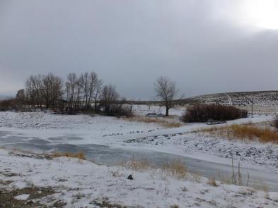
White Earth Campground sits along the banks of Canyon Ferry Reservoir in the open valley between the Big Belt and Elkhorn mountain ranges.

Nearby Attractions

White Earth Group Use Shelter is located halfway between Yellowstone National Park and Glacier National Park. The city of Helena, MT, the state’s capital, is 25 miles away. For up-to-date events visitwww.helenamt.com/

Reservation

More from CampingHiking.net:

EASTWOOD, Wisconsin Campground Images, Info & Reservations

Directions From Medford, Wisconsin, travel north on State Highway 13 for about 15 miles. Turn left on County Road D for about 6 miles, then turn left onto Forest Road 104 for about 2 miles and continue into the campground. Phone 715-748-4875 Activities BOATING, CAMPING, FISHING, HIKING, WILDLIFE VIEWING, SWIMMING

KIASUTHA, Pennsylvania Campground Images, Info & Reservations

Directions From Kane, Pennsylvania, take State Highway 321 north for 10 miles, then turn onto Longhouse Scenic Drive and continue for a mile to the campground. From Warren, Pennsylvania, take State Highway 59 east for 13 miles, then turn south on Longhouse Scenic Drive and continue for 10 miles. Phone

SAN JUAN BAY CABIN, Alaska Campground Images, Info & Reservations

Directions The cabin is 90 miles southwest of Cordova in San Juan Bay on the southwest end of Montague Island. Access to the cabin is by wheel plane at low tide only (60 minutes from Cordova, 40 minutes from Seward). Click here for local tide tables. Phone 1 (907) 424-7661

JEFFERSON SPRINGS, Tennessee Campground Images, Info & Reservations

Directions From downtown Nashville, TN, take I-24 east to Sam Ridley Parkway. Turn left onto Jefferson Pike and the Recreation Area will be on the left. Phone 615-889-1975 Activities BOATING, FISHING, HIKING, WILDLIFE VIEWING Keywords JEFS,J. PERCY PRIEST,PERCY PRIEST LAKE,J PERCY PRIEST DAM Related Link(s) Rec Area Info & Images

SANDERS COVE, Texas Campground Images, Info & Reservations

Directions From Paris, TX, take HWY 271 north 12 miles to FM 906 W and follow it 1 mile to CR 35920. Turn left into the park following signs. Phone 903-732-4955 Activities BIKING, BOATING, CAMPING, FISHING, HIKING, HUNTING, SWIMMING, WATER ACTIVITIES, WATER ACCESS, ACCESSIBLE SWIMMING Keywords SACV,PAT MAYSE LAKE,SANDERS CREEK,SANDERS