CRYSTAL LAKE GROUP CAMPSITE, MT Campground Reservation, Info, Images, Map, Directions

CRYSTAL LAKE GROUP CAMPSITE, Montana Campground Images, Info & Reservations

Listen

Directions

From Lewistown, drive west on Montana Highway 200/US 87 for about 8 miles. Turn left (south) on Crystal Lake Road. Continue south, following the well-signed directions to the lake for 20 miles. At the "T" junction, turn left and continue on to Crystal Lake. The last 6 miles is paved and mostly a single lane. On December 1, the paved section is gated, and access beyond the gate is by snowmobile, skis, snowshoes or hiking only.

Phone

406-566-2292 OR 406-236-5511

Activities

BIKING, BOATING, HISTORIC & CULTURAL SITE, CAMPING, FISHING, HIKING, HORSEBACK RIDING, SWIMMING SITE

Keywords

Related Link(s)

Rec Area Info & Images

Montana State Tourism

Montana State Road Conditions

Overview

The Crystal Lake Group Campground is located in the beautiful Big Snowies south of Lewistown, Montana, at 5,700 feet. Home to the Crystal Lake recreation area, visitors enjoy hiking and fishing in the Snowies.

Recreation

The lake provides opportunities for swimming, fishing and canoeing. The various trails that stem from the Crystal Lake complex provide excellent views and interesting photo opportunities. One trail displays old hieroglyphs in a cave allowing visitors a glimpse of the past.

Facilities

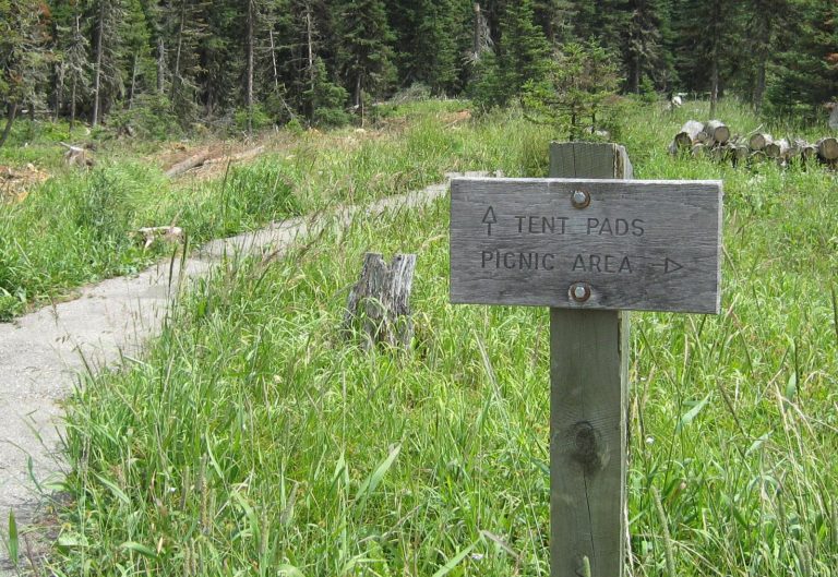
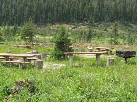
Water is available via a spring faucet and is just down from the camping site. An outhouse is provided next to the parking area for the group site. There is room for parking behind the gate in a parking area or to have two (up to 35) campers parked there as well. Asphalt walkways and tent pads are present but room in the adjacent meadow can be used for bigger tents. Two large picnic tables are on site and a metal fire ring.

Natural Features

Settled in the basin of Crystal Lake, the group site offers great access to trails and ta short drive or walk to the lake. Some trees are around the campsite but may not offer much shade.

Nearby Attractions

Ice Caves Trail, Cascade Trails and the lake are all located in the complex.

Reservation

More from CampingHiking.net:

EUREKA, Kentucky Campground Images, Info & Reservations

Listen Directions From Nashville, Tennessee take I-24 West to Exit 40. Turn left onto Highway 62 West for 2.9 miles then turn left onto Highway 810. Go 0.7 miles then turn right onto State Route 1271. Continue onto 1271 for 1.8 miles. The road leads directly into the campground. Phone

HORSE HEAVEN GROUP, California Campground Images, Info & Reservations

Listen Directions The campground is located 50 miles east of San Diego, California. Take I-8 to Sunrise Highway exit. Go approximately 14 miles until you see the Horse Heaven Group Campground sign and turn down the campground entrance road. Phone 619-445-6235 Activities BIKING, CAMPING, HIKING, HORSEBACK RIDING, WILDLIFE VIEWING, MOUNTAIN

Gold Bar Group Sites, Utah Campground Images, Info & Reservations

Listen Directions From Moab, drive five miles north on Hwy 191 to the intersection with Hwy 279. Turn left/west on Hwy 279 and drive ten miles to the campground entrance road. Phone 435-259-2100 Activities BIKING, BOATING, CLIMBING, CAMPING, HIKING, OFF HIGHWAY VEHICLE, RECREATIONAL VEHICLES, PHOTOGRAPHY, PADDLING, MOUNTAIN BIKING, OFF ROAD

COON CREEK (IL), Illinois Campground Images, Info & Reservations

Listen Directions From Shelbyville, Illinois: Go 4.5 miles north of Shelbyville on State Route 128 to County Road 1750 N. Turn right (east) and drive 0.9 miles to County Road 1900 E. Make a left (north) and go 0.35 mile to County Road 1785 N. Turn right (east) and drive

MILLPOND PAVILION, Oregon Campground Images, Info & Reservations

Listen Directions From Roseburg, travel east on Highway 138 for 22 miles. Turn left (north) on Rock Creek Road and proceed 5 miles. Campground is on the right. Phone 541-440-4930 Activities BIKING, CAMPING, WATER SPORTS, FISH HATCHERY, SWIMMING SITE Keywords MIPA,Mill Pond Pavilion Related Link(s) Rec Area Info & Images

COTTONWOOD POINT, Kansas Campground Images, Info & Reservations

Listen Directions From Marion, Kansas, take Highway 56 for about 4 miles. Turn north on Old Mill Road and continue almost three miles, then follow signs to the campground. Phone 620-382-2101 Activities BOATING, CAMPING, FISHING, HIKING, SWIMMING, WATER ACCESS, ACCESSIBLE SWIMMING Keywords COTP,MARION RESERVOIR,MARION RESERVOIR Related Link(s) Rec Area Info