SOLDIER LAKE, MI Campground Reservation, Info, Images, Map, Directions

SOLDIER LAKE, Michigan Campground Images, Info & Reservations

Listen

Directions

23998 M-28 Raco Michigan 49715

From Sault Ste. Marie, take I-75 approximately 8 miles south to Exit 386. Turn right onto M-28 and travel 21.5 miles west to Forest Road 3138. Turn left and continue less than a mile to the campground.

Phone

906-203-9872

Activities

BOATING, CAMPING, FISHING, HIKING, SWIMMING SITE

Keywords

SDLK,Soldier’s Lake Campground,HIAWATHA NF – FS

Related Link(s)

Rec Area Info & Images

Michigan State Tourism

Michigan State Road Conditions

Overview

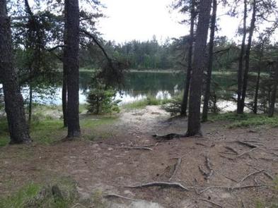
A quiet, relaxing campground with campsites nestled in the pines surrounding Soldier Lake in Michigan’s Upper Peninsula. The campground provides a feeling of remoteness but is still close to roads that lead to some of the best sightseeing the area has to offer.

Recreation

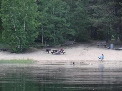
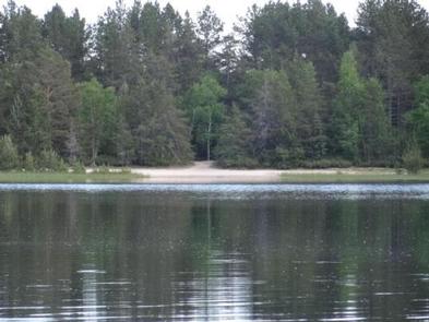
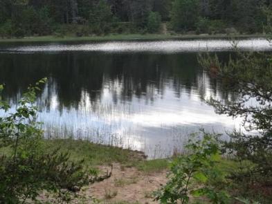
Non-motorized boating is allowed on Soldier Lake. Swimming is also a popular activity. Two sandy beaches are found within the campground and day use areas. The North Country National Scenic Trail, which winds through several northern states, can be accessed from the day use area.

Facilities

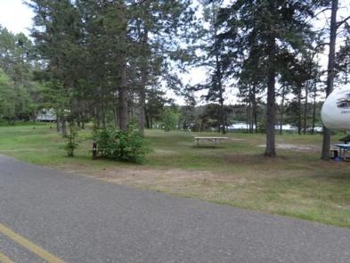
The rustic campground offers shaded single-family sites for tent and RV camping. Each site is equipped with a table and a campfire ring. Vault toilets and drinking water are provided. No hookups are available. The campground also has two large day-use picnic areas with tables and grills. A sheltered picnic area is equipped with a fireplace. The picnic area has vault toilets and drinking water.

Natural Features

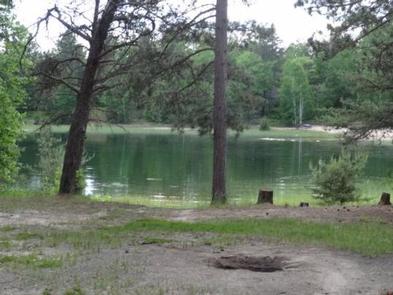
The campground surrounds 15-acre Soldier Lake. A scenic forest of pine, aspen and maple trees covers the area.

Nearby Attractions

The closest town is Strongs, 7 miles west. Services available include a fuel station, restaurants, and a general store.

Charges & Cancellations

Please cancel 7 days in advance for reservation sites. Reservation sites cannot be transferred to walk-in sites.

Reservation

More from CampingHiking.net:

PARKER CREEK, Arkansas Campground Images, Info & Reservations

Listen Directions From Texarkana, Arkansas, take Interstate 30 east for 46 miles to Prescott. Continue onto Highway 19 north to Narrows Dam. After crossing the bridge across the Little Missouri River, proceed about 3 miles to the campground. Phone 870-285-2151 Activities BOATING, CAMPING, FISHING, HIKING, HUNTING, SWIMMING SITE Keywords PARR,Couch

ANNA CREEK CABIN, Montana Campground Images, Info & Reservations

Listen Directions Anna Creek Cabin is located 30 miles from Hungry Horse, MT on the West Side Hungry Horse Reservoir Road (895). From Hungry Horse, turn south on Road 895, cross the Hungry Horse Dam and continue 29 miles on the west side of Hungry Horse Reservoir to the cabin.

CHERRYVALE PARK, Kansas Campground Images, Info & Reservations

Listen Directions From Highway 169 in Cherryvale, Kansas, turn east onto Main Street. Continue through the town and turn right onto Olive Street. After half a block turn left onto County Route 5000. Continue 4.5 miles to the lake and follow signs to the park. Phone 620-328-2050 Activities BOATING, CAMPING,

JUMPUP CABIN, Arizona Campground Images, Info & Reservations

Listen Directions From Fredonia, AZ: Travel on State Route 89a south 1 mile to Forest Road (FR) 22. Take a right onto FR22. Follow FR22 for approximately 30 miles (the pavement ends after approximately 19 miles). From FR22 take FR447 west (right turn) to the junction of the FR234 (4

VIGILANTE CABIN, Montana Campground Images, Info & Reservations

Listen Directions From Sheridan, travel south on Highway 287 for about 10 miles to Alder. Turn south on Ruby River Road and continue about 22 miles to Vigilante Station. The last 20 miles are on a gravel road, which can be slippery when wet or snow-covered. The gate lock code