
Directions
There are no roads or maintained trails in Kodiak National Wildlife Refuge. All cabins are accessible by float plane. Blue Fox Bay, Uganik Island, and Viekoda Bay are also accessible by boat. Refuge employees cannot assist in making travel arrangements, but can provide a current list of charter operators permitted to transport customers into the refuge. To obtain this list please contact the refuge headquarters at (888) 408-3514.
Phone
1-888-408-3514
Activities
BOATING, CAMPING, FISHING, HIKING, HUNTING, WILDLIFE VIEWING
Keywords
KODIAK NATIONAL WILDLIFE REFUGE,KNWR
Related Link(s)
Overview
Kodiak National Wildlife Refuge is known world-wide for its iconic wildlife. Visitors journey here to view Kodiak brown bears and majestic bald eagles, fish for all five species of Pacific salmon, hunt big game, watch marine life, and plenty of other wildlife related activities. The refuge is located on the rugged Kodiak Archipelago in the Gulf of Alaska, 252 miles southwest of Anchorage. It covers 1.9 million acres on Kodiak, Uganik, Ban and Afognak Islands, and is only accessible by float-plane or boat.
Recreation
Kodiak Refuge is an ideal destination for wildlife viewing, hunting, hiking, kayaking, fishing, camping and other types of outdoor adventures. Adventurous, full or half-day flight-seeing trips are also a popular activity in this vast and beautiful area. Popular fishing destinations such as the Uganik, Karluk and Ayakulik Rivers, offer world-class angler opportunities. With elk, Sitka black-tailed deer, mountain goats, and brown bears in the area, the refuge offers multiple hunting possibilities.
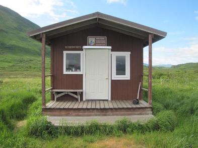
Facilities
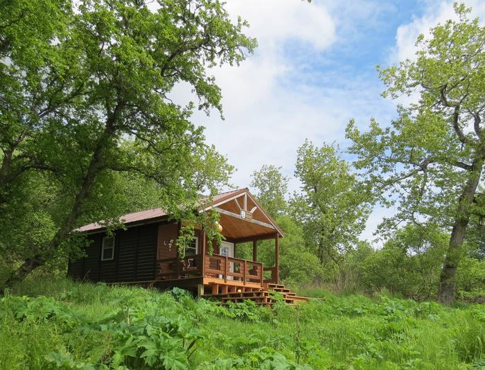
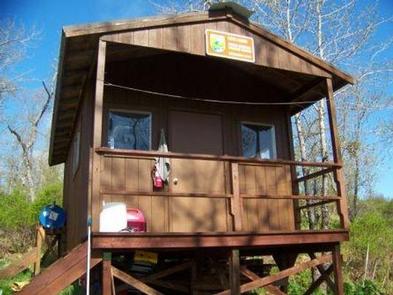
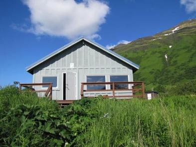
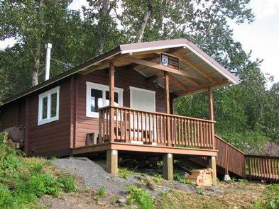
The refuge currently maintains 8 public-use cabins, each available on a reservation basis. The cabins are rustic and equipped with basic amenities including bunk beds without mattresses, a table and chairs, and an exterior storage cache for supplies, or fish and game meat storage. Outhouse-style toilets are also provided.
Cabins are also equipped with Nordic-brand stoves for heating. They can burn kerosene, home heating oil or automotive diesel, and 1-3 gallons per day is usually sufficient.
Never use gasoline, Blazo, Coleman fuel or similar products. Be sure to use heating stoves according to posted directions.
Please watch this video on stove use —> Nordic Stove Operation
Natural Features
Misty fiords, deep glacial valleys and lofty mountains distinguish the refuge landscape. Diverse habitats encompass 117 salmon-bearing streams, 16 lakes, riparian wetlands, grasslands, shrub lands, Sitka spruce forest, tundra and alpine meadows. Collectively, these habitats are home to approximately 3,000 brown bears, account for up to 30 million salmon caught by the Kodiak-based fishing fleet, support more than 400 breeding pairs of bald eagles and provide essential migration and breeding habitats for another 250 species of fish, birds and mammals. Kodiak has a maritime climate. The weather is variable, but cool, wet and windy conditions prevail. Hypothermia is a possibility at any time of year without the proper attire. Regardless of the season, always bring warm, waterproof gear and be prepared for weather delays during arrival or departure.
Nearby Attractions
Kodiak Island houses six permanent villages, four of which are surrounded by refuge lands: Karluk, Larsen Bay, Akhiok and Old Harbor. Port Lions and Ouzinkie are several miles north of the refuge. Two small airlines service these villages on a daily basis.