ROCKY CREEK PARK (BENBROOK LAKE), TX Campground Reservation, Info, Images, Map, Directions

ROCKY CREEK PARK (BENBROOK LAKE), Texas Campground Images, Info & Reservations

Listen

Directions

From the intersection of Granbury Road / Summer Creek Drive and Sycamore School Road / Columbus Trail, go west and southwest 1.5 miles (2.6 km) to the intersection of Granbury Road, McPherson Road and St. Francis VIllage Road. Proceed on Rocky Creek Park Road 1 mile (1.6 km) to the park entrance. Or from the Chisholm Trail Parkway, exit for McPherson Road and go west to Rocky Creek Park Road.

Phone

817-292-2400

Activities

BOATING, CAMPING, FISHING, HIKING, PICNICKING, WILDLIFE VIEWING, DAY USE AREA

Keywords

ROCKY CREEK PARK (BENBROOK LAKE) (TX),Benbrook,Benbrook Lake

Related Link(s)

Rec Area Info & Images

Texas State Tourism

Texas State Road Conditions

Overview

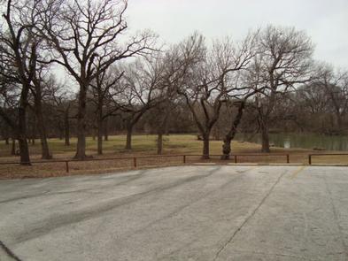
Rocky Creek Park is on the east side of Benbrook Lake in north central Texas, accessible form Granbury Road or McPherson Road. Picnicking, camping, hiking & horseback trails, boat launch, and fishing are available.

Recreation

Picnicking, fishing, boating, hiking and birding are all available in the Rocky Creek Park Primitive, seasonal camping may be available.

Facilities

Drinking water, vault tolets, and boat launching ramps are available in both the picnic areas and campground.. There are several miles of hiking & horseback trail accessible from Rocky Creek Park. The primitive campground offers tent & RV sites but without utility hookups.

Natural Features

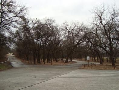
The park is on the east side of wooded Rocky Creek. The main picnic area lies on an open peninsula below wooded hillsides. The wooded campground is up the creek.

Nearby Attractions

Fort Worth’s renowned Cultural & Museum District, Stockyards National Historic District, Botanical Gardens, Zoo, Bass Performance Hall, and downtown Sundance Square are all only as hort drive.

Reservation

More from CampingHiking.net:

POTTERS CREEK PARK, Texas Campground Images, Info & Reservations

Listen Directions From IH-35 take FM-306 West 23 miles to Potter’s Creek Road. Go south 2 miles to park entrance. From Highway 281, take FM-306 east 8 miles to Potter’s Creek Road. Go south for 2 miles to park entrance. Phone 830-964-3341 Activities CAMPING, FISHING, HIKING, WILDLIFE VIEWING, SWIMMING, EDUCATIONAL

RADEKE CABIN, New Hampshire Campground Images, Info & Reservations

Listen Directions From NH Route 16 in Conway, take NH route 112 (Kancamagus Highway) west for 14 miles. The cabin is on the right, a quarter mile before Passaconaway Campground. From Interstate route 93 in Lincoln, take exit 32 for NH Route 112. At bottom of exit ramp, turn left

SITTING BULL, Wyoming Campground Images, Info & Reservations

Listen Directions From Ten Sleep, Wyoming: Take Hwy 16 east for approximately 20 miles to Forest Service Road 432. Turn left on FSR 432 and continue about a mile to campground. Phone 406-587-9054 Activities BIKING, CAMPING, FISHING, HIKING, WILDLIFE VIEWING Keywords SITT,BIGHORN NF – FS Related Link(s) Rec Area Info

CASCADE (COLORADO), Colorado Campground Images, Info & Reservations

Listen Directions From Buena Vista, Colorado, take Highway 285 south to Nathrop. Turn west on County Road 162 and travel 9 miles to the campground. Phone CAMPGROUNDS DO NOT HAVE PHONE SERVICE, CALLING TO CHECK AVAILABILITY PRIOR TO ARRIVAL IS NOT POSSIBLE. FOR RESERVATIONS CALL: 1-877-444-6777 Activities HISTORIC & CULTURAL

BOULDER FLAT CAMPGROUND, Oregon Campground Images, Info & Reservations

Listen Directions From Roseburg, OR travel east on OR-138 East/NE Diamond Lake Blvd. for 53 miles to Boulder Flat Campground, located on the left side of the highway. Phone 541-496-3532 Activities BIRDING, WHITEWATER RAFTING Keywords Related Link(s) Rec Area Info & Images Oregon State Road Conditions Oregon State Tourism Overview