
Directions
From Antonito, CO, follow Highway 17 west to its junction with FSR 250. Follow FSR 250 northwest up the Conejos Canyon about 22 miles to Platoro. Turn left on FSR 250.6A and follow it 0.2 mile to the cabin.
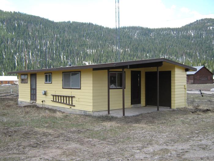
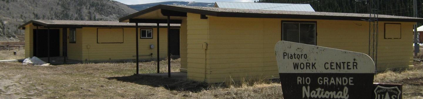
From the town of South Fork, follow Highway 160 to the southwest for about 7.5 miles. Turn left onto Park Creek Road, which is also Forest Service Road 380. Continue for approximately 27 miles, paralleling Park Creek for much of the way. Turn right (south), crossing the Alamosa River, and follow National Forest Road 250 over Stunner pass and into the town of Platoro. This stretch of the trip is about 6 miles long. The cabins are located on the southeast part of town. It is best to cross the Conejos River using the lower bridge; this is National Forest Road 250.6A. Continue on this road for about .2 miles to the cabins. The cabins are easily identified by their yellow and brown siding and trim, as well as by the Forest Service signs.
Note: Be careful not to leave Forest Service Road 380 and continue towards Summitville. Forest Service Road 380 makes a bit of a hairpin turn near the old mining settlement of Summitville. This occurs about 19 miles from the US Highway 160 and Park Creek Road intersection.
Phone
719-274-8971
Activities
CAMPING, FISHING, HIKING, HORSEBACK RIDING
Keywords
PLATORO CABIN 1 (CO),PLATORO CABINS,PLATORO WORK CENTER,,PLATORO CABIN CREW QUATERS
Related Link(s)
Colorado State Road Conditions
Overview
Platoro Cabin 1 is located downtown in the small mining town of Platoro, Colorado, at an elevation of 10,000 feet in the Rio Grande National Forest.
The cabin was built in 1963 by the Rio Grande National Forest as base quarters for various Forest Service Crews working in the surrounding areas until the early 1990s.
Today the cabin is a getaway for guests seeking relaxation and recreation in south central Colorado.
Visitors to the area should be aware that Platoro is only occupied when snow levels allow driving access, which is usually less than six months of the year.
Recreation
The area around the cabin offers a variety of recreational opportunities year-round. Summertime brings great scenic driving tour opportunities in and around Platoro and Summitville.
Anglers have a spectacular backdrop while fishing Iron Creek or Treasure Creek. Nearby Platoro Reservoir, which feeds the Conejos River, provides excellent fishing for kokanee salmon, rainbow and brown trout.
Great hiking can be found around the area, as it spans both the Rio Grande and San Juan National Forests as well as the South San Juan Wilderness.
Big game hunting is popular in fall, while snowmobiling, skiing and snowshoeing are popular winter activities.
Facilities
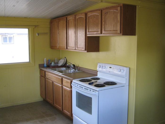
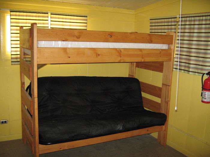
The cabin has a combination kitchen/living room, a bedroom and a bathroom. It is furnished with two bunkbeds, with single beds on the top and foldout double beds on the bottom, accommodating up to six people. It has a heater, stove, refrigerator and lighting, all powered by propane. The kitchen is equipped with a table and chairs and cooking gear. In the bathroom there is a flush toilet and showers.
Although the cabin has most amenities, guests do need to provide their own food, sleeping bags, linens, towels, dish soap, matches, first aid kit, toilet paper and garbage bags. Guests are also encouraged to bring an additional light source in case of emergencies.
Nearby Platoro Cabin #2 is similar to Platoro Cabin #1, with the addition entry ramps and wheelchair accessible facilities in the bathroom and the kitchen.
The town of Platoro has access to rental cabins, a small lodge, outfitter-guide services and horseback rides.
Natural Features
Platoro is a natural and unspoiled destination nestled in the San Juan Mountains of southern Colorado. Platoro started out as a boomtown in the late 1800s following the discovery of large deposits of gold and silver in the area.
The nearby San Juan Wilderness is an area defined by peaks and cliffs as well as pinnacles and ridges. The headwaters for the Conejos, San Juan and Blanco Rivers are located here as well. The erosion of rich volcanic rock in combination with heavy snowfall has produced forest ecosystems in the area that transition from lodgepole pine to aspen, then through Engelmann spruce and subalpine fir to alpine tundra.
Nearby Attractions
Summitville is a nearby ghost town where gold was first discovered in 1870, then mined until the early 1990s. When contaminants leaked off-site and flowed into the local watershed the government forced it to shut down. Now a water treatment plant is on the site as part of a federal clean up program.