WISH POOSH CAMPGROUND, WA Campground Reservation, Info, Images, Map, Directions

WISH POOSH CAMPGROUND, Washington Campground Images, Info & Reservations

Directions

From Seattle, take I-90 East to exit 80, then take a left on Bullfrog Road, then head north on County Road 903. The campground is on the left after approximately 8 miles.

Phone

509-852-1100

Activities

BIKING, BOATING, FISHING, PICNICKING, SWIMMING, KAYAKING

Keywords

WISH POOSH CAMPGROUND (IL)

Related Link(s)

Rec Area Info & Images

Washington State Tourism

Washington State Road Conditions

Overview

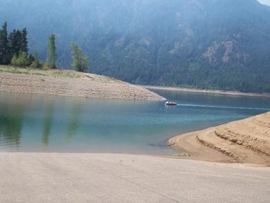
Wish Poosh Campground sits near the southeastern shore of Cle Elum Lake in the Okanogan-Wenatchee National Forest.

This campground is a popular gathering place for individuals and families to enjoy both the mountains and the serenity of the lake at an elevation of 2,300 feet. Recreational opportunities abound for those wanting to take advantage of the trails and waterfront areas nearby.

Recreation

In addition to being a prime location for hiking, fishing, swimming, horseback riding and mountain biking in summer and early fall, the area offers excellent snowshoeing and snowmobiling in the winter months.

Anglers also enjoy the abundance of fishing opportunities. Please check the Washington Department of Fish and Wildlife regulations for the most current fishing information: here

The nearby Speelyi Beach features a wide sandy beach surrounded by conifer forest on Cle Elum Lake. Visitors enjoy swimming and kayaking.

Facilities

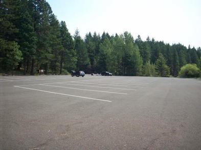
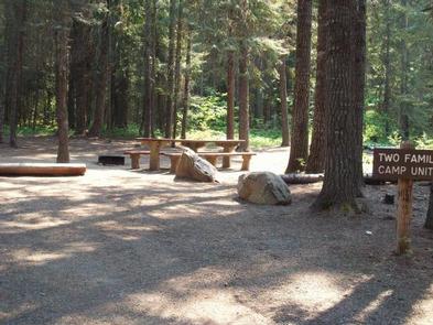
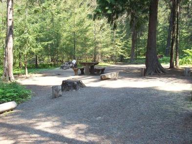
For the 2020 season Wish Poosh Campground’s drinking water system and flush toilets are out of order. Portable toilets will be provided. There are 34 sites for both tent and RV camping.

All sites are first come first served and are equipped with picnic tables and campfire rings with grills.

Natural Features

Okanogan-Wenatchee National Forest offers stunning scenic views, with high, glaciated alpine peaks, valleys of old growth forest and rugged shrub-steppe country making up the diverse landscape. Elevations range from below 1,000 feet to over 9,000 feet. Visitors can expect warm, sunny weather in the summer, and winters with clear skies and plenty of snow. The surrounding undeveloped wilderness, clean streams and diverse forests support an abundance of wildlife, including deer, porcupine, native fish and migratory birds.

Nearby Attractions

There are hiking trails within 5 miles of the campground, and the spectacular Pacific Crest Trail (PCT), one of the world’s premier National Scenic Trails which showcases some of North America’s most fantastic scenery as it winds its way its way from Mexico to Canada, is accessible near the campground.

Reservation

More from CampingHiking.net:

TRAIL CREEK CABIN, Montana Campground Images, Info & Reservations

Directions From Newman Creek, foot, ski and horse travel are accommodated. To reach the trailhead, travel south off Interstate 90 (exit 316) on Trail Creek Road for approximately 7 miles, then west on Newman Creek Road to the trailhead (1 mile). The trail to the cabin is 2.2 miles, with

HENDERSON PARK, Arkansas Campground Images, Info & Reservations

Directions From Mountain Home, Arkansas, travel east on US Highway 62/412 10 miles to the town of Henderson. Look for park signs for the park entrance on the left. Phone 870-425-2700 Activities BOATING, CAMPING, FISHING, HUNTING, WATER SPORTS, DAY USE AREA, HOTEL/LODGE/RESORT PRIVATELY OWNED Keywords Related Link(s) Rec Area Info

GREEN VALLEY, California Campground Images, Info & Reservations

Directions From Running Springs, travel east on Highway 18 about 3 miles to Green Valley Lake Road. Turn left and continue about 6 miles to the campground. Phone 909-866-8550 Activities BOATING, CAMPING, FISHING, HIKING, SWIMMING SITE Keywords GREV,GREEN VALLEY San Bernardino,SAN BERNARDINO NF – FS Related Link(s) Rec Area Info

MERRISACH LAKE, Arkansas Campground Images, Info & Reservations

Directions From DeWitt, Arkansas, take US-165 south for 8.1 miles to State Route 44. Turn east for 5.3 miles and continue south onto Tichnor Blacktop Rd. After 10 miles, turn right onto Merrisach Lake Lane and continue into the park. Phone 870-548-2291 Activities BOATING, CAMPING, FISHING, HUNTING, WILDLIFE VIEWING, BIRDING

OAK FLAT LOOKOUT, California Campground Images, Info & Reservations

Directions From Bakersfield, California, take Highway 99 to Highway 178 and travel east towards the Kern River Canyon. After passing through the last traffic light (Miramonte Drive) east of town, you will travel downhill. Rancheria Road will be the next left turn off the highway. Proceed 15 miles north along

IRON MOUNTAIN, Arkansas Campground Images, Info & Reservations

Directions From Interstate 30, take exit 78 and merge onto State Highway 7 north for 2.5 miles. Turn left onto Skyline Drive and continue for another 2.5 miles. Turn right on Iron Mountain Road and proceed to the campground. Phone 870-246-5501 Activities BOATING, CAMPING, FISHING, HIKING Keywords IROM,DEGRAY LAKE,IRON MOUNTAIN