LeBaron Campground, UT Campground Reservation, Info, Images, Map, Directions

LeBaron Campground, Utah Campground Images, Info & Reservations

Listen

Directions

Travel east of Beaver approximately 10 miles on SR 153, turn right on to Forest Road 137 for about 10 miles.

Phone

435-438-2436

Activities

CAMPING, FISHING, WILDLIFE VIEWING

Keywords

LEBARON CAMPGROUND,LEBERON,LABARON

Related Link(s)

Rec Area Info & Images

Utah State Road Conditions

Utah State Tourism

Overview

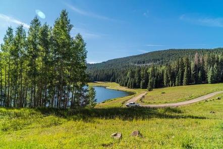
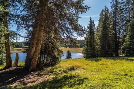
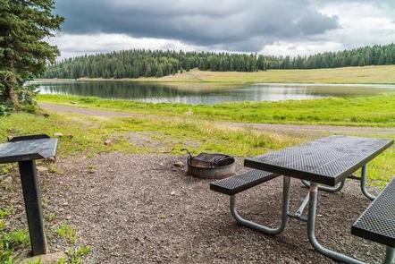
LeBaron Campground is located in the Fishlake National Forest at an elevation of 9,900 feet. This beautiful high mountain retreat in Utah offers excellent fishing in LeBaron Lake and outstanding scenery.

Recreation

Anglers will enjoy fishing for brook and rainbow trout in LeBaron Lake from the shore or small non-motorized boat. The LeBaron ATV Trail is just west of LeBaron Campground on Forest Road #147 and is a jumping off point to numerous loop trails and ATV Forest Roads, including the Piute ATV trail.

Facilities

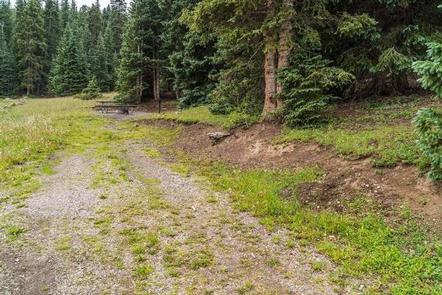
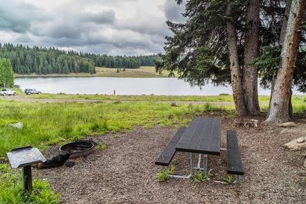
The campground has 11 single units and one group unit. All sites are back-in and will accommodate trailers from 12 to 45 feet long. Each campsite has a table and campfire ring. One vault toilet serves the campground. Drinking water is not available. There is a camping limit of 14 consecutive days.

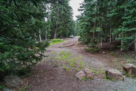
A designated ATV parking area is located to the west side of the campground to access available ATV trails.

No hook-ups or dump station are available. The nearest dump station is located in Beaver, Utah.

Natural Features

The campground is surrounded by a mix of aspen and conifers. The trees provide a range of shade depending on campsite locations with a majority of the sites well-shaded.

The Fishlake National Forest offers spectacular vistas and opportunities to view wildlife in their natural habitat. Elk, deer, black bear, moose, cougar and mountain goats are some of the large animals that call the forest home.

Reservation

More from CampingHiking.net:

Creek Pasture Group Site, Utah Campground Images, Info & Reservations

Listen Directions Turn west off US 191 onto Highway 211 and travel approximately 27 miles. The turn off to the campground is on the north side of the highway. It is located approximately 7.5 miles southeast of the Canyonlands National Park visitor’s center and 14.5 miles northwest of Newspaper Rock.

Pictured Rocks National Lakeshore Backcountry Camping Permit, Michigan Campground Images, Info & Reservations

Listen Directions https://www.nps.gov/piro/planyourvisit/directions.htm Phone 906 387 3700 MUNISING FALLS VISITOR CENTER EMAIL: INFORMATION_PIRO@NPS.GOV Activities INTERPRETIVE PROGRAMS, HIKING, WINTER SPORTS, VISITOR CENTER, PHOTOGRAPHY, WATER ACTIVITIES, KAYAKING, CANOEING, SEA KAYAKING, CROSS COUNTRY SKIING, ICE CLIMBING, BACKPACKING Keywords Related Link(s) Rec Area Info & Images Lake Superior Marine Forecast Michigan State Tourism Pictured

LEWIS CANYON, Arizona Campground Images, Info & Reservations

Listen Directions Drive to Pinedale, Arizona, on State Highway 260, approximately 14 miles northwest of Show Low. Turn south on Forest Road 130 and continue approximately 2.3 miles to Junction 130A. Turn right to the group site, following the signs.  Phone 928-368-2100 Activities BIKING, CAMPING, HIKING Keywords LEWI,APACHE-SITGREAVES NF-FS Related

ANNA CREEK CABIN, Montana Campground Images, Info & Reservations

Listen Directions Anna Creek Cabin is located 30 miles from Hungry Horse, MT on the West Side Hungry Horse Reservoir Road (895). From Hungry Horse, turn south on Road 895, cross the Hungry Horse Dam and continue 29 miles on the west side of Hungry Horse Reservoir to the cabin.

RAMSHORN, California Campground Images, Info & Reservations

Listen Directions From Downieville, take Highway 49 south for about 5.5 miles. The campground is on the right side of the highway. Phone (530)478-6253 Activities BIKING, CAMPING, FISHING, HIKING, HUNTING, SWIMMING, MOUNTAIN BIKING, KAYAKING, SCENIC DRIVE Keywords RAMS,TAHOE NF – FS Related Link(s) Rec Area Info & Images California State

DEERLICK CREEK, Alabama Campground Images, Info & Reservations

Listen Directions From I-59 in Alabama, take Exit 73 (MacFarland Boulevard). Go west on MacFarland Blvd./Highway 82 for approximately 4.2 miles. Veer right onto Rice Mine Road. At the stoplight turn left onto Rice Mine Rd. Then, turn right at the stoplight onto New Watermelon Road and follow it for