

Directions
Getting There (GPS Info):
GPS Info. (Latitude, Longitude( (NAD83)
N-20.7689599
W-156.2430039
Directions to the Summit Area (mountain and crater): There are brown information signs along the way. From Kahului, take Hana Highway (SR36) and travel 2.0 miles (toward Hana). Turn right onto Haleakala Highway (SR37) and travel for 7.8 miles. Turn left onto State Highway 377 and travel for 6 miles. Turn left onto Crater Road (large brown wooden Haleakala NP sign mounted in median) and travel for 1.2 miles. Continue on Crater Road for 9.9 miles to arrive at the park boundary/Entrance Station. The Summit (elevation 10,023ft 3055m) is 11 miles, about an additional 30-minute drive, beyond the Entrance Station.
Phone
808-572-4487
Activities
CAMPING, BACKPACKING
Keywords
Haleakala Crater,The Crater,Haleakala Summit
Related Link(s)
Overview
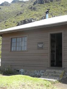
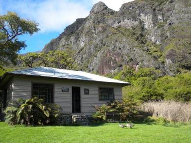
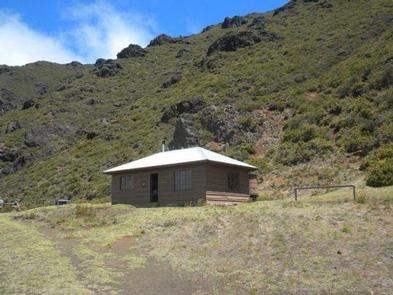
Located on the island of Maui, Haleakala National Park maintains three wilderness cabins for normal visitor use, Holua (elevation 6,940ft 2,115m), Kapalaoa (elevation 7,250ft 2,210m), and Paliku (elevation 6,380ft 1,945m) in the Wilderness Area of the park. These wilderness cabins are accessible only by trail and from the summit area require you to hike a minimum of 3.7 miles (5.9km) to Holua, 5.5 miles (8.9km) to Kapalaoa, and 9.3 miles (15km) to Paliku. For normal visitor use, the wilderness cabins are available year-round by permit only, through advance reservation.
Message of Cultural Sensitivity: Upon entering Haleakala National Park, you are a guest of the Hawaiian culture, which considers the entire area sacred. Each person should behave as if entering a temple or reverent place in his or her own culture or belief system. The rocks, the plants and even the silence are part of the sacredness and should not be disturbed. For Native Hawaiians, Haleakala represents an important place within their culture. Quietness and sense of place are of importance. Originally, within cultural practices, Ancients only came to Haleakala for very important reasons and they conducted these visits in silence. Therefore, the Wilderness Cabin Use Permittee agrees to carry out the activities of this Permit with deference to, and respect for, this cultural belief. The Permittee and their participants/associates shall carry out the authorized activity as quietly as possible, and shall to the extent possible, also carry out the authorized activity in such a manner to be dignified and respectful to the Haleakala sense of place.
Recreation
Facilities
There are no food establishments, stores, showers, or laundry facilities in the park. Each of the parks three wilderness cabins are equipped with 18 lockers; each locker contains three logs. Combinations will be issued by park staff at the time of check in for cabin permits at Headquarters Visitor Center (at 7,000 ft. elevation) in the summit district. Permits will only be issued between 8 am and 3 pm. Permits may be obtained one day prior or day of reservation. Please bring a lighter or matches; firestarter briquettes recommended. Any visitors wanting to pack in more wood can purchase logs and fire starter at the gift store. Each log weighs 5 pounds. The park cannot guarantee that propane or wood will be available.
Natural Features
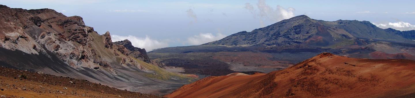
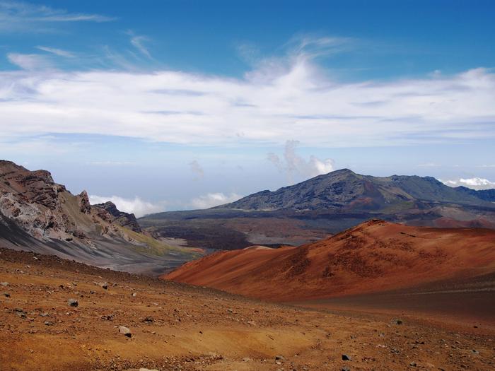
The distinctive cinder cones that dot the summit landscape of Haleakala resulted from relatively recent eruptions. Material from these mildly explosive, fountaining eruptions settled back around the vent forming the cones. Only a few plants, birds, and insects have adapted to the harsh conditions created at the summit and on the upper slopes of the volcano. Rainfall sinks rapidly into the porous rocky ground, whose bare surface become summer every day, winter every night. This harsh environment is home to the endangered ahinahina (silversword), a unique species of plant which grows nowhere else in the world.
Charges & Cancellations
1) Cancellations prior to 21 days—$10.00 charge + partial refund 2) Cancellations within 20 days of arrival—No refund 3) $10.00 change fee per reservation night prior to 7 days. No changes within 7 days (not counting arrival day)