
Directions
Take Highway 65 for 13 miles north of McGregor, Minnesota. Follow “South Entrance” signs to the campground office if assistance in finding your campsite is required.
Phone
651-290-5850
Activities
BOATING, HISTORIC & CULTURAL SITE, CAMPING, INTERPRETIVE PROGRAMS, FISHING, HIKING, VISITOR CENTER, WILDLIFE VIEWING, DAY USE AREA, SWIMMING SITE, RANGER STATION, CANOEING
Keywords
SANL,BIG SANDY LAKE,LIBBY,LIBBY DAM,MISSISSIPPI HEADWATER,SANDY LAKE DAM:SANDY LAKE RECREATION AREA
Related Link(s)
Minnesota State Road Conditions
Overview
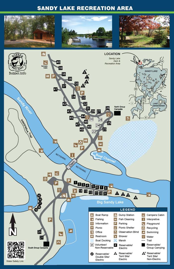
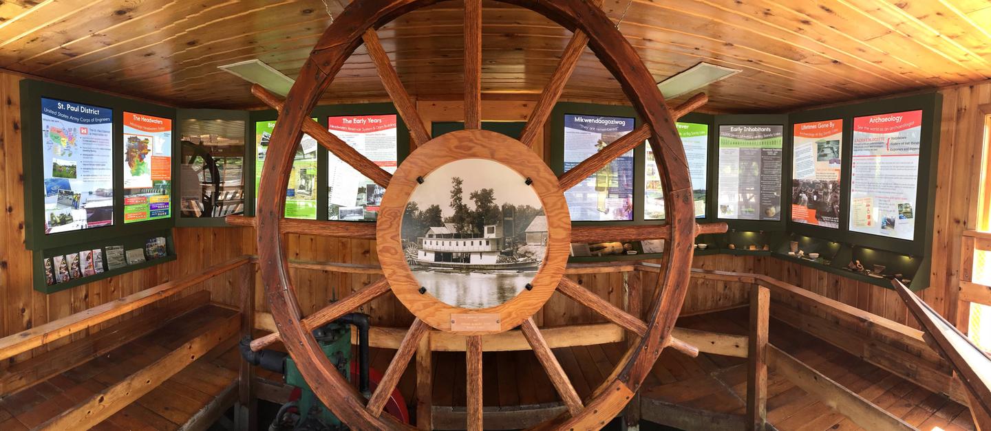
The Sandy Lake Dam and Recreation Area is situated at the outlet of Big Sandy Lake in northern Minnesota, 13 miles north of McGregor, MN. The dam is a part of the Mississippi Headwaters Project, one of the first reservoir systems in the country, and the Sandy Lake Dam structure dates back to 1895. Today the grounds have been developed into a park and campground that is noted for its clean, family-friendly environment and access to fishing and boating on both the lake and nearby Mississippi River. It offers the only public campground and beach on Big Sandy Lake. The area is also a part of the historic canoe route that connected the Mississippi River to Lake Superior and major fur trading companies. Artifacts from the area’s long history are kept in a small museum located near the dam.
Recreation
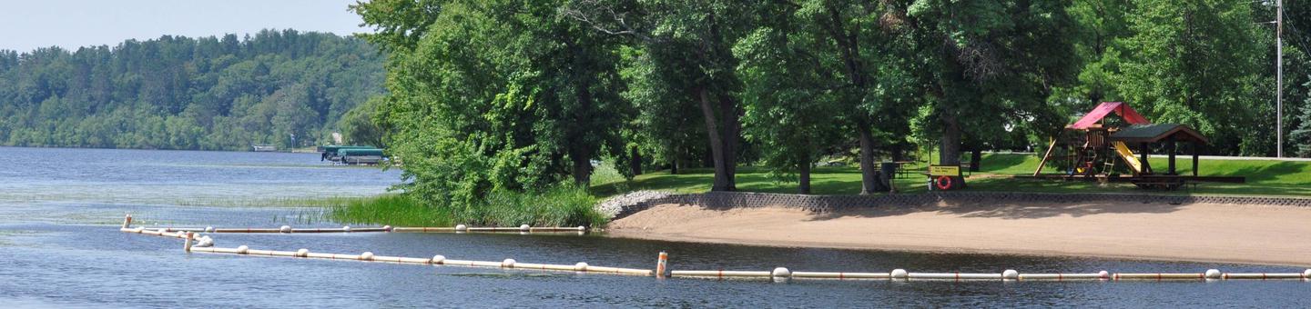
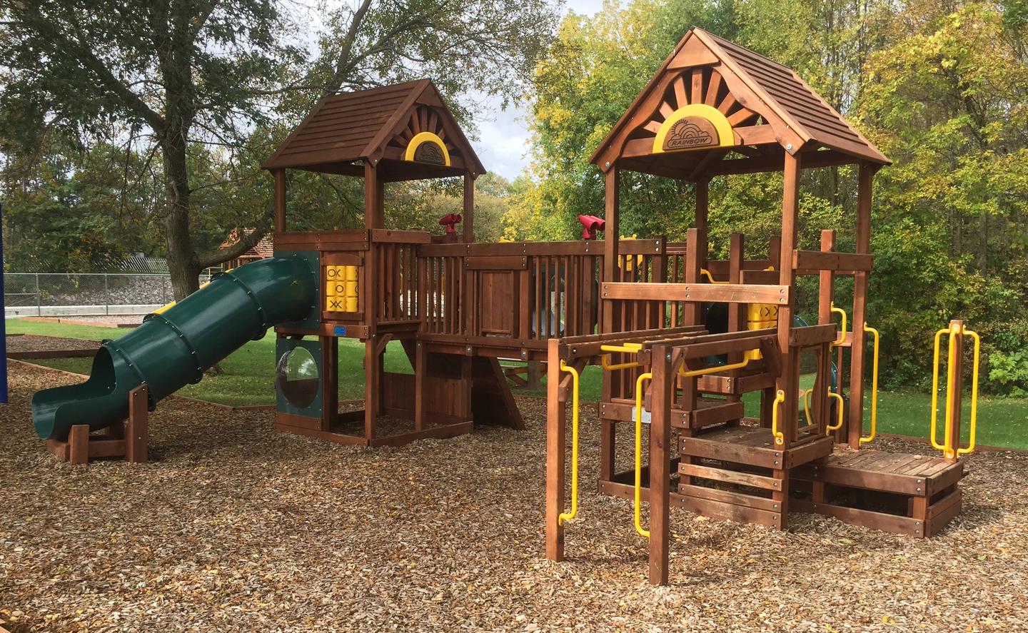
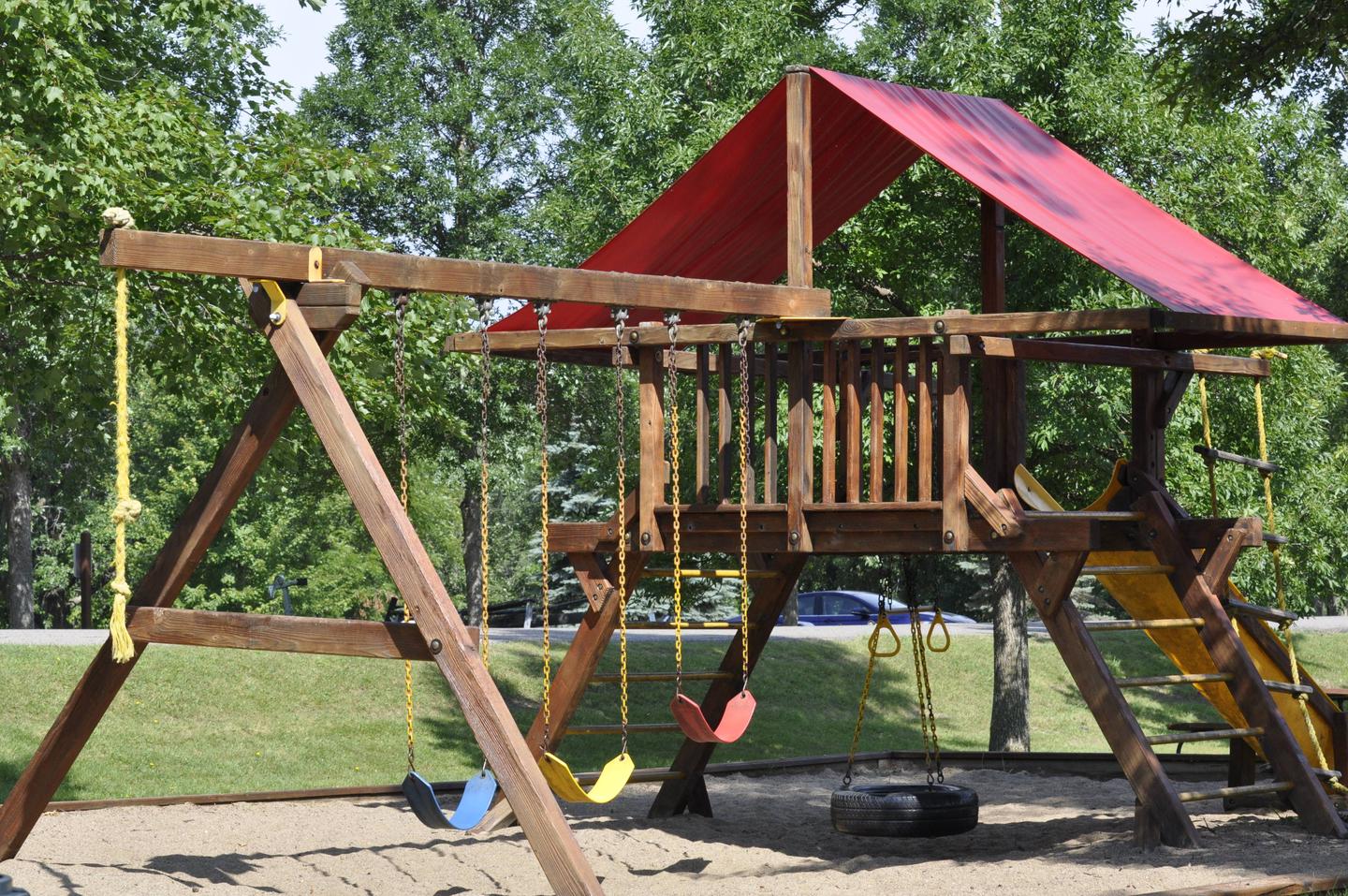
Sandy Lake offers many recreational opportunities including camping, boating, swimming, picnicking, birding and hiking. Anglers enjoy fishing the lake and river for Northern pike, walleye, small mouth bass, bluegill, crappie and even catfish. Playgrounds are located on both sides of the dam and are located near the beach and visitor museum areas. The old lock house has been converted into a free small museum containing historical artifacts from the area. Educational programs are offered seasonally and are open to the public.
Facilities
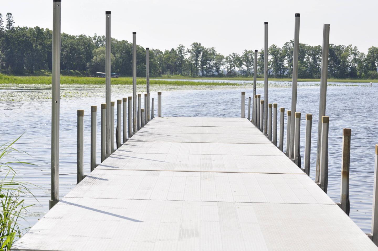
This campground offers a variety of camping sites, including 43 single family sites, five double family sites and two group sites all with electric hookups. Eight primitive walk-to tent sites (four of which have electrical hookups), a camper cabin with bunk beds and a day-use group picnic shelter are also available. Amenities include flush and vault restrooms, showers, drinking water, laundry facilities and a dump station. Day use facilities are intertwined within the campground and contain two lake boat ramps, one river boat ramp, docks, a fishing pier, beach, playgrounds and a short hiking trail.
Natural Features
Big Sandy Lake is a reservoir that was created in the late nineteenth century from the waters of the Sandy River. A forest of mixed hardwoods and towering red and white pine covers the area. An abundance of wildlife can be found including bald eagles, white-tail deer, black bears, chipmunks, loons, mink, river otters and many others. Wild rice is harvested from the lake seasonally and wild berries are occasionally found.
Nearby Attractions
Nearby attractions include golf courses, shopping and dining venues, Savannah Portage State Park, Rice Lake National Wildlife Refuge, and many acres of state and county forest land.