EAST DAVIS CAMPGROUND, OR Campground Reservation, Info, Images, Map, Directions

EAST DAVIS CAMPGROUND, Oregon Campground Images, Info & Reservations

Listen

Directions

From Crescent, OR: Travel 8.8 miles west on County Road 61, then 7.7 miles north on Highway 46, then 2.6 miles west on Forest Road 4600 850.

Phone

541-323-1746

Activities

CAMPING

Keywords

Related Link(s)

Rec Area Info & Images

Oregon State Tourism

Oregon State Road Conditions

Overview

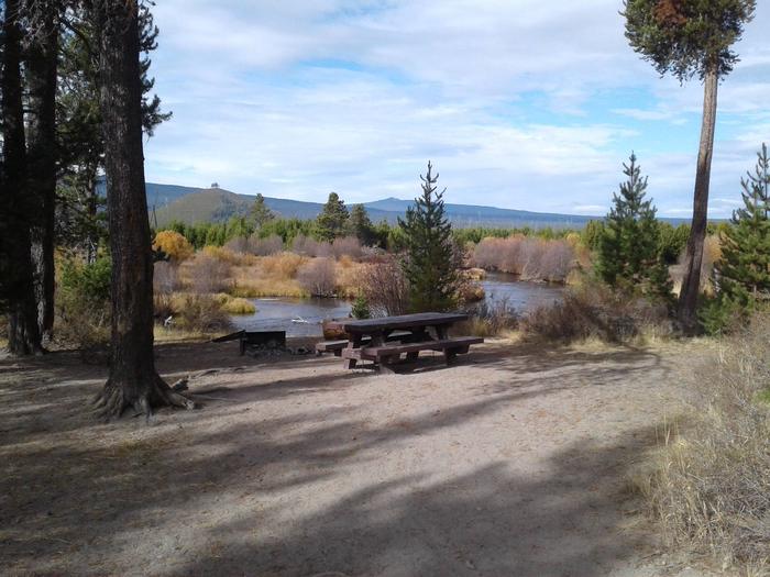
East Davis Campground is located on the east side of Odell Creek where it enters Davis Lake and offers visitors the opportunity to experience the beauty and recreational opportunities of the eastern Cascade Range.

Recreation

Davis Lake is one of the most popular fly fishing only lakes in the Pacific Northwest, producing abundant trophy size rainbow trout and largemouth bass.

Facilities

East Davis Campground can accommodate RV, trailer or tent-campers however water and electric hookups are not available. All sites are equipped with a picnic table and campfire ring with grill and the campground has vault toilets and drinking water available.

Natural Features

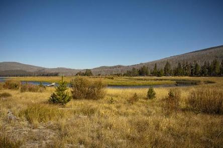
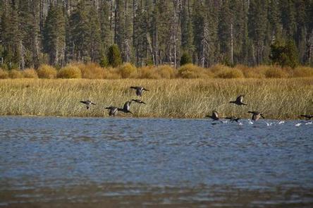
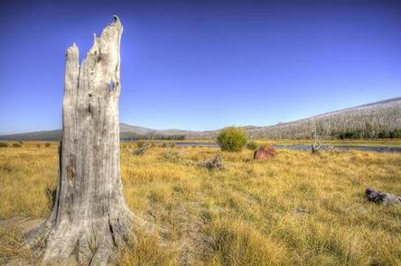
Nearby Davis Lake is one of the most productive wildlife areas in central Oregon. Add a superb view of Cascade peaks at no charge and you have a truly special place to visit. It is known for its wildlife, wildflowers, bird watching opportunities, sightseeing, and access to a nearby lava flow.

Nearby Attractions

Visitors can explore wilderness areas, rivers, lakes and reservoirs, and approximately 1,600 miles of trails that comprise nearly 2.5 million acres within the Deschutes National Forest and the adjacent Ochoco National Forest.

Lava Lands Visitor Center in nearby Bend, Oregon, and the unique geological landscape of Newberry National Volcanic Monument draw visitors to the region as well.

Visitors enjoy traveling the Cascade Lakes Scenic Byway, known as Oregon’s Highway in the Sky, which climbs into the clouds on a 66-mile drive through the Cascade Range, weaving past snow-capped peaks and alpine lakes.

Reservation

More from CampingHiking.net:

EAST TWIN, Wisconsin Campground Images, Info & Reservations

Listen Directions Drive 4 miles north from Clam Lake on County Highway GG. Turn right (east) on Forest Road 190 and continue for about one mile to the campground. Phone (715) 634-4821 OR (715) 264-2511 Activities BIKING, BOATING, CAMPING, FISHING, HIKING Keywords EATW,CHEQUAMEGON-NICOLET NF – FS Related Link(s) Rec Area

HICKORY CREEK, Texas Campground Images, Info & Reservations

Listen Directions Due to construction on the I-35E bridge, the directions to the campground have changed if approaching from the north. Take I-35E south to Exit 460 – Meadow Oaks Rd/ Corinth Parkway. Stay on the I-35E access road heading south, go through the red light at Swisher Rd. Turn

CASTLE BUTTE LOOKOUT, Idaho Campground Images, Info & Reservations

Listen Directions From Missoula, MT: Take US Highway 12 West for about 65 miles. All roads from this point are gravel or dirt and a vehicle with high clearance is suggested. Turn right onto Forest Service Road 108 (Waw’aalamnime Rd), go about .5 miles, turn left onto Forest Service Road

PINEY BAY, Arkansas Campground Images, Info & Reservations

Listen Directions From London, Arkansas, take US-64 west for 3 miles to State Route 359 north. Continue for 3.5 miles and follow signs into the campground. Phone 479-885-3029 Activities BOATING, CAMPING, FISHING, DAY USE AREA, SWIMMING SITE Keywords PINB,DARDANELLE LAKE-ARK. RIV.NAV.,DARDANELLE LAKE Related Link(s) Rec Area Info & Images Arkansas

GROOM CREEK SCHOOLHOUSE, Arizona Campground Images, Info & Reservations

Listen Directions From Phoenix, Arizona, take I-17 north for 61.8 miles. Take exit 262 toward Cordes Junction/Prescott. Merge onto State Route 69 west and follow for 33.8 miles. At the split, take the ramp for Route 89 south. Turn slight left onto East Gurley Street/89 and follow for about 0.8-mile.