EAST TWIN, WI Campground Reservation, Info, Images, Map, Directions

EAST TWIN, Wisconsin Campground Images, Info & Reservations

Listen

Directions

Drive 4 miles north from Clam Lake on County Highway GG. Turn right (east) on Forest Road 190 and continue for about one mile to the campground.

Phone

(715) 634-4821 OR (715) 264-2511

Activities

BIKING, BOATING, CAMPING, FISHING, HIKING

Keywords

EATW,CHEQUAMEGON-NICOLET NF – FS

Related Link(s)

Rec Area Info & Images

Overview

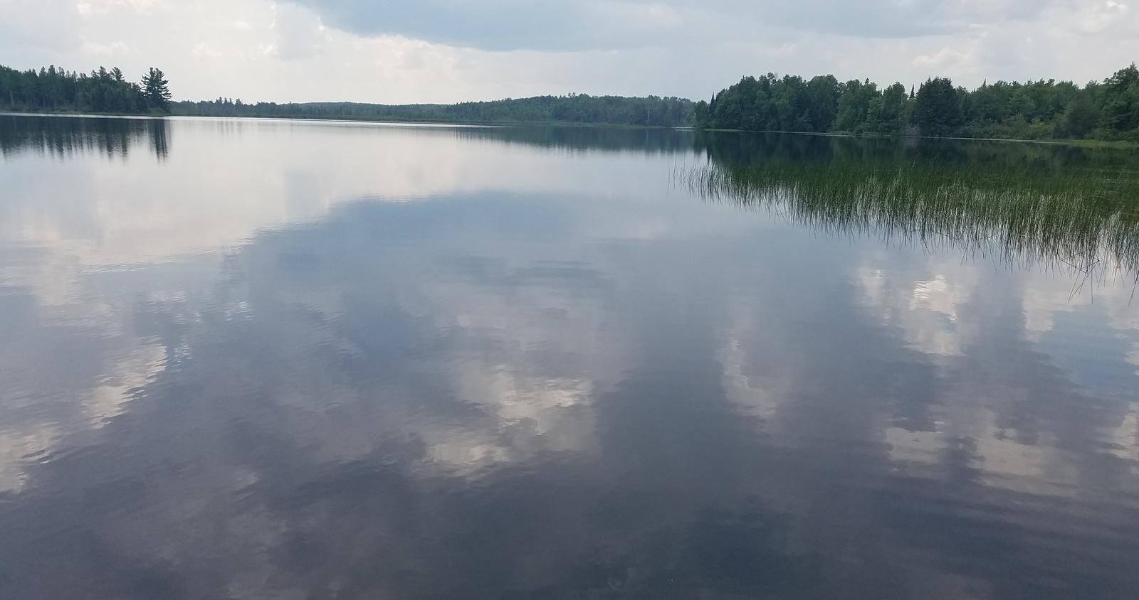
Located on a sparkling 110-acre lake, the East Twin Campground is a known family favorite. The area provides access to a beautiful portion of the Chequamegon National Forest in northwestern Wisconsin.

Recreation

A variety of recreational activities are available, including fishing, boating and swimming on the adjacent lake. A boat ramp is located about a half-mile east of the campground, providing access to East Twin Lake and also features a walk-in portage to West Twin lake which is located just outside the campground. Largemouth bass and pan fish are akin to the body of water, as well as an occasional musky or other freshwater species.

Miles of hiking and mountain bike trails are located nearby and just down the road is an established Blue Heron rookery.

Facilities

The campground offers several single family campsites for tent and RV camping with many located on the lake. East Twin campground offers two tent walk-in sites for those looking for a somewhat more secluded camping experience. Each site is equipped with tables and campfire rings with grills. Accessible vault toilets and drinking water are provided. Trash collection and an aluminum can recycling bin are also available at the campground.

Natural Features

The campground is situated in a maple, birch and hemlock forest, with many sites overlooking the lake. A variety of birds and wildlife, including elk, eagles, loons, blue heron and other species, make their homes near the campground.

Nearby Attractions

The Dead Horse Run trailhead is located just five miles south on County Road GG.

Reservation

More from CampingHiking.net:

VIGILANTE CABIN, Montana Campground Images, Info & Reservations

Listen Directions From Sheridan, travel south on Highway 287 for about 10 miles to Alder. Turn south on Ruby River Road and continue about 22 miles to Vigilante Station. The last 20 miles are on a gravel road, which can be slippery when wet or snow-covered. The gate lock code

PAWNEE, Colorado Campground Images, Info & Reservations

Listen Directions From Denver, travel north on Interstate 25 to U.S. Highway 36 West to Boulder. Continue on Colorado Highway 119 (Canyon Boulevard) for 22 miles to Nederland, then go north on Colorado Highway 72 to Ward. Turn left at the sign and travel 5 miles to Brainard Lake Recreation

LOFERS BEND EAST, Texas Campground Images, Info & Reservations

Listen Directions From I-35 in Hillsboro, take Highway 22 west 12 miles to Whitney. Continue 7 miles past Whitney, turn right before dam. Follow park road to 4-way stop. Turn left to go to West Lofers or right to go to East Lofers. Phone 254-622-3332 Activities BOATING, CAMPING, SWIMMING SITE

BOULDER DAY USE, Illinois Campground Images, Info & Reservations

Listen Directions (Address: 25501 Boulder Access RD, Shattuc, IL 62231). From I-57, take Old U.S. Highway 50 west. Continue for 19 miles through Salem, Odin and Sandoval. Turn north on Boulder Road and follow 7 miles to the day use and recreation area. Phone 618-226-3586 Activities BIKING, BOATING, CAMPING, FISHING,

TRIAL LAKE CAMPGROUND, Utah Campground Images, Info & Reservations

Listen Directions From Salt Lake City, Utah, take I-80 east for approximately 30 miles to Exit 146 for Highway 40 toward Park City/Heber City/Vernal. Take Exit 4 onto Highway 248 toward Kamas. Take left onto UT 32 then right onto Highway 150 (Mirror Lake Scenic Byway). Go 25 miles to