LOWER FALLS CAMPGROUND, WA Campground Reservation, Info, Images, Map, Directions

LOWER FALLS CAMPGROUND, Washington Campground Images, Info & Reservations

Listen

Directions

From Portland or Seattle take I-5 to exit 21 for WA-503 E toward Woodland/Cougar. WA-503 will turn into FR 90, turn right at the Pine Creek Visitor Center. Lower Falls Campground will be on your right hand side after you pass mile marker 28 on FR 90.

Phone

509-395-3400

Activities

BIKING, CAMPING, HIKING

Keywords

Related Link(s)

Rec Area Info & Images

Washington State Road Conditions

Washington State Tourism

Overview

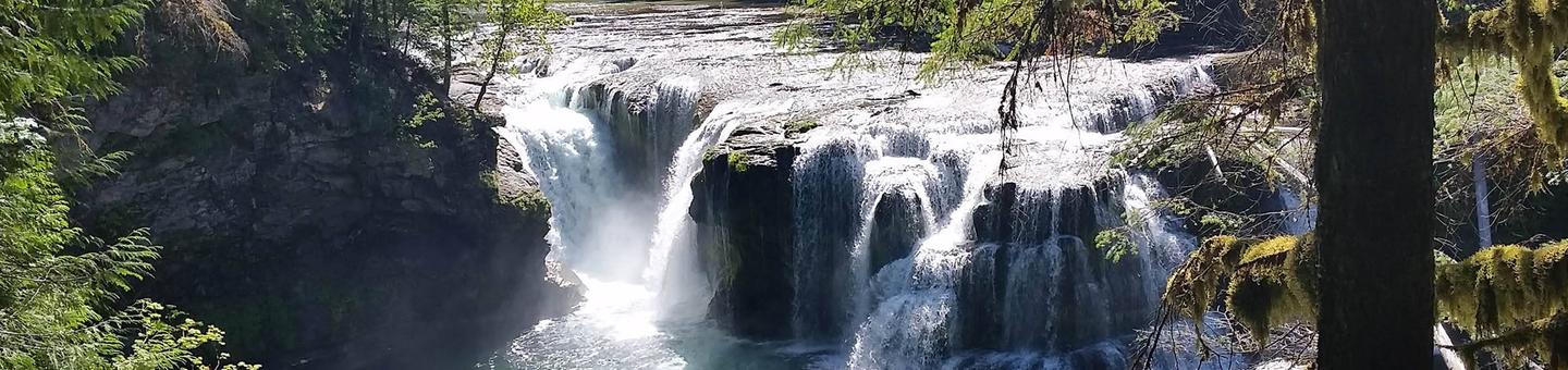
Lower Falls Campground is located in the Gifford Pinchot National Forest. Visitors enjoy several waterfalls in the area and access to the Lewis River Trail. The campground is open from May through October.

Recreation

Near the campground are several trailheads that provide visitors with a variety of recreational opportunities. There are hiking trails, mountain bike trails, horse trails, and motorcycle trails within 10 miles of the campground.

The Lewis River contains rainbow, cutthroat, and bull trout as well as whitefish. The area is catch and release only.

Facilities

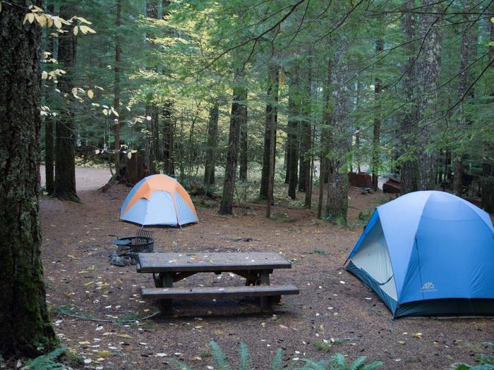
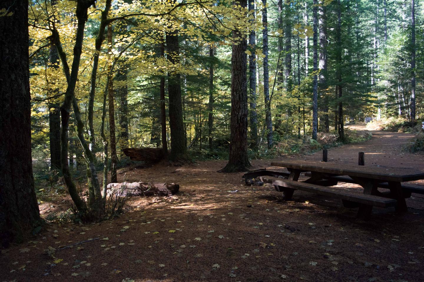
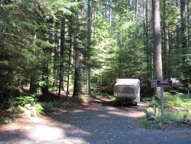
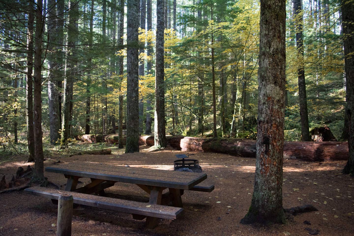
Lower Falls Campground offers 43 standard sites that accommodate both tents and RVs (60 feet), but no hookups are available. Picnic tables and campfire rings with grills are provided, as are composting toilets and drinking water.

Natural Features

The campground is just off the Lewis River at an elevation of 1,300 feet. The campground road is paved and shaded by large evergreen trees. There are trails down to the Lewis River and falls area.

Nearby Attractions

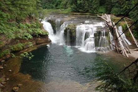
There are falls viewing opportunities at Lower Lewis River Falls, Curly Creek Falls, Big Creek Falls, and Middle Falls, all within 15 minutes of the campground.

Hiking trails within 10 miles include trail #31 Lewis River, Trail #5 Quartz Creek, and trail #80 Wright Meadows.

Reservation

More from CampingHiking.net:

STUB CREEK CABIN, Colorado Campground Images, Info & Reservations

Listen Directions From Fort Collins, get off I-25 at the Mulberry Street/Highway 14 exit. Travel west on Mulberry to Riverside Ave, then north on College Avenue to Highway 287. Turn left and go west on Highway 14 (Poudre Canyon) for about 60 miles, to County Road 103. Go north on

MANISTIQUE – RAPID RIVER DISPERSED CAMPSITES, Michigan Campground Images, Info & Reservations

Listen Directions All driving directions are listed by lake. Please check campsite details. Phone 906-474-6442 Activities BIKING, BOATING, CAMPING, FISHING, HIKING, HORSEBACK RIDING, WATER SPORTS, WILDLIFE VIEWING, DAY USE AREA, SWIMMING SITE Keywords Dispersed campsites,Manistique,Rapid River,lyman lake,swan lake,bass lake,bear lake,camp cook,carr lake,chicago lake,clear lake,crooked lake,east lake,gooseneck lake,ironjaw lake,jackpine lake,lake nineteen,leg

LITTLE SHAHEEN CABIN, Alaska Campground Images, Info & Reservations

Listen Directions Access to the cabin is by float plane or canoe with portage. It is about a 45-minute flight from Juneau. By canoe and portage, it is about 10 miles from Mole Harbor. Click here for for information about Admiralty Island Canoe Route and portage. This cabin is in

RAINBOW BAY, Oregon Campground Images, Info & Reservations

Listen Directions From Klamath Falls travel 33 miles northwest on Highway 140. Turn south on Forest Road 3701 and continue .6 miles to the campground. Phone 866-201-4194 Activities BIKING, BOATING, CAMPING, FISHING, HIKING, SWIMMING SITE Keywords RABA,LAKE OF THE WOODS,WINEMA NF – FS Related Link(s) Rec Area Info & Images

CASTLE BUTTE LOOKOUT, Idaho Campground Images, Info & Reservations

Listen Directions From Missoula, MT: Take US Highway 12 West for about 65 miles. All roads from this point are gravel or dirt and a vehicle with high clearance is suggested. Turn right onto Forest Service Road 108 (Waw’aalamnime Rd), go about .5 miles, turn left onto Forest Service Road